
Surface elevation 500 m | Max. depth 60 metres (200 ft) Outflow location Mojave River Lake type Glacial lake (Lake) | |
 | ||
Etymology After the nearby Manix railway station Primary inflows Surface area 236–780 square kilometres (91–301 sq mi) | ||
Lake Manix is a former lake fed by the Mojave River in the Mojave Desert of San Bernardino County, California. Located close to Barstow, this lake had the shape of a cloverleaf and covered four basins named Coyote, Cady/Manix, Troy and Afton. It covered a surface area of 240–780 square kilometres (91–300 sq mi) and reached an altitude of 543 metres (1,781 ft) at highstands, although poorly recognizable shorelines have been found at altitudes of 547–558 metres (1,795–1,831 ft). The lake was fed by increased runoff during the Pleistocene and overflowed into the Lake Mojave basin and from there to Lake Manly in Death Valley or less likely into the Bristol Lake basin and from there to the Colorado River.
Contents
- Map of Lake Manix California USA
- NameEdit
- GeographyEdit
- HydrologyEdit
- BiologyEdit
- ClimateEdit
- HistoryEdit
- ArcheologyEdit
- References
Map of Lake Manix, California, USA
The lake formed about 500,000 years before present, when the Mojave River left the Victorville area and started to drain into Manix and Lake Harper. The lake did not immediately include the Afton basin; only about 190,000 years ago did a most likely catastrophic flood cause its integration. Lake Manix did last until 25,000 - 13,800 years ago when Afton Canyon formed; whether through slow downcutting or a large outburst flood is not clear.
The lake during its existence supported a rich ecosystem where birds, fish, mammals and plants have been found. Controversially, a number of archeological finds in the area have been called the "Lake Manix Industry".
NameEdit
The name Lake Manix was bestowed upon the lake by J.P.Buwalda in 1913, who also named its fossil-bearing sediments Manix Beds. The name was derived from the railroad siding Manix of the Union Pacific, east of Barstow. Thus, As of 2008 the study of the lake deposits is almost a century old.
GeographyEdit
Lake Manix was located 32–64 kilometres (20–40 mi) west of Barstow and Daggett. The town of Manix, California lies close to the lake bed.
Lake Manix had a cloverleaf shape, formed by a northwestern Coyote Basin, a south-southeastern Troy Basin and an eastern-northeastern Afton Basin. The latter basin is heavily dissected in comparison to the first two, and was formerly separated from the Cady Basin between Coyote Basin and Troy Basin by the Buwalda Ridge before the Mojave River eroded its way through it, possibly assisted by the Manix Fault trace. A bedrock sill at 540 metres (1,770 ft) separates the Coyote Basin from the rest of the lake basin. The total surface area of the lake was about 520–780 square kilometres (200–300 sq mi), or 236 square kilometres (91 sq mi). Higher stands in the past may have reached until Yermo, California. Yermo together with Dunn and Newberry Springs are present day towns whose locations would have been close to the shore of or submerged beneath Lake Manix.
The upper threshold of the lake reached 543 metres (1,781 ft) above sea level; a shoreline at 549 metres (1,801 ft) was later shown to be an error of measurement, although some poorly recognizable higher shorelines at 547–558 metres (1,795–1,831 ft) have been found. The stability of the 543 metres (1,781 ft) shoreline suggests that the lake either became much larger at that point or started to overflow. These shorelines are marked by beach bars and wavecut scarps. Other landforms include alluvial fans, deltas, mudflats and their deposits. Part of the shorelines were buried by deposits transported by the Mojave River; these include large parts of a 557 metres (1,827 ft) high shoreline. One island potentially existed in the middle of the lake; at 558 metres (1,831 ft) it would have split in two and another island would have appeared as well. The lake reached a depth of 60 metres (200 ft).
The lake was surrounded by mountain chains, clockwise the Cronese Mountains, the Cave Mountains, the Cady Mountains, the Newberry Mountains, the Calico Mountains and the Alvord Mountains. These mountains are principally of volcanic origin and contributed sediments to Lake Manix. The whole region was subject to strong tectonically driven deformation from the Eastern California Shear Zone. A number of faults in the region show evidence of Holocene activity, including the Calico Fault, the Camp Rock Fault, the Dolores Lake Fault, the Pisgah Fault and the Manix Fault. This last fault probably contributed to the formation of the drainage by shearing rocks along its path.
Lake Manix was influenced by earthquakes. Distorted sediments, soil liquefaction remnants and sand blows have been identified in drilling cores made in Lake Manix sediments. The whole lake basin is crossed by faults. The 1947 Manix earthquake occurred along the Manix fault.
The Mojave River entered the lake from the west, probably forming a river delta. Afton Canyon presently drains the lake east towards Soda Lake, Silver Lake and eventually Death Valley. This draining cut 120 metres (390 ft) deep into the sediments of Lake Manix, removing about 2.815 cubic kilometres (0.675 cu mi) of material and depositing it below Afton Canyon.
The playas Coyote Lake and Troy Lake presently fill the homonymous basins of Lake Manix. In many places, wind and water driven erosion has removed deposits from Lake Manix and obscured shorelines. The present-day Interstate 40 and Interstate 15 cross the former lake bed of Lake Manix.
HydrologyEdit
During the ice ages, a number of lakes filled in the Great Basin and the southwestern United States. These lake fillings were influenced by shifts in storm tracks caused by the Laurentide icesheet. Alternatively, changes in sea surface temperatures increasing moisture supply or increased supply from tropical regions have been implicated. Some interglacials also featured the growth of lakes. In the region, runoff is also influenced by the El Nino Southern Oscillation, the Northern Annular Mode and the Pacific Decadal Oscillation. Such lakes include Lake Babicora, Lake Bonneville, Lake Estancia, Lake Lahontan, Lake Manly, Lake Owens, Lake Panamint, Lake Russel and Lake Searles.
The Mojave River drained into Lake Manix, with the formation of the lake reflecting increased precipitation in the San Bernardino Mountains. Other local arroyos also drained into the lake. It has been estimated that runoff had to increase by a factor of about ten to form Lake Manix. Lake Manix contained over 1.6 cubic kilometres (0.38 cu mi) of water, possibly 3.2 cubic kilometres (0.77 cu mi). Water levels in the lake frequently fluctuated by 5–15 metres (16–49 ft). Formerly, it was the Mojave River's terminal lake, and received about 1 millimetre per year (0.0012 in/Ms) of sediment. The Coyote Basin was not permanently coupled to the main lake body; its relatively large surface area and consequently high evaporation would have stabilized lake levels when it was connected to the main Lake Manix.
Tufa formed within Lake Manix. Based on information gleamed from fossil ostracods, Lake Manix was a well mixed lake especially in summer; no thermocline developed in it. While the lake may have been warm during oxygen isotope stage 12 and possibly nourished from early summer runoff, after that point it was much colder with water temperatures not rising above 4 °C (39 °F). After oxygen isotope stage 5 the lake became warmer again. The environment of Lake Manix has been compared to shallow lakes in northern California behind the Cascades.
Lake Manix was not the only lake that formed on the Mojave River; Lake Mojave in the Silver Lake and Soda Lake basins was also formed by the river. While it was at first believed that the two lakes could not have existed simultaneously, later it was suggested that Lake Mojave could have formed when Lake Manix still existed. Water spilled from Lake Manix to Lake Mojave; possibly, Lake Manix overflowed to that basin through Baxter Wash from a spillway south of the present-day Afton Canyon at an altitude of 544 metres (1,785 ft), but while it is reasonable to assume that earlier highstands were stabilized by overflow, there is no physical evidence in Baxter Wash for an overflow path there. Whatever path overflow might have taken, Lake Mojave was nourished by such overflow. Also the Mojave River together with the Amargosa River formed Lake Manly in Death Valley; the disappearance of Lake Manix after the formation of Afton Canyon would have increased water supply to Death Valley as the evaporation surfaces were reduced. Another theory assumes that the Troy Lake basin of Lake Manix might have spilled into Bristol Lake and from there into the Colorado River, but is highly questionable although paleocurrent data obtained from the Lake Manix deposits may support it.
Water levels in Lake Manix appear to have reached peaks during both cold and warm stages of the Dansgaard-Oeschger events, with southward shift of storm activity and increased moisture supply triggering increased precipitation. The average storm track passes far north of the Mojave River headwaters, meaning that the river is exquisitely sensitive to changes in their position.
BiologyEdit
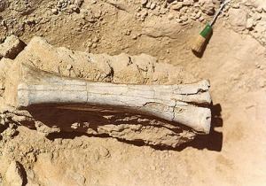
Bird species whose skeletons have been found in sediments of Lake Manix include the western grebe and the white pelican. Other bird skeletons found there were attributed to the species Aquila chrysaetos (Golden eagle), Branta canadensis (Canada goose), Ciconia maltha (an extinct stork), Erismatura jamaicensis (Ruddy duck), Grus, Nyroca valisineria, Phalacrocorax auritus (double crested cormorant), Phoenicopterus copei and Phoenicopterus minutus. These are typical lake dwelling birds and have been found at Fossil Lake in Oregon. Mammals also existed at Lake Manix, including Canis, Felis, Equus, Camelops, Tanupolama, Ovis, Bison, Mammuthus and Nothrotherium. This fauna list is not exhaustive, and is named "Camp Cady local fauna" after an Union Army post in the area.
The freshwater clam Anodonta californiensis existed in Lake Manix, as well as gastropods. Anodonta especially was probably very common in Lake Manix and other paleolakes considering the large shell deposits left by it. Fish species whose fossils have been found include the Mojave tui chub. The Western pond turtle also existed in the lake.
Ostracods also existed in the lake, including Limnocythere ceriotuberosa and other Limnocythere species. Subordinates include Candona species, Cypridopsis vidua, Heterocyphris incongruens, Limnocythere bradburyi, Limnocythere platyforma and Limnocythere robusta.
Diatoms which have been found at Lake Manix include Stephanodiscus species. Likewise, stromatolite deposits have been found.
Lake Manix during the time of its existence featured reedy marshes and was surrounded by juniper-sage vegetation and pinyon-juniper forests in the mountains. The present natural vegetation consists mostly of the creosote bush; starting from 1964 parts of the lake bed were used for groundwater-supported center pivot irrigation driven agriculture before increasing water pumping costs after 1980 caused their abandonment.
ClimateEdit
Present-day climates at the location of Lake Manix are dry and warm, with the mean temperature at Barstow reaching 17.7 °C (63.9 °F). Precipitation is scarce, 125–150 millimetres per year (0.156–0.187 in/Ms), and evaporation exceeds 2,000 millimetres per year (2.5 in/Ms). While the Victorville area is dominated by winter precipitation, at Barstow during late summer a secondary rain season occurs.
HistoryEdit
Originally, the Mojave River flowed south before tectonic changes forced its course into the Mojave Desert. This occurred 2-1.5 million years ago; at that point it ended at Victorville and after 575,000 - 475,000 years ago in Harper Lake. About 500,000 years ago it reached the Cady Basin of Lake Manix, based on tephrochronological data of the Bishop Tuff. At first the river may have alternated between Harper Lake and Lake Manix. 190,000 years ago Afton Basin was integrated with the other three basins, as the river cut through the Buwalda Ridge. This breakthrough was probably a catastrophic flood, considering the chaotically bedded rocks formed by the breakthrough. Afton Basin had a bottom at an altitude of c. 460 metres (1,510 ft) before; as it was integrated into Lake Manix sedimentation progressively filled it. The course change from Harper Lake to Lake Manix was not immediately stable; 25,000 years ago the Mojave River was again filling both lakes before definitively shifting to Manix by 20,000 years before present.
Conflicting interpretations of the history of Lake Manix exist, particularly for the late Pleistocene. One theory assumes three distinct highstands during the Pleistocene; they have been dated 33,500 - 30,500, 23,500 - 20,800 and 17,600 - 16,500 years ago. An alternative timeline assumes three highstands 40,000 - 35,000, 33,000 - 20,000 and 27,000 - 25,000 radiocarbon years. Clusters of shells in highstand deposits are dated 36,000 - 33,000 and 26,500 - 21,500 years before present. Other theories assume eight highstands and unstable lake levels between 45,000 and 25,000 years before present. Yet another theory assumes four highstands during oxygen isotope stage 6,4 and 2. Finally, radiocarbon dating in 2015 yielded ages of 43,000, 39,700, 36,100, 34,100, 31,600, 30,800, 29,400, 27,200 and 25,600 years ago, coinciding with cold and wet periods in speleothem records in Arizona and New Mexico.
The lake existed at least until 14,230 ± 1,325 years before present. Lake Manix drained when the Afton Canyon formed, possibly around 13,800 years before present; an earlier estimate of 14,000 years ago was later discarded. An alternative date is about 25,000 years before present. This drainage was probably quick and removed Lake Manix within a short time, perhaps as little as ten hours. The draining probably contributing to the "Lake Mojave II" highstand of Lake Mojave. After the initial catastrophic cutting, a slower incision further deepened the Afton Canyon. Alternative theories assume a much slower formation of the Afton Canyon outlet, based on the presence of several terraces and possible recessional landforms. As of 2003, the speed question was still not settled. The formation of this path was probably aided by the Manix Fault, which had left easily eroded sediments. The Mojave River may have drained into the Coyote Basin even after the formation of Afton Canyon, until headward erosion cut off that basin from the river flow about 9,000 - 7,500 years ago. Sediments transported through Afton Canyon during the event and later have buried the landscape beneath Afton Canyon, potentially also contributing sand to the development of the Kelso Dunes.
Presently, almost all runoff of the Mojave River comes from the San Bernardino Mountains, and ground infiltration and water diversions mean the river ends in the Victorville area; only the biggest floods can reach all the way to Soda Lake. Water occasionally also flows into the Cronese Lakes beneath the Afton Canyon.
ArcheologyEdit
Lake Manix may have been important for early humans in the area. Radiocarbon dating attests to the presence of humans at Lake Manix around 11,500 years before present.
Lithic artifacts have been found at the shorelines of Lake Manix. Some are of late Pleistocene age. Such artifacts include bifaces, disks, flakes and hammerstones which were grouped as the "Lake Manix Industry". Their supposedly pre-Clovis origin was questioned for a number of reasons. Dates obtained on the desert varnish they were embedded in yielded ages of 400-32,000 years before present, indicating that these items have varying origins and cannot be considered part of one grouping.