
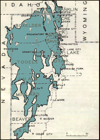
Area 51,282 km² | ||
 | ||
Ice age floods lake bonneville flood
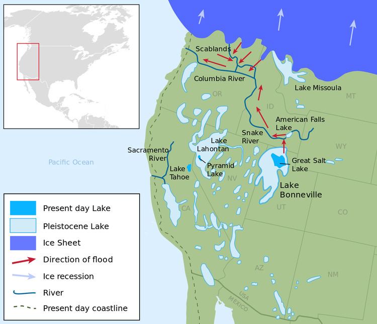
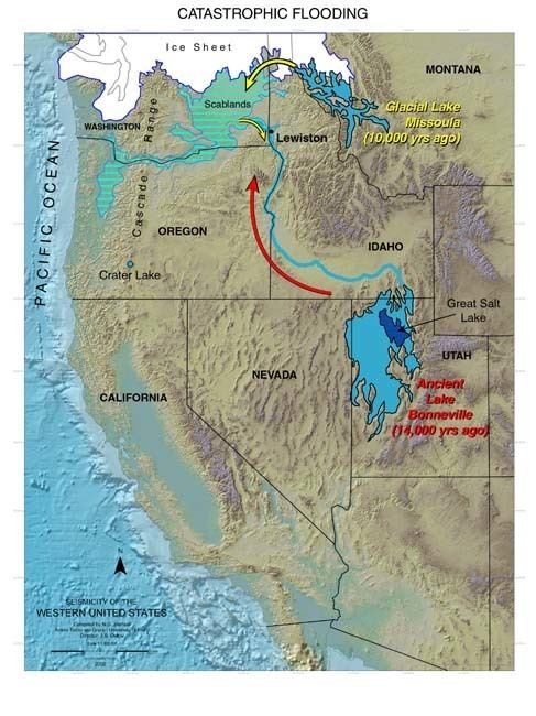
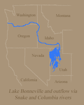
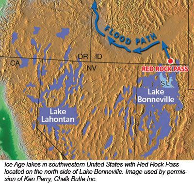
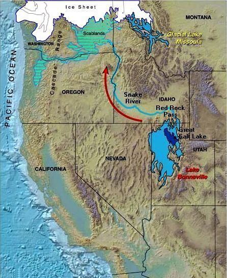
Lake Bonneville was a prehistoric pluvial lake that covered much of the eastern part of North America's Great Basin region. Most of the territory it covered was in present-day Utah, though parts of the lake extended into present-day Idaho and Nevada. (Its counterpart Lake Lahontan occupied much of northwestern Nevada while extending into California and Oregon.) Formed about 32,000 years ago, Lake Bonneville existed until about 14,500 years ago, when a large portion of the lake was released through the Red Rock Pass in Idaho. Following the Bonneville Flood, as the release is now known, the lake receded to a level called the Provo Level. Many of the unique geological characteristics of the Great Basin are due to the effects of the lake.
Contents
- Ice age floods lake bonneville flood
- Ancient lake bonneville utah glacial flood
- Geologic history
- References
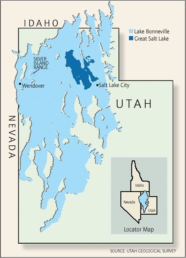
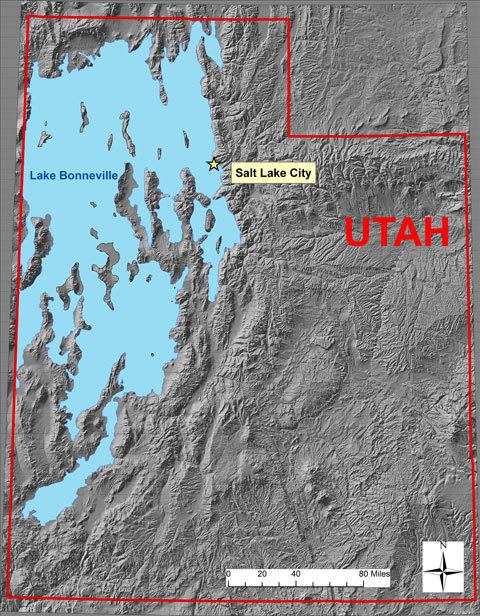
At more than 1,000 ft (300 m) deep and more than 19,691 square miles (51,000 km2) in area, the lake was nearly as large as Lake Michigan and significantly deeper. With the change in climate, the lake began drying up, leaving Great Salt Lake, Utah Lake, Sevier Lake, Rush Lake, and Little Salt Lake as remnants.
Lake Bonneville was named by the geologist G. K. Gilbert after Benjamin Louis Eulalie de Bonneville (1796–1878), a French-born officer in the United States Army, who was also a fur trapper, and explorer in the American West. Bonneville was noted for his expeditions to the Oregon Country and the Great Basin.
Ancient lake bonneville utah glacial flood
Geologic history
Like most, if not all, of the ice age pluvial lakes of the American West, Lake Bonneville was a result of the combination of lower temperatures, decreased evaporation, and higher precipitation that then prevailed in the region, perhaps because of a more southerly jet stream than today's. The lake was probably not a singular entity either; geologic evidence suggests that it may have evaporated and reformed as many as 28 times in the last 800,000 years.
Great Salt Lake, Utah Lake, and Sevier Lake are the largest remnants of the original Lake Bonneville. Several levels of the old shorelines are still visible above Salt Lake City, along the Wasatch Front and elsewhere. The appearance of the shorelines is that of a shelf or bench protruding from the mountainside, well above the valley floor. Four main shorelines are associated with the fluctuating levels of the ancient lake. The Stansbury, Bonneville, Provo and Gilbert shorelines each mark a time when lake level remained constant long enough to deposit massive accumulations of sand and gravel.
The Bonneville Bench, at about 5,102 feet (1,555 m) above sea level, is part of the preserved ice age shoreline. This shoreline marks the highest level attained by the Pleistocene lake approximately 15,500 years ago. During this period, the lake covered over 20,000 sq mi (52,000 km2) and was over 980 ft (300 m) deep in places.
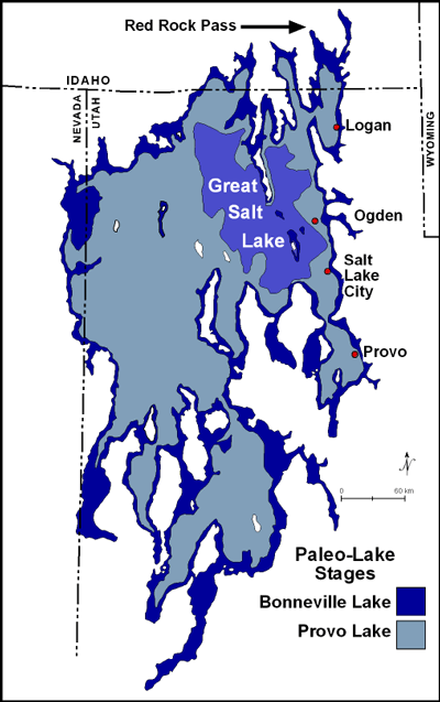
About 14,500 years ago, the lake level fell catastrophically as Lake Bonneville overflowed near Red Rock Pass, Idaho and washed away a natural dam formed by opposing overlapping alluvial fans. The lake level fell some 344 ft (105 m) to what is now the next lower bench (the "Provo level") in a flood that geologists estimate to have lasted up to a year. It is estimated that this breach released 1,000 cubic miles (4,200 km3) of water in the first few weeks. The Provo level is the most easily recognized shoreline feature throughout the Bonneville basin and is distinguished by thick accumulations of tufa that formed near the shorelines during the 500 years that the lake was at this level. During this period, the Red Rock Pass contained a river carrying water overflowing out of Lake Bonneville into the Snake River.
About 14,000 years ago, the lake started to drop again because of changing climate conditions, and by 12,000 years ago, the lake reached a level even lower than that of the modern day Great Salt Lake. A slight transgression or rise in lake level occurred about 10,900 to 10,300 years ago and formed the Gilbert shoreline. The Gilbert shoreline is the least conspicuous of the major shorelines but evidence of it remains at Antelope Island and in large coastal features, such as the Fingerpoint Spit near the Hogup Mountains.
In addition to geological traces, the lake has left a legacy of related fish distributed in now-isolated bodies of water. The term "Lake Bonneville drainage" is often used to refer to the assembly of disconnected lakes and rivers; since the draining happened relatively recently, most of the fish have not had time to evolve into distinct species.