
Area 260 km² | Surface elevation -85 m | |
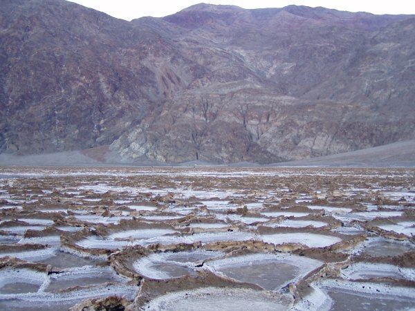 | ||
Lake manly badwater basin death valley national park
Lake Manly is a former pluvial lake in Death Valley, California.
Contents
- Lake manly badwater basin death valley national park
- Map of Lake Manly California USA
- NameEdit
- Research historyEdit
- GeographyEdit
- ShorelinesEdit
- HydrologyEdit
- InflowEdit
- OutletEdit
- Water compositionEdit
- ClimateEdit
- BiologyEdit
- ChronologyEdit
- Earliest highstandsEdit
- Blackwelder highstandEdit
- Later lake stagesEdit
- Present dayEdit
- References
Map of Lake Manly, California, USA
NameEdit
The lake was named in honour of William Lewis Manly. Manly in 1849 rescued white immigrants from Death Valley. The name is used for the lakes that occupied Death Valley in the past, but occasionally the name "Lake Manly" is used only for the most recent lake stage.
The name "Lake Manly" was coined in 1932. Other names for the lakes in Death Valley are "Death Valley Pleistocene lakes" and "Death Valley Lake", a name first used in a publication of 1902.
Research historyEdit
The existence of large ancient lakes in the Great Basin of the United States was already supposed at the end of the 19th century, when the existence of Lake Lahontan and Lake Bonneville was first described. The existence of a lake in Death Valley in the past was also considered during that time, although it was at first not universally accepted that it had been a large lake. The first evidence for it to have been a large lake was described in 1024 by Levi F. Noble.
Evidence for the lake's existence include wavecut terraces observed by geologists in 1925 and containing pebbles and tufa, layers of clay and salt on its former lake bed, calc deposits that were probably formed by algae in the lake These clues are dispersed across Death Valley, with the Beatty Junction and Desolation Canyon areas featuring some of the better researched areas.
While the deposits were once attributed to a single lake stand, later evidence of various lake cycles going back to the Pliocene was found. The history of Lake Manly is not as well understood as that of Lake Lahontan and Lake Bonneville, the two largest pluvial lakes recorded in the Great Basin.
GeographyEdit
Lake Manly formed in Death Valley, which is a tectonic depression located between the Panamint Range and the Amargosa Range. Death Valley is about 200 kilometres (120 mi) long and 10–30 kilometres (6.2–18.6 mi) wide and consists of three basins named Badwater Basin which reaches a depth of 86 metres (282 ft) beneath sea level, Cottonball Basin and Middle Basin. Southern California and southern Nevada contain deserts with valleys such as Death Valley that are not formed by rivers. Many of them held water in the past; some lakes such as Great Salt Lake, Mono Lake, Pyramid Lake and Walker Lake still exist. These ancient lakes were ultimately generated by Basin and Range province tectonic phenomena which caused runoff to collect in closed basins.
Lake Manly was a narrow and long lake. It was about 181–184 metres (595–605 ft) deep at highstand, about 94 metres (310 ft) above sea level. The lake reached a width of 9.7–17.7 kilometres (6–11 mi) and length of 140 kilometres (90 mi). The shores of the lake were 320 kilometres (200 mi) long. The most prominent shoreline at about 90 metres (300 ft) elevation is known as "Blackwelder shoreline". At this stand, the lake had a surface area of about 1,600 square kilometres (620 sq mi) using present-day topography; the absolutely highest surface area Lake Manly could have (at overflow height) is 8,000 square kilometres (3,100 sq mi). Some landforms indicative of lacustrine deposition have been found at altitudes of 595 metres (1,952 ft) (the overflow height) above sea level around Death Valley but they could also be the consequences of non-lacustrine processes.
The Death Valley are is tectonically active with faults such as the Black Mountains fault and the Southern Death Valley fault. Thus, shorelines from the same lake stands are often not at the same altitude in various parts of the basin. Faulting has caused a progressive drop in the elevation of the floor of Death Valley, keeping pace with sedimentation, although the exact rates are not known. This deformation causes the southwestern shores of Lake Manly to sag with respect to the northeastern ones, and together with sedimentation renders estimating the depth of Lake Manly unreliable. This is compounded by the fact that many lake deposits are located close to the active faults of the Death Valley fault zone.
One island existed close to Beatty Junction. No river deltas or other embankments have been found at Lake Manly's shorelines; their formation was likely hampered by unstable water levels. Only vague remnants of a delta are found where the Amargosa River probably entered Lake Manly.
ShorelinesEdit
At Beatty Junction, winds on Lake Manly formed several spits and barrier bars. Shorelines at Desolation Canyon also included spits and a tombolo. Just south of Desolation Canyon, the so-called Manly Terraces are a group of 850 metres (2,790 ft) long and 300 metres (980 ft) wide terraces.
Some sand and gravel deposits at Salt Spring Hills with elevations of about 180 metres (590 ft) may have been formed by either Lake Manly or another paleolake south of Death Valley, Lake Dumont.
The shores of Lake Manly were influenced by wave action. These waves probably came predominantly from the north-northwest, causing near shore material to be transported to the south. This also explains why most shore features are found on the eastern shores of the lake; these were most exposed to wave action.
It is not always clear whether a strandline is actually a strand line or a surface expression of fault activity; for example some supposed lower strandlines at Mormon Point were later reinterpreted as fault scarps.
HydrologyEdit
Fundamentally, the size of pluvial lakes such as Lake Manly when seepage and overflow can be neglected is governed by the balance between inflow by precipitation or rivers or streams and evaporation. This can make the surface of such lakes an useful gauge for paleoclimatic conditions. The principal water supply to Lake Manly were the Amargosa River, the Mojave River and the Owens River.
InflowEdit
The principal river flowing into Lake Manly was the Amargosa River. The Mojave River may have reached the Amargosa and thus drained into Lake Manly, but probably only during wet periods, and only starting from the latest Pleistocene. The Amargosa River originally ended in Lake Tecopa; only 140,000 years ago did it arrive at Death Valley.
At least during the Tahoe glaciation, the Owens River drained into Lake Manly after filling Owens Lake, China Lake, Searles Lake and the Panamint Valley. Increased precipitation and the formation of glaciers on the eastern Sierra Nevada increased the amount of water in the Owens River, and decreased temperatures reduced evaporation at each of these lakes, thus allowing water to get from lake to lake. When Panamint Lake reached a water depth of 270 metres (900 ft), it spilled over Wingate Pass into Lake Manly. Only little evidence of such spillover remains, including delta-like deposits at Anvil Spring Canyon. During the Tioga glaciation, the Owens River stopped in Lake Searles, considering that lower shorelines at Lake Searles do not appear to correspond to any shoreline in Panamint Valley and Death Valley.
Further water reached the lake from streams in the Amargosa Mountains and the Panamint Mountains. Presently Salt Creek from the north and the Amargosa River are the main inflows, with springs around the basin contributing a large proportion of the present day water budget in the valley. Other such streams include Furnace Creek, Hanaupah Canyon, Point Canyon, Six Springs Canyon and Willow Springs Canyon.
Springs also contributed water to Lake Manly, especially during the early lake stage. The brines and evaporites indicate that spring water contributed to the hydrology of Lake Manly.
OutletEdit
According to early researchers, Lake Manly had no outlet and its water level would have been governed exclusively by the balance of inflow and evaporation. Biological evidence such as fossil pupfish indicates though that connections to the Colorado River existed.
It was however postulated that Death Valley once drained into the Colorado River. Such a drainage may have occurred across the c. 580 metres (1,900 ft) high pass close to Ludlow and entered the Colorado close to present-day Parker, Arizona. Potentially, such an overflow if it existed reached rates of 2,000 cubic metres per second (71,000 cu ft/s).
There is no evidence that Lake Manly reached such an elevation although shorelines may have been obscured by later alluvial fans. A prominent 9 metres (30 ft) deep and 30–40 metres (98–131 ft) channel over Ash Hill (the pass in question) may have been the overflow channel, but it could also be the product of local runoff. Further, there is no indication that Bristol Lake, the lake that water from an overflow would have entered into, was ever filled with freshwater in the last four million years.
Water compositionEdit
As an endorheic lake, Lake Manly was naturally a saltwater lake. The waters would have less saline at highstand than during growth and regression stages. Further, given that most water inflow occurred from the south, waters probably were less saline there. The content of calcium in lake deposits suggests that calcium-rich springs which are associated with a crustal magma chamber in the southern Death Valley contributed sizable quantities of water to the lake.
ClimateEdit
The mean annual temperature of Death Valley is about 26 °C (79 °F), partly because of its relatively low elevation.
Death Valley has a dry climate, owing to the rain shadow formed by the Panamint Range and the Sierra Nevada. Thus less than 50 millimetres (2.0 in) precipitation fall every year.
Lake Manly was probably windier than present-day Death Valley, as present day winds could not be strong enough to move some of the rocks that were moved along Lake Manly's shores; wind speeds of over 31 metres per second (100 ft/s) would be needed. Later research reduced this requirement to about 14–27 metres per second (46–89 ft/s), which is consistent with estimated present day wind speeds in Death Valley. The topography of the valley would have generated northerly winds over Lake Manly, but strong southwesterly winds also contributed to the formation of beach deposits.
Heights of waves have been estimated to be about 0.76–0.94 metres (2 ft 6 in–3 ft 1 in) with higher heights of about 1.35–2.22 metres (4 ft 5 in–7 ft 3 in) convert needed to transport beach material, enough to form backwash and swash. Wave activity was most pronounced in the southern and northern parts of Lake Manly.
BiologyEdit
Some inferences on the biota of Lake Manly can be made on the basis of analogous lakes like Mono Lake and Great Salt Lake and the streams that drain into Death Valley. Shared species are considered evidence not only for the integration of regional river systems, but also for connections with more remote water systems such as the Colorado River.
Some tufa deposits were formed by blue-green algae.
Species that inhabited the lake probably included the brine fly larvae, brine shrimp and molluscs like Anodonta and Carinifex.
Minnows like Agosia and Syphateles as well as the desert pupfish inhabit streams and probably lived in Lake Manly itself as well.
The shores of the lake supported bird populations. Vegetation including sagebrush probably covered mountain slopes, with higher slopes containing juniper and pine forests.
ChronologyEdit
Lake Manly existed during the late Pleistocene, in the early Wisconsin glaciation (Tahoe stage). Originally, it was believed that Lake Manly did not exist during the Tioga glaciation. Later evidence such as drilling core data evidence two distinct lake stages, one 185,000 - 128,000 years ago and another 35,000 - 10,000 years ago. This corresponds to oxygen isotope stage 6 and 2 respectively. Between 120,000 and 60,000 no lake existed in Death Valley and separate saline lakes between 60,000 and 35,000 years ago. Lake levels in Lake Manly appear to track the size of the Laurentide ice sheet but only very roughly so.
Earliest highstandsEdit
A Pliocene stage is also documented in southern Death Valley. Another old lake stand may have occurred in 194,000 - 216,000 years before present; its shorelines presently are at altitudes of 73–96 metres (240–315 ft). The existence of Lake Manly 600,000 - 1,000,000 years ago is possible but questionable; yet older lake formations have been variously dated between 3,7 and 0.77 million years ago.
Blackwelder highstandEdit
The highest shoreline at elevations of 90–100 metres (300–330 ft) has been named Blackwelder stand, after a researcher who first examined the fossil shorelines. It appears to belong to the first (Illinoian) stage of the lake, but was at first considered to belong to the second (Wisconsinian) stage, during oxygen isotope stage 6. Uranium-thorium dating has linked this shoreline to the older highstand, about 186,000 - 120,000 years before present; an alternative proposal linking the Blackwelder stand with a wet period in Lake Searles 1.3-1 million years ago conflicts with other dates. The uranium-thorium and other dates of the Blackwelder stand however are not beyond all doubts.
Depending on the rate of tectonic sinking, the lake at the early stage was 175 metres (574 ft) and up to 335 metres (1,099 ft) deep.
This shoreline is found at Mormon Point, Shoreline Butte and elsewhere in the northern Death Valley but not in the southern Death Valley; one theory states that shorelines at elevations of 180 metres (590 ft) (Salt Spring and Saddle Springs) and 340 metres (1,120 ft) (Mesquite Spring at Soda Lake) are Blackwelder shorelines that were offset by tectonic deformation at a geologically reasonable rate of 2 millimetres per year (0.0025 in/Ms). Such would imply that Soda Lake and Silver Lake during the Blackwelder stand were connected with Lake Manly. Such an expansion would have occurred whenever the lake levels rose above 178 metres (584 ft) above sea level and thus could flow south across Salt Spring Hills; the enlargement of the lake surface that resulted would have increased evaporation and stabilized lake levels. There is no clear cut evidence that these shorelines are of the same age as the Blackwelder shoreline, although they are of similar appearance.
There is no indication that Soda Lake during OIS 6 had a lake, although water currents in a previous lake may have transported sands that are usually only found in ephemeral lakes through a deeper lake. Futher, shorelines at Salt Spring appear to belong to the later lake stage based on dating, and the tectonic deformation required to link the two southern shorelines to the Blackwelder shoreline has been deemed implausible. and not supported by analysis of the shorelines themselves.
The Blackwelder highstand was probably not stabilized by overflow seeing as the only spillway close to Ludlow is about 595 metres (1,952 ft) high above sea level, considerably higher than the Blackwelder highstand could plausibly be. Further, the development of stable shorelines does not by default require an overflow, as demonstrated by the Dead Sea and its precursos Lake Lisan.
The Sperry terrace in Amargosa Canyon appears to be of the same general age as the Blackwelder highstand.
Another explanation assumes that Lake Manly during that stage did not extend into southern Death Valley.
Later lake stagesEdit
The later lake stage whoch occurred during the Wisconsin glaciation/Weichselian glaciation was not as large as the Blackwelder lake stage; at first it was suggested that only small lakes occupied Death Valley during that time. The later lake was shallower, with tufas dated at 25,000 and 18,000 years before present having formed at elevations of −22 – −30 metres (−72 – −98 ft). That lake was probably shallow, with estimated depths of 64–78 metres (210–256 ft). Later research indicated that the late Lake Manly was even shallower, probably because regional climate conditions favourable to its growth were rarer during the later lake stage than at Blackwelder times.
Present dayEdit
By 12,000 years before present Lake Manly had shrunk to the Badwater basin and was probably only 2 metres (6 ft 7 in) deep. After 10,000 years before present, the lake did not exist anymore. Based on the state of preservation of shoreline deposits e.g at Hanaupah Fan the retreat of the lake was probably much faster than its growth.
Occasionally, parts of Death Valley are flooded during wet weather, causing parts of Lake Manly to reform. Legend has it that such happens only every hundred years. Severe flooding in March 2005 resulted in parts of Death Valley becoming submerged.