
Prominence 586 m Parent range Sierra Nevada | Elevation 3,965 m Mountain range Sierra Nevada | |
 | ||
First ascent 1919 by Walter L. Huber Similar Koip Peak, Mount Maclure, Mount Gibbs, Mount Ansel Adams, North Peak | ||
Kuna Peak is a summit on the boundary between Mono and Tuolumne counties, in the United States. With an elevation of 13,008 feet (3,965 m), Kuna Peak is the 146rd highest summit in the state of California. and the third highest in Yosemite National Park. While the mountain's western face is in the park, the eastern side is in the Ansel Adams Wilderness.
Map of Kuna Peak, California 93541, USA
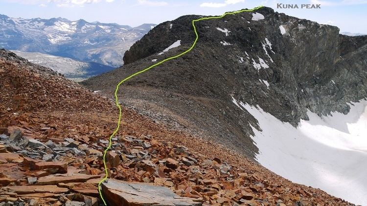
The peak is often climbed as a traverse from Koip Peak Pass to the east, and the summit block is an easy class 2-3 scramble. The red rock of Kuna Peak is similar to that of its northernly Yosemite neighbors, Mount Gibbs, Mount Dana, and Excelsior Mountain.
Kuna is derived from a Native American word meaning "fire". On the summit, there are many jagged pieces of rock which resemble fire themselves.