
Governing body U.S. Forest Service Area 932 km² Established 1964 | Created 1964 Address Lee Vining, CA 93541, USA Phone +1 559-877-2218 | |
 | ||
Similar Devils Postpile National, Red's Meadow Resort, Silver Lake Resort, Mammoth Ranger District C, Twin Lakes Campgro | ||
Ansel adams wilderness california backpacking september 2015
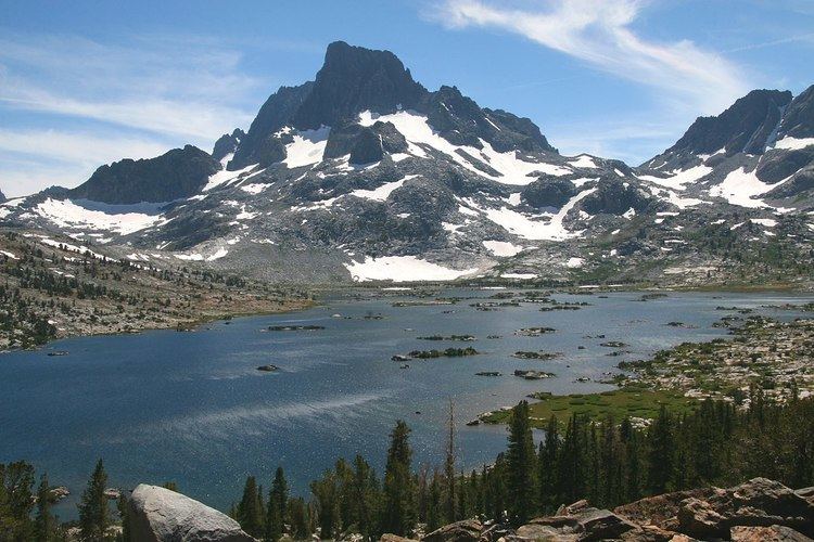
The Ansel Adams Wilderness is a wilderness area in the Sierra Nevada of California, USA. The wilderness is part of the Sierra (majority of the wilderness) and Inyo National Forests. The wilderness spans 231,533 acres (93,698 ha). Yosemite National Park lies to the north and northwest, while the John Muir Wilderness lies to the south.
Contents
- Ansel adams wilderness california backpacking september 2015
- National geographic live peter essick ansel adams wilderness revisited nat geo live
- History
- Geography and Geology
- Ecology
- Recreation
- References
National geographic live peter essick ansel adams wilderness revisited nat geo live
History
The wilderness was established as part of the original Wilderness Act in 1964 as the Minarets Wilderness. The 109,500-acre (44,300 ha) Minarets Wilderness was created by enlarging and renaming the Mount Dana-Minarets Primitive Area.
In 1984, after his death, the area was expanded and renamed in honor of Ansel Adams, well-known environmentalist and nature photographer who is famous for his black and white landscape photographs of the Sierra Nevada.
Geography and Geology
The Ansel Adams wilderness spans in elevation from 3,500 to 13,157 feet (1,067 to 4,010 m), forming the northern end of the High Sierra.
The centerpiece of the Ansel Adams wilderness is the Ritter Range, which includes dark metavolcanic glaciated mountains such as Mount Ritter, Banner Peak, and The Minarets.
Immediately to the east of the Ritter Range is the Middle Fork of the San Joaquin River, which contains Devils Postpile, a series of basaltic columns that were revealed and smoothed by glacier action. The Middle Fork originates from Thousand Island Lake, at the foot of Banner Peak, one of the largest backcountry lakes in the Sierra.
To the east of the Middle Fork canyon is the true Sierra Crest, which, at roughly 10,000 feet (3,000 m) of elevation is lower than the Ritter Range. This relatively low region of the Crest allows winter storms through and cause large amounts of snowfall on Mammoth Mountain, which sits in the gap. The gap also allows migration of plants and animals across the Sierra Crest.
To the west of the Ritter Range lies the canyon of the North Fork of the San Joaquin, a relatively remote and unvisited high-country area. The southern part of the wilderness contains the 3,000 feet (900 m) deep canyon of the main San Joaquin River, which flows out of the Sierra Nevada to California's Central Valley.
Ecology
The Ansel Adams wilderness contains substantial area above treeline, at approximately 9,600 to 10,400 feet (2,900 to 3,200 m). The area above treeline contains alpine meadows and fellfields, with a large number of glacial lakes. Below treeline, the wilderness is dominated by lodgepole pine, red fir, and Jeffrey pine, depending on elevation.
Recreation
The wilderness contains 349 miles (562 km) of hiking trails, including portions of the John Muir and Pacific Crest Trails. The Sierra High Route, an off-trail route described by Steve Roper, runs along the base of the Ritter Range, through the wilderness.
The Middle Fork of the San Joaquin receives the most visitors: a mandatory bus is required for visitors to reach Devils Postpile from the Mammoth Mountain Ski Area during the summer.
The Minarets are a well-known area for technical rock climbing.
Winter brings various cross-country ski possibilities, accessible from both Mammoth Mountain and the June Mountain ski area.