
Area 76,000 km² | Federal district Southern Established September 13, 1937 Area rank 42nd Population 5.227 million (2012) | |
 | ||
Colleges and Universities Kuban State University, Kuban State Agrarian, Krasnodar State University, Kuban State Technolo, Kuban State Medical Points of interest Rosa Khutor Alpine Re, Mount Fisht, Park "Riviera", Lake Ritsa, Sochi Park | ||
The city of krasnodar
Krasnodar Krai (Russian: Краснода́рский край, Krasnodarsky kray; [krəsnɐˈdarskʲɪj kraj]) is a federal subject of Russia (a krai), located in the Southern Federal District. Its administrative center is the city of Krasnodar. It had a population of 5,226,647 (2010 Census).
Contents
- The city of krasnodar
- Map of Krasnodarskiy Kray Russia
- Anapa krasnodar krai black sea russia hd travel
- Geography
- Climate
- Hydrography
- Soil
- Vegetation
- Animal world
- History
- Politics
- Administrative divisions
- Transportation
- Demographics
- Religion
- 2012 floods
- References
Map of Krasnodarskiy Kray, Russia
The krai is sometimes referred to as Kuban, a term describing a historical region of southern Russia.
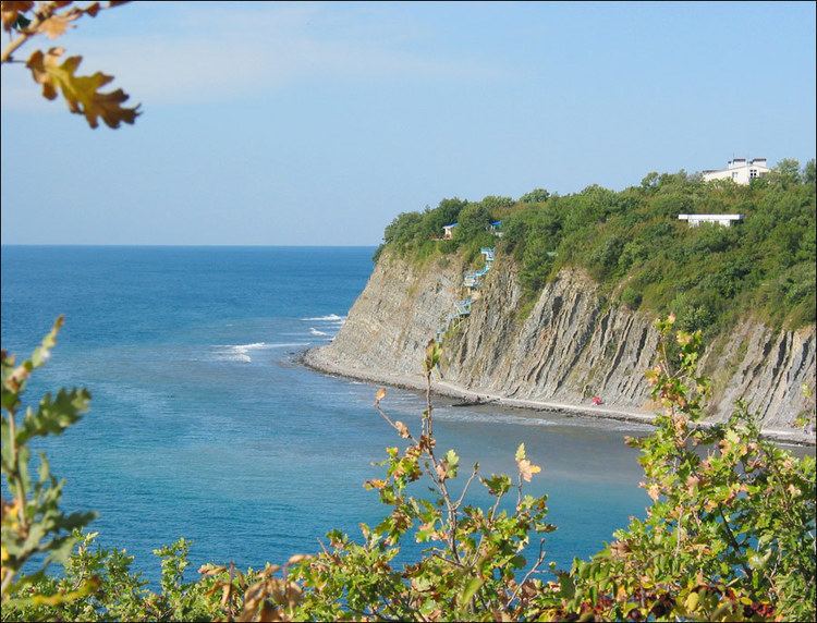
Anapa krasnodar krai black sea russia hd travel
Geography
Krasnodar Krai is located in the southwestern part of the North Caucasus and borders with Rostov Oblast in the northeast, Stavropol Krai and Karachay-Cherkessia in the east, and with the breakaway republic of Abkhazia (claimed by Georgia) in the south. The Republic of Adygea is completely encircled by the krai territory. The krai's Taman Peninsula is washed by the Sea of Azov in the north and the Black Sea in the south. In the west, the Kerch Strait separates the krai from the Crimean Peninsula. At its widest extent, the krai stretches for 327 kilometers (203 mi) from north to south and for 360 kilometers (220 mi) from east to west.
The krai is split into two distinct parts by the Kuban River, which gave its name to this entire geographic region. The southern, seaward part is the western extremity of the Caucasus range, lying within the Crimean Submediterranean forest complex ecoregion; the climate is Mediterranean or, in the southeast, subtropical. The northern part is a steppe zone which shares continental climate patterns.
The height of the mountains exceeds 3,000 meters (9,800 ft), with Mount Tsakhvoa being the highest at 3,346 meters (10,978 ft). Mount Fisht, at 2,867 meters (9,406 ft), is the Great Caucasus' westernmost peak with a glacier.
The Black Sea coast stretches from the Kerch Strait to Adler and is shielded by Caucasus Mountains from the cold northern winds. Numerous small mountain rivers flow in the coastal areas, often creating picturesque waterfalls.
Lake Abrau, located in the wine-making region of Abrau-Dyurso, is the largest lake in the northeastern Caucasus region. Lake Ritsa is considered to be one of the most picturesque lakes in the region and "the diamond of Caucasus"; it is located in an intermountain basin at the height of 884 meters (2,900 ft) above sea level.
Climate
The climate in most of the temperate continental, on the Black Sea coast from Anapa to Tuapse - semi-arid Mediterranean climate, south of Tuapse - humid subtropical. In the mountains, expressed high-altitude climatic zonation. Throughout the year, typical of extreme weather changes - significant monthly, seasonal and long-term fluctuations in temperature. For fёny foothills are characterized by promoting rapid snowmelt in spring and increased flooding on the rivers. In the area of Anapa - Novorossiysk - Gelendzhik typical boron with wind speed exceeding 15 m / s, sometimes more than 40 m / s (in December 1997 there was boron with wind force of up to 47 m / s). The average number of days of 21 Bora (in Novorossiysk more than 40), 18 of them in the cold half of the year.
The average January temperature in the plains -3 ... -5 ° C, on the Black Sea coast of 0 ... + 6 ° C, in Sochi +5,9 ° C. The average July temperature is +22 ... + 24 ° C. Annual precipitation - from 400 to 600 mm in the plains to 3242 mm and more - in the mountains. Every spring, the edge of flooded floods. In general for the region is characterized by hot summers and mild winters.
Hydrography
The main river of the Krasnodar Territory - Kuban, receiving many tributaries on the left (Urup, Laba, Belaya, and others.), For the regulation of the flow which built the Krasnodar Reservoir. Her name is often referred to, and the whole region, calling it simply Kuban. The rivers of the Azov Sea basin have flat nature, most of them - Her, Beysug River, Kirpili. The rivers of the Black Sea coast are small, the largest of them - the Mzymta.
On the territory of the region there are many small karst lakes on the Taman Peninsula and the Sea of Azov - lakes, estuaries. In the Krasnodar Territory is the largest lake in the North Caucasus - Abrau.
The Region is a large swimming pool Azov-Kuban fresh groundwater, which has significant reserves of thermal and mineral waters.
Soil
The bulk of the soil of the steppe zone edge up Ciscaucasian carbonate and leached chernozems. Taman busy brown, West Ciscaucasian bog soils. In the mountains - mountain-forest brown and rendzina, in high - mountain meadow.
The total land area of Krasnodar region is 7.5 million hectares, including arable land - 3.9 million hectares. This is the main arable fund edges, characterized by high fertility.
A narrow strip on the left bank of the Kuban, Prikubanskaya sloping plain and a part of the foothills are suitable for gardening and cultivation of yellow tobacco.
Vegetation
Part of the province (up mountain ranges and Anapa Black Sea coast to the south) is occupied by steppes. Among Kuban forest resources it plays an important role, as it has great environmental value and is the main source of timber Russia valuable species. The total forest area of the Krasnodar Territory is more than 1.8 million hectares. Unminable oak and beech woods (broadleaf forests) occupy respectively 49 and 19% of all forests. Also in the region are growing mountain dark coniferous (spruce, fir) forests, subalpine and alpine meadows. Of great interest is the plant world Coast. Thus, the special value juniper (often with an admixture of Pistachio) woodlands. They are spread from Anapa to the mouth of the river Mezyb (for Gelendzhik) and serve as a refuge of ancient Mediterranean flora. The main types - high juniper, juniper smelly, Pistachio, Etruscan honeysuckle.
Animal world
On the territory of the region inhabited by 86 species of mammals, 20 - reptiles, more than 300 - birds, 11 species of amphibians, with a significant number of animals included in the Red Book of Russia (11 mammals, 24 - the birds 2 - amphibians, 3 species of reptiles). Among them are such rare species as the ferret-polecat, Caucasian otter, eagle, serpent eagle, ibis, bustard, spoonbill, imperial, steppe eagle, white-tailed eagle, curly and pink pelicans, peregrine falcon, osprey, merlin, little bustard, the Caucasian black grouse and other . In Soviet times acclimatized raccoon
History
In 631, Kubrat was founded on the Kuban State and the Great Bulgar Khans dynasty began. The Royal city became Phanagoria. The territory of Krasnodar Region from the 8th to the 10th centuries was part of the Khazars. After the defeat of the Khazar Khanate in 965 Kievan prince Svyatoslav conquered the area, it came under the rule of Kievan Rus', and it then formed the Tmutarakan principality. Later, due to the increasing claims of Byzantium at the end of the 11th century, the Tmutarakan principality came under the authority of the Byzantine emperors (until 1204).
In that period of history, Russian Circassians first appeared under the name (ethnonym) Kasogs. For example, Rededi Prince Kasozhsky was mentioned in The Tale of Igor's Campaign.
In 1243-1438 the current territory of the Kuban was part of the Golden Horde. After the collapse of the latter, parts of Kuban were held under the Crimean Khanate, Circassia, and the Ottoman Empire, which dominated the region. The Tsardom of Russia began to challenge the protectorate of the Ottoman Empire in the area during the Russian-Turkish wars.
In April 1783, by decree of Catherine II, right-bank Kuban and Taman Peninsula were annexed to the Russian Empire. In the years 1792-93 Cossacks moved here from Zaporozhye, now located in Ukraine, and formed the Black Sea Area troops, with the creation of a solid cordon line for the Kuban River and the marginalization of the neighboring Circassians.
During the campaign for control of the North Caucasus (Caucasian war 1763-1864) to Russia in 1829 pushed the Ottoman Empire and the 1830s. Border was marked on the Black Sea coast. For this see Russian conquest of the Caucasus#Black Sea Coast.
In 1783 present northern territory of Kuban region, became part of Russia after the liquidation of the Crimean Khanate. To protect the river Kuban, a border garrison was here in the years 1793-94. The remains were relocated to the Cossacks, initiating development of the region. Administrative region received the status of "Land of Black Sea Cossack Army".
Before the October Revolution of 1917, most of the territory of modern Kuban-Krasnodar territory occupied area, formed in 1860 from the Black Sea Cossack Army, the western part of the Caucasus Line Cossack troops. Kuban region was a territory of the Kuban Cossack Army.
In 1900 the region's population numbered around two million people. In 1913 the gross grain harvest Kuban region entered the 2nd place in Russia, for the production of marketable grain - in the 1st place.
Politics
During the Soviet period, the high authority in the krai was shared between three persons: The first secretary of the Krasnodar CPSU Committee (who in reality had the greatest authority), the chairman of the Krai Soviet (legislative power), and the chairman of the Krai Executive Committee (executive power). Since 1991, CPSU lost all the power, and the head of the krai administration, and eventually the governor was appointed/elected alongside elected regional parliament.
The Charter of Krasnodar Krai is the fundamental law of the region. The Legislative Assembly of Krasnodar Krai is the province's standing legislative (representative) body. The assembly exercises its authority by passing laws, resolutions, and other legal acts and by supervising the implementation and observance of the laws and other legal acts passed by it. The highest executive body is the krai government, which includes territorial executive bodies such as district administrations, committees, and commissions that facilitate development and run the day to day matters of the province. The krai administration supports the activities of the governor who is the highest official and acts as guarantor of the observance of the Krai Charter in accordance with the Constitution of Russia.
Administrative divisions
Krasnodar Krai is administratively divided into thirty-eight districts (raions) and fifteen cities of district equivalence. The districts and cities are further subdivided into eleven towns, plus urban-type settlements, and rural okrugs and stanitsa okrugs.
Transportation
Several lines of Russian Railways cross the region and link it with Abkhazia, Ukraine, and neighboring Russian regions. There are direct trains from resort cities like Sochi and Anapa to Moscow, via Krasnodar, which become very popular during the summer vacation season. There are also suburb train connections. The Apsheronsk narrow-gauge railway, the longest mountain narrow-gauge railway in Russia, runs through Krasnodar Krai.
There are several airports in the region, including Krasnodar International Airport, Sochi International Airport, Anapa Airport, and Gelendzhik Airport.
The biggest ports are Novorossiysk and Tuapse. Others are Eisk and Temryuk on the Azov Sea, and Port Kavkaz, Taman, Anapa, Gelendzhik, and Sochi on the Black Sea. There is a Kerch Strait ferry line which connects Krasnodar Krai and Crimea.
Demographics
Population: 5,404,300 (2014 est.); 5,226,647 (2010 Census); 5,125,221 (2002 Census); 5,113,148 (1989 Census).
The population of Krasnodar Krai is concentrated in the Kuban River drainage basin, which was traditionally Cossack land (see History of Cossacks). The Kuban Cossacks are now generally considered to be ethnic Russians, even though they are still an important minority in their own right in the area. Historically, they were considered to be ethnic Ukrainian, and reported their language as Ukrainian in censuses well into the 20th century; this change in identity is due to assimilation and historical persecution of the Kuban Cossacks, which was particularly prominent due to questions of their loyalty to Moscow and the Communist state during the Russian Revolution and First World War. Other notable ethnic groups are the Adyghe, who have lived in the Kuban area for thousands of years, and the Armenians (including Christian Hamsheni and Cherkesogai), who have lived in the region since at least the 18th century.
Ethnic groups: the 2010 Census identified ethnic groups, as shown in the following table:
Vital Statistics for 2007: Source
Vital Statistics for 2008:
2009 - 1.59 | 2010 - 1.57 | 2011 - 1.58 | 2012 - 1.70 | 2013 - 1.72 | 2014 - 1.81 | 2015 - 1.84 | 2016 - 1.86(e)
Religion
According to a 2012 official survey 52.2% of the population of Krasnodar Krai adheres to the Russian Orthodox Church, 3% are unaffiliated generic Christians, 1% are either Orthodox Christian believers who don't belong to church or members of non-Russian Orthodox churches, and 1% are Muslims. In addition, 22% of the population declares to be "spiritual but not religious", 13% is atheist, and 7.8% follows other religions or did not give an answer to the question.
2012 floods
On July 7, 2012, at least 171 people died in Krasnodar Krai, after torrential rains overnight caused the worst flooding and landslides in more than seventy years. Over 280 millimeters (11 in) of rain – the typical amount for a four- or five-month period – was reported to have fallen within forty-eight hours. A local police spokesman stated that most of the dead were in Krymsky District, where at least 159 died when a wave of water 5 meters (16 ft) high swept through the town of Krymsk in the middle of the night. Ten more deaths occurred in Gelendzhik, including five electrocuted when a transformer fell into the floodwater, and two in Novorossiysk. Authorities stated that 17 people had been officially reported missing, and there were fears the death toll would rise further, while medics had hospitalized 210 people, including 16 children.
The regional government claimed that over 24,000 people were affected by the floods, with more than 3,000 evacuated, and that more than 10,000 rescuers and 140 helicopters were searching for victims and evacuating survivors. In Krymsk, 14 temporary shelters were set up to house around 2,000 evacuees. The transport system in the region was said to have collapsed, while oil shipments from Novorossiysk were halted when the port, located in the lower part of the city, was threatened by landslides. Russia's President Vladimir Putin flew to the area to hold emergency talks with officials in Krymsk, while authorities in Perm Krai dispatched a rescue team to evacuate dozens of children from the region, who had been staying at summer camps on the Black Sea coast.
Residents of Krymsk claimed the wave of water that hit the town resulted from the sluice gates of a nearby reservoir being opened, although this was denied by the prosecutor general's investigative committee. Local prosecutors had earlier confirmed that the gates were opened, but stated that it was too early to determine whether this was the cause of the flooding.