
Founded 24 May 1984 Area code 0499 | Area 1,992 km² ISO 3166 code ISO 3166-2:IN | |
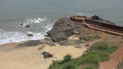 | ||
Points of interest Bekal Fort, Ananthapura Lake Temple, Chandragiri Fort - Kerala, Payaswini, Srimath Anantheshwar Temple Destinations | ||
Kasaragod district tourism
Map of Kasaragod, Kerala
Kasaragod District (Malayalam: കാസർഗോഡ് ജില്ല) is one of the 14 districts in the state of Kerala, India. Kasaragod became part of Kannur district following the reorganisation of states and formation of Kerala in November 1, 1956. Kasaragod was declared as a district on 24 May 1984.
Contents
- Kasaragod district tourism
- Map of Kasaragod Kerala
- Overview
- History
- Geography
- Demographics
- Health
- Languages
- Parliament Constituency
- Assembly Constituencies
- Notable People
- References
Overview
To its south lies Kannur District, to the South east is Kodagu district(Coorg) and to the north Dakshina Kannada district. All along its east it is walled by the Western Ghats while along the west the Laccadive Sea borders it.
The district, covering an area of around 1992 km2, has a population (2011 census) of 1,307,375 and has four taluks, namely, Kasaragod and Hosdurg (Kanhangad), Vellarikundu and Manjeshwaram Taluk. Major towns in Kasaragod district are Nileshwar, Kanhangad, Kasaragod, Uppala, Kumbla, cheruvathur and Trikaripur. It has three municipalities (Nileshwar Kasaragod, and Kanhangad and thirty-eight grama panchayats.
History
Kasaragod was known to the Arabs by the name Harkwillia. Many Arab travelers who visited Kerala between the 9th and the 14th centuries visited Kasaragod, which was an important trade centre then. Duarte Borbosa, the Portuguese traveler who visited Kumbla, near Kasaragod in 1514, recorded rice being exported for coir to Maldives.
Kasaragod was part of the kumbala Kingdom in which there were 64 Tulu and Malayalam villages. When the Vijayanagara empire attacked Kasaragod, it was still under the Kolathiri Raja who had Nileshwaram as one of his capitals. During the decline of the Vijayanagara empire, the administration of this area was vested with Ikkeri Nayakas. At the onset of collapse of the Vijayanagara empire, Venkappa Nayaka declared independence to Ikkery. Kumbla, Chandragiri and Bekal are considered to be the chain of forts constructed or renovated by Shivappa Nayaka.
Francis Buccanan, the family doctor of Arthur Wellesley, visited Kasargod in 1800. In his travelogue, he recorded information on places like Athiraparambu, Kavvai, Nileshwaram, Bekal, Chandragiri and Manjeshwaram. In 1763, Hyder Ali conquered Bedanoor (Bidnur), the capital of the Ikkery Naiks. His son Tippu Sultan conquered much of Malabar. As per the Sreerangapattanam Treaty of 1792, Tippu surrendered Malabar, except Kanara to the British. The British got Kanara only after the death of Tippu Sultan. it is said that Kinavoor Molom (Sree Dharma Shashtha Temple)is belonging to Karinthalam (one among 64 Brahmin Villages in old Kerala).
Before the formation of Kerala, Kasaragod was a part of erstwhile South Canara district of Madras Presidency. Kasaragod became part of Kannur district following the reorganisation of states and formation of Kerala in November 1, 1956. Kasaragod was declared as a district on 24 May 1984.
Geography
The district is the northernmost district of the State of Kerala. Kasaragod is located at 12.5°N 75.0°E / 12.5; 75.0. It has an average elevation of 19 metres (62 feet).
Demographics
According to the 2011 census Kasaragod district has a population of 1,307,375, roughly equal to the nation of Mauritius or the US state of New Hampshire. This gives it a ranking of 375th in India (out of a total of 640). The district has a population density of 654 inhabitants per square kilometre (1,690/sq mi) . Its population growth rate over the decade 2001–2011 was 8.18%. Kasaragod has a sex ratio of 1079 females for every 1000 males, and a literacy rate of 89.85%.
Health
Kasaragod district is one of the worst HIV infected areas in Kerala. 970 HIV cases were registered in Kasaragod district. Ten AIDS related deaths were reported in the Kasaragod district within a short period of two months in 2016. This is actually comparable to a lot of other rural Indian districts. In terms of general healthcare, kasaragod is comparable to any other district in Kerala.
Languages
Kasargod district is one of the rare districts in India which houses as many as 7 different languages (excluding dialects and tribal languages), with each spoken by a substantial number of people.
The Malayalam spoken here has influences from Kannada and Tulu.
Parliament Constituency
Assembly Constituencies
- Manjeswar
- Kasaragod
- Udma
- Kanhangad (SC)
- Trikkarpur
Notable People
The following list gives the names of people from Kasaragod District who have a page on them in the Wikipedia.