
Length 350.3 km | ||
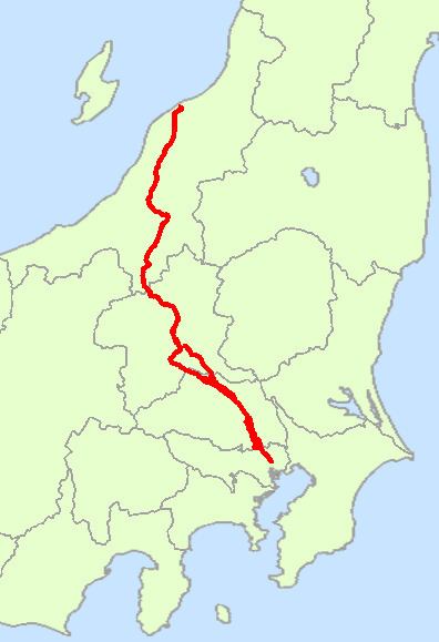 | ||
National Route 17 (国道17号, Kokudō 17-gō) is a highway on the island of Honshu in Japan. It originates at Nihonbashi in Chūō, Tokyo, and terminates in the city of Niigata (the capital of Niigata Prefecture), where it meets Routes 7, 8, 49, 113 and 116).
Contents
Map of Japan, %E5%9B%BD%E9%81%9317%E5%8F%B7%E7%B7%9A
Route 17 measures 350.3 km in length. It incorporates parts of two ancient highways, the Nakasendō and Mikuni Kaidō. The newer Kan-Etsu Expressway parallels Route 17.
In addition to Chūō, Route 17 passes through Itabashi. It links the prefectural capitals of Saitama (Saitama Prefecture) and Maebashi (Gunma Prefecture).
Route data
Other names
References
Japan National Route 17 Wikipedia(Text) CC BY-SA