
Area 10.21 km² Population 141,454 (1 May 2015) | Region Kantō region | |
 | ||
Time zone Japan Standard Time (UTC+9) Website www.city.chuo.lg.jp/foreign/english/index.html University St. Luke's International University Points of interest Tsukiji fish market, Hamarikyu Gardens, Tsukiji Hongan‑ji, Mitsui Memorial Museum, Currency Museum of the Bank | ||
Chūō (中央区, Chūō-ku, "Central Ward") is a special ward that forms part of the heart of Tokyo, Japan. The ward refers to itself in English as Chūō City.
Contents
- Map of Chuo Tokyo Japan
- Geography
- History
- Nihonbashi Area
- Kybashi Area
- Tsukishima Area
- Economy
- Foreign operations
- Former economic operations
- Politics and government
- Elections
- Rail
- Highway
- Education
- References
Map of Chuo, Tokyo, Japan
Its Japanese name literally means "Central Ward", and it is historically the main commercial center of Tokyo, although Shinjuku has risen to challenge it since the end of World War II. The most famous district in Chūō is Ginza, built on the site of a former silver mint from which it takes its name. The gold mint, or Kinza (金座), formerly occupied the site of the present-day Bank of Japan headquarters building, also in Chūō.
As of May 1, 2015, the ward has an estimated resident population of 141,454 and a population density of 13,850 persons per km². The total area is 10.21 km². However, because of the concentration of businesses, offices and retail space, the daytime population swells to an estimated 650,000.
Geography
Chūō is in the central area of Tokyo, surrounded by the five special wards of Chiyoda, Minato, Taitō, Sumida, and Kōtō.
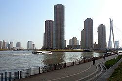
Administratively, Chūō is divided into the three zones of Nihonbashi, Kyobashi and Tsukishima. Nihonbashi and Kyobashi are predominantly commercial areas on the east side of Tokyo Station, and incorporate the famous districts of Ginza and Tsukiji. Tsukishima is a separate island in Tokyo Bay dominated by condominium towers.
Until World War II, the area was criscrossed by small rivers and canals, used by small boats which were the primary vehicles of commerce at the time. After the war, many of these waterways were filled in to make way for new roads, buildings and expressways. However, the former waterways are the basis for many of the neighborhood divisions in the ward. The Sumida River forms the eastern boundary of the ward.
Chūō is physically the second-smallest ward in Tokyo, with a total area of just 10.15 km²; only Taitō is smaller.
History
Nihonbashi Area (日本橋地区)
Kyōbashi Area (京橋地区)
Tsukishima Area (月島地区)
Economy
Ricoh is headquartered in the Ricoh Building in Chūō. In 2006 Ricoh's headquarters to the 25-story building in the Ginza area in Chūō from Minato, Tokyo; in the building the headquarters occupies the same space as its sales offices. Sumitomo Corporation is headquartered in the Harumi Island Triton Square Office Tower Y in Chūō. Daiichi Sankyo, a global pharmaceutical company is also headquartered in the ward, in the Daiichi Sankyo Building. Oji Paper Holdings, the pulp and paper manufacturing company has its headquarters in Ginza. J. Front Retailing has its headquarters in Yaesu. Asahi Shimbun, Asatsu DK, and Nihon Ad Systems have their headquarters in Tsukiji. Ajinomoto, Mitsui Fudosan, Shinsei Bank, Nomura Group and Meidi-Ya are also headquartered in the ward. Shimizu Corporation is headquartered in the ward, in Kyōbashi. Orion Breweries and Takeda Pharmaceutical Company have their Tokyo-area offices in Chūō. Toray Industries and Denki Kagaku Kogyo, two global chemical companies, Astellas Pharma, a global pharmaceutical company, KOSÉ, a personal care and cosmetics company, Nisshinbo Holdings, a diversified manufacturing company, and Akebono Brake Industry, an automobile component manufacturer, have their headquarters in the Nihonbashi area of the ward. Sumitomo Chemical is also headquartered in the ward, in the Kyōbashi area.
Foreign operations
IBM has its Japan headquarters in Chūō.
Former economic operations
Dai-ichi Kikaku Senden Co., Ltd. opened in Chūō in Ginza, Chūō in December 1951. In January 1958 the company relocated to a new headquarters in Ginza. The company moved to another headquarters in Ginza in September 1961 and its name changed to Dai-ichi Kikaku Co. Ltd. In November 1974, after growth, the company moved to another headquarters in Ginza. In November 1981 Dai-ichi Kikaku moved its head office to a facility in Ginza and a facility in Uchisaiwaichō, Chiyoda. The headquarters of Asatsu moved to Ginza in July 1995. Asatsu and Dai-ichi Kikaku merged into Asatsu-DK on January 1, 1999.
In the late 1990s GeoCities Japan was headquartered in the Nihonbashi Hakozaki Building in Nihonbashi.
Tokyopop maintained its Japanese headquarters in Mid-Tower of the Tokyo Towers.
Politics and government
Chuo is run by a city assembly of 30 elected members. The current mayor is Yoshihide Yada, an independent backed Liberal Democratic Party and Komeito.
Elections
Rail
At Tokyo Station, six Shinkansen, seven ordinary railway, and one subway line serve Chūō. In addition, three Toei subway lines stop at various stations throughout the ward.
Highway
Education
Public elementary and middle schools in Chūō are operated by the Chūō City Board of Education. Public high schools are operated by the Tokyo Metropolitan Government Board of Education.