
Length 417.6 km | ||
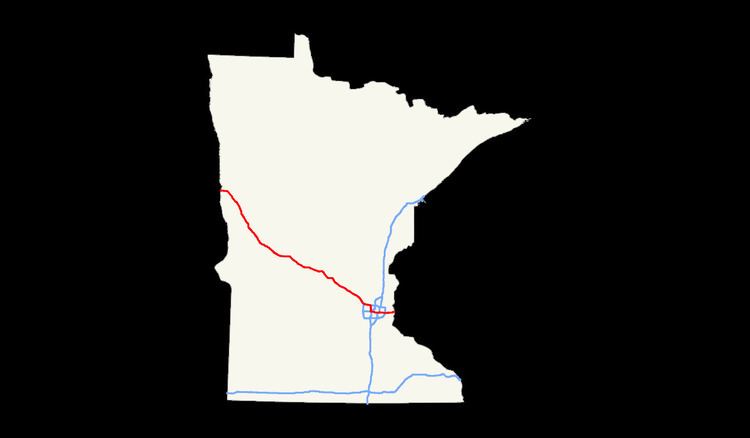 | ||
In the U.S. state of Minnesota, Interstate 94 runs 259 miles (417 km) east–west through the central portion of the state. The route connects the cities of Moorhead, Fergus Falls, Alexandria, St. Cloud, Minneapolis, and Saint Paul.
Contents
Route description
Interstate 94 enters the state from North Dakota at the city of Moorhead and heads southeast after serving Moorhead.
Traveling southeast from Moorhead, there are several places where the elevation of I-94 rises slightly; these are "beaches" that formed as the glacial lake rose or fell. Finally, at Rothsay, I-94 climbs the last beach line and enters terrain more typical for Minnesota. From Rothsay to the Twin Cities, the terrain of I-94 is rolling with frequent lakes visible from the highway.
I-94 traverses by Fergus Falls, Alexandria, and Sauk Centre on its way to St. Cloud. The "original main street" in Sauk Centre near I-94 commemorates the Sinclair Lewis novel that skewered this town.
Monticello is roughly the midpoint exurb for both St. Cloud and Minneapolis. Between exits 201 (Albertville) and 194 (Monticello) sits the Minnesota Road Research Facility.
Upon arrival to the Twin Cities, I-94 first approaches Minneapolis from the north, then the highway turns east after passing through the Lowry Hill Tunnel and heads to Saint Paul while traveling east.
The road crosses the Mississippi River in Minneapolis between the Prospect Park and Seward neighborhoods. The highway joins Minneapolis and St. Paul together where it meets MN Highway 280. In Saint Paul, the routing of I-94 is set through the historic Rondo neighborhood, which prior to the highway's construction was the largest African-American community in Saint Paul.
Upon leaving Saint Paul, the route travels through suburban Washington County and exits the state into Wisconsin between Lakeland, MN and Hudson, WI, while crossing the St. Croix River.
Legally, the Minnesota section of Interstate 94 is defined as unmarked Legislative Route 392 in the Minnesota Statutes § 161.12(4).[1] Interstate 94 is not marked with this legislative number along the actual highway.
Concurrencies and reroutes
History
Interstate 94 in Minnesota was authorized as part of the original interstate network in 1956. It was mostly constructed in the 1960s.
I-94 follows the original route of old U.S. Highway 52 from Moorhead to St. Cloud, then I-94 stays south of the Mississippi River along the former route of old State Highway 152 between St. Cloud and the Twin Cities. I-94 then passes through both downtowns and exits toward Wisconsin along the former route of old U.S. Highway 12.
The first section of I-94 in Minnesota constructed was between Moorhead and Albany in the early 1960s, as an extension of the existing highway in North Dakota.
The section of I-94 between Minneapolis and Saint Paul was completed in 1968. In the Twin Cities, the construction of the highway was politically charged. The highway was built primarily through many working-class and African-American neighborhoods. In Saint Paul, the routing of I-94 displaced the historic Rondo neighborhood, which prior to the highway construction was the largest African-American community in Saint Paul.
The section of I-94 between Maple Grove and Brooklyn Center was completed in 1969.
The section of I-94 between Saint Augusta and Maple Grove was completed in 1973.
The section of I-94 between Albany and Saint Augusta was completed in 1977.
The section of I-94 from Brooklyn Center through north Minneapolis was completed in 1984. Like Rondo in the 1960s, this segment was through a primarily African-American and working-class neighborhood.
The last section of I-94 in Minnesota constructed was the ten miles (16 km) between its junction with I-494 / I-694 at Woodbury and the Wisconsin state line at Lakeland. This was completed in 1985.
In 2004, a major traffic bottleneck was relieved when a third lane was constructed between Brooklyn Boulevard at Brooklyn Center and Hemlock Lane at Maple Grove. This is located immediately east of the I-494 / 694 / 94 interchange in Maple Grove, also known locally as the Fish Lake Interchange.
From September 2007 to October 2008, the Minnesota Department of Transportation (Mn/DOT) added a temporary extra lane to I-94 between northbound I-35W and MN-280 in the Twin Cities to help relieve traffic congestion caused by the collapse of the I-35W Mississippi River bridge. As a result, this portion of I-94 was not up to Interstate Highway standards during this time period.
On November 17, 2015, a group of Black Lives Matter protesters blocked westbound traffic on the highway in response to the officer-involved shooting of Jamar Clark.