
Existed: 1970 – present Constructed 1985 | Length 49.52 km | |
 | ||
Minnesota interstate 694 inner loop mile marker 40 to 50 5 22 16
Interstate 694 (I-694) is an east–west auxiliary Interstate Highway located in the Minneapolis – Saint Paul metropolitan area in the U.S. state of Minnesota. The western terminus of the route is at its junction with I-94 and I-494 in Maple Grove. The eastern terminus of I-694 is at its junction with I-94 and I-494 at the Woodbury–Oakdale city line. I-694 comprises the northern and northeastern portions of a beltway around the Twin Cities, with I-494 forming the remainder of the beltway. The speed limit is 60 miles per hour (95 km/h). Interstate Highways outside of the loop in Minnesota may be signed as high as 70 mph (115 km/h), but can only reach 60 mph (95 km/h) inside the loop.
Contents
- Minnesota interstate 694 inner loop mile marker 40 to 50 5 22 16
- Map of I 694 Minnesota USA
- Minnesota interstate 694 inner loop mile marker 50 to 58 5 22 16
- Route description
- History
- References
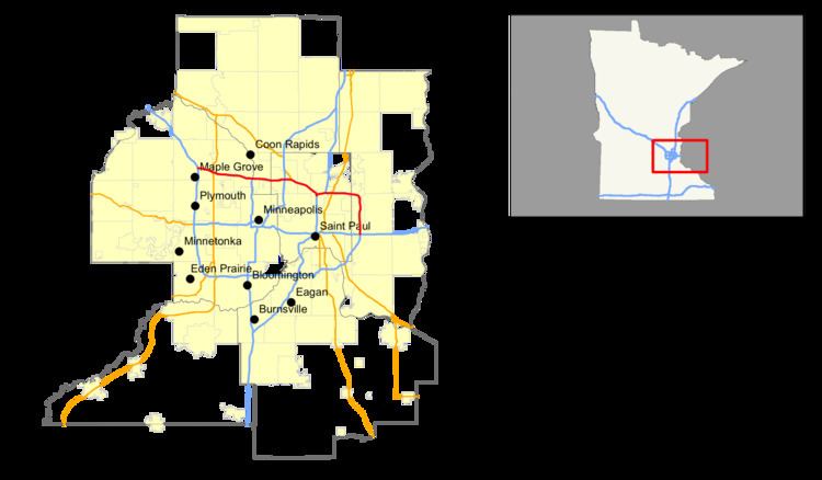
Map of I-694, Minnesota, USA
I-694 also interchanges with I-35W at New Brighton–Arden Hills and I-35E at Little Canada–Vadnais Heights. I-694 is also concurrent with I-94 for eight miles (13 km) from Maple Grove to Brooklyn Center. I-694 is 30.767 miles (49.515 km) in length.
Minnesota interstate 694 inner loop mile marker 50 to 58 5 22 16
Route description
I-694 begins on the counter-clockwise end at the junction of I-94, I-494, and I-694 in the city of Maple Grove, often referred to as the Fish Lake Interchange. From the Fish Lake Interchange, I-694 travels eastbound (clockwise) and concurrent with I-94 through the cities of Maple Grove, Brooklyn Park, and Brooklyn Center. In Brooklyn Center, I-94 splits from I-694 and then I-94 travels south toward downtown Minneapolis, while I-694 continues its beltway function, crossing the Mississippi River, and then passing through the communities of Fridley and New Brighton, where it has an interchange with I-35W. I-694 turns slightly to the southeast as it passes through the communities of Arden Hills, Shoreview, and Little Canada. I-694 turns back to near due east at its western junction with I-35E. It continues east through the communities of Vadnais Heights, White Bear Lake, and Maplewood. In Pine Springs, I-694 has a cloverleaf interchange with State Highway 36 (MN 36). The I-694–MN 36 interchange makes out a rough corner, in which I-694 switches direction from eastbound to southbound. I-694 continues south through the city of Oakdale, and finally terminates on the clockwise end at the interchange of I-94, I-494, and I-694 at the Oakdale–Woodbury city boundary line. I-694 becomes I-494 after this interchange.
Mileposts on Interstate 694 are numbered to increase while traveling eastbound (clockwise). They are in sequence with the numbering of adjoining I-494, where the numbering begins and ends at the Minnesota River. Between Maple Grove and Brooklyn Center, the mileposts correspond to the beltway numbering, not I-94 mileage.
I-694 has problems with "weave" interchanges. The Unweave the Weave construction project, completed between 2004 and 2008, disentangled I-694 and I-35E at Little Canada–Vadnais Heights. The project was designed to increase traffic flow, driver safety, and improve the condition of the roadway. Another construction project, the I-35W/US 10/I-694 North Central Corridor Reconstruction Project, also designed to unweave the highway, began in September, 2011. This project will eliminate the weaving movements of I-694 at its interchange with U.S. Highway 10 (US 10) and MN 51 in Arden Hills. This interchange often creates one of the worst bottlenecks in the Twin Cities because drivers need to change at least one lane to continue either direction on I-694 between MN 51 (Snelling Avenue) and US 10. When the construction project is completed, the roadway of I-694 will include three thru-lanes in each direction from I-35W at New Brighton to US 10 at Arden Hills; four thru-lanes in each direction from US 10 in Arden Hills to Rice Street at Shoreview–Little Canada; and five thru-lanes in each direction from Rice Street to the I-694–I-35E interchange, compared with the current two to three lanes throughout the I-694 corridor.
Legally, the route of I-694 is defined as part of unmarked Legislative Route 393 in the Minnesota Statutes §161.12(5). I-694 is not marked with this legislative number along the actual highway. The entire freeway, as part of the Interstate Highway System, has been included in the National Highway System, a system of roads important to the country's economy, defense, and mobility.
History
The construction of I-694 was authorized in 1956. The first section of I-694 completed was between US 10 at Arden Hills to I-35E at Little Canada in the early 1960s. The last section of I-694 completed was between I-35E at Little Canada to its junction with I-94 and I-494 at Oakdale–Woodbury, completed by the early 1970s.
I-694 was built as the main thoroughfare for the northern suburbs of Minneapolis–Saint Paul. These include the cities of Maple Grove, Brooklyn Park, Brooklyn Center, Fridley, New Brighton, Arden Hills, Shoreview, Little Canada, Vadnais Heights, White Bear Lake, Maplewood, Pine Springs, and Oakdale.