
Area 2,727 km² Population 60,661 (2013) | Website www.co.clay.mn.us Founded 8 March 1862 Unemployment rate 3.0% (Apr 2015) | |
 | ||
Points of interest Rourke Art Museum, St John the Divine Episcopal, Gooseberry Mound Park, Comstock House, Lamb Park | ||
Clay County is a county located in the U.S. state of Minnesota. As of the 2010 census, the population was 58,999. Its county seat is Moorhead. The county's name is in honor of American statesman Henry Clay, member of the United States Senate from Kentucky and United States Secretary of State in the 19th century. The county was formed in 1862 and organized in 1872. It was originally called Breckenridge County, but changed to its current name in 1862.
Contents
- Map of Clay County MN USA
- Geography
- Adjacent counties
- Climate and weather
- Law and government
- Demographics
- Census designated places
- References
Map of Clay County, MN, USA
Clay County is part of the Fargo, ND-MN Metropolitan Statistical Area.
Geography
According to the U.S. Census Bureau, the county has a total area of 1,053 square miles (2,730 km2), of which 1,045 square miles (2,710 km2) are land and 7.3 square miles (19 km2) (0.7%) are covered by water.
Adjacent counties
Climate and weather
In recent years, average temperatures in the county seat of Moorhead have ranged from a low of 0 °F (−18 °C) in January to a high of 82 °F (28 °C) in July, although a record low of −48 °F (−44 °C) was recorded in January 1887 and a record high of 114 °F (46 °C) was recorded in July 1936. Average monthly precipitation ranged from 0.64 inches (16 mm) in February to 3.90 inches (99 mm) in June.
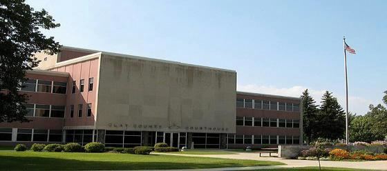
Law and government
Clay County is governed by a board of five commissioners.
Demographics
As of the census of 2000, there were 51,229 people, 18,670 households, and 12,340 families residing in the county. The population density was 49 people per square mile (19/km²). There were 19,746 housing units at an average density of 19 per square mile (7/km²). The racial makeup of the county was 93.99% White, 0.52% Black or African American, 1.44% Native American, 0.88% Asian, 0.03% Pacific Islander, 1.67% from other races, and 1.47% from two or more races. 3.65% of the population were Hispanic or Latino of any race. 40.4% were of Norwegian and 26.8% German ancestry.
There were 18,670 households out of which 33.80% had children under the age of 18 living with them, 53.90% were married couples living together, 8.80% had a female householder with no husband present, and 33.90% were non-families. 26.10% of all households were made up of individuals and 10.60% had someone living alone who was 65 years of age or older. The average household size was 2.53 and the average family size was 3.07.
In the county, the population was spread out with 25.00% under the age of 18, 17.10% from 18 to 24, 25.70% from 25 to 44, 19.30% from 45 to 64, and 12.90% who were 65 years of age or older. The median age was 32 years. For every 100 females there were 93.70 males. For every 100 females age 18 and over, there were 89.10 males.
The median income for a household in the county was $37,889, and the median income for a family was $49,192. Males had a median income of $34,176 versus $23,149 for females. The per capita income for the county was $17,557. About 7.40% of families and 13.20% of the population were below the poverty line, including 13.30% of those under age 18 and 7.50% of those age 65 or over.