
Existed: 1958 (1958) – present | Length 354.8 km | |
 | ||
History: Under construction: 1958–1992 Counties | ||
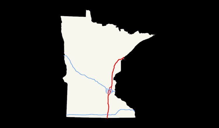
Interstate 35 (I-35) is a north–south Interstate Highway in the United States that stretches from Laredo, Texas, to Duluth, Minnesota. In Minnesota, the route travels from south to north and terminates after slightly deflecting to the east near the state line with Wisconsin. The highway enters the state near Albert Lea from Iowa and intersects I-90 shortly after. Passing through Owatonna, I-35 continues north nearing the twin cities of Minneapolis and Saint Paul. It enters them in the south, bridging across Lake Marion and passing by Crystal Lake, where it splits into Interstates 35E and 35W, going through Saint Paul and Minneapolis respectively. Northeastern of the twin cities, I-35E and I-35W join again, and I-35 continues to the north–east, where it crosses the St. Louis River south of Scanlon and terminates in Duluth at its junction with Minnesota Highway 61 (MN 61).
Contents
Route description
I-35 enters the state from Iowa near Albert Lea. It heads roughly due north towards the Twin Cities, where it splits into I-35E and I-35W. The two halves of I-35 rejoin north of the Twin Cities. From there, I-35 travels north-northeast; south of Duluth, it becomes more northeasterly. The route ends near the shore of Lake Superior in Duluth. The entire route is officially designated the Red Bull Highway, named after the 34th Infantry (Red Bull) Division. Legally, Interstate 35 is defined as Routes 390, 395, and 396 in the Minnesota Statutes § 161.12(2); however, the route is not marked with those numbers. The I-35 legislative route designation and mileposts follow I-35E in the Twin Cities area.
Southern segment
I-35 enters the state in Freeborn County south of Albert Lea. The first mile northbound contains a rest area and Minnesota welcome center. Shortly after the first exit, for Freeborn County Highway 5 (County 5), there is a sweeping S curve to the northwest and back to the north. The exit for County 13 marks the last exit before Albert Lea. Up to here, the interstate roughly marked the halfway point between U.S. Route 65 (US 65) and US 69. Both US Highways end in Albert Lea.
In Albert Lea, it curves to the northeast and meets US 65, which passes beneath the interstate. US 65 picks up Interstate 35 Business (I-35 Bus.), which follows the US Highway through the city. It then crosses Albert Lea Lake of a pair of one-quarter-mile-long (0.40 km) bridges. It straightens back to the north to meet County 46, which follows the former route of US 16. Shortly after that interchange, it intersects the national northern end of US 65; however, there access to US 65 is limited to the southbound lanes of I-35 and traffic from US 65 can only access the northbound lanes of I-35. At the northeastern edge of Albert Lea, there is an interchange with I-90, which directs traffic to La Crosse, Wisconsin, or Sioux Falls, South Dakota.
I-35 continues north through the rolling hills of southern Minnesota. At Clarks Grove, it intersects State Highway 251 (MN 251). Between there and the County 35 exit to Geneva, it passes to the west of Geneva Lake. Just east of Ellendale is an interchange with MN 30. Exit 32, County 4 to Hope, is the last interchange before Owatonna. On the southern edge of Owatonna is an interchange with US 14. As of June 2012, the interchange has been rebuilt as a full cloverleaf interchange; previously, it was a trumpet interchange. US 218 begins at the interchange along US 14. North of County 45, the County 34 exit serves northern Owatonna and provides access to the Owatonna Degner Regional Airport. The County 9 exit serves Clinton Falls and a Cabela's.
Further north, I-35 meets County 12 and County 23 in Medford. Along County 23, which serves as a western frontage road to I-35, lies an outlet mall. Now in Rice County, the interstate approaches Faribault. Exit 55 only serves exiting northbound traffic and entering southbound traffic. MN 60 is the main east–west street through Faribault, and MN 21 provides access to Fairbault from the north of town. MN 21 ends at MN 60; however the road continues south and reconnects to I-35 at exit 55.
North of Faribault, the interstate heads due north before the two directions are briefly separated when they enter a corridor of trees. The route straightens out again and intersects County 1 and MN 19 at diamond interchanges spaced three miles (4.8 km) apart. It briefly enters Scott County where it meets County 2 near Elko New Market. It then enters Dakota County and the Minneapolis-St. Paul metropolitan area.
In southwestern Lakeville, there is a folded diamond interchange with County 70. Right before a partial cloverleaf interchange with County 60, the interstate crosses Marion Lake. Shortly after an interchange with County 5 and County 50 there is a park and ride complex on the northbound side of the interstate. An entrance and exit ramp provide access to the interstate while two entrances from Kendrick Avenue, a frontage road, provide non-interstate access to the complex. After the County 46 interchange, the interstate enters Burnsville. A half diamond interchange, with only northbound exit and southbound entrance ramps, immediately precedes the split. I-35 splits into I-35W and I-35E (signed for Minneapolis and Saint Paul, respectively).
Northern segment
Interstates 35W and 35E join again at Columbus, near Forest Lake. The route then continues as Interstate 35. In contrast to the rolling terrain of I-35 south of the Twin Cities area, this region is quite flat. This is the Anoka Sand Plain, an area that was formed by outwash under the last glaciers that lay over this area as they melted. This is an extensive region that continues north for another twenty miles (32 km). The urban sprawl of the northern Twin Cities continues along I-35 to North Branch.
In Pine City and Hinckley, there are museums near I-35, the Pine City one at a refurbished fur trading post and interpretive center, and the Hinckley one commemorating the Great Hinckley Forest Fire that occurred in 1894. Motorists who take the I-35 Business Loop through Pine City can experience a quintessential All-American main street.
Between Sandstone and Moose Lake, the landscape around I-35 makes a dramatic change. Exposed granite can be seen at the surface, and the deciduous forest changes to evergreens.
I-35 climbs Thompson Hill as it approaches the city of Duluth. As the highway enters the city limits at Boundary Avenue, the Saint Louis Bay and Lake Superior are in view. I-35 then descends Thompson Hill into Duluth, with numerous exits. The freeway has an interchange with I-535 / U.S. 53, known locally as the "Can of Worms". The junction features a pair of left exits from I-35, a stoplight, and lane drops over the I-35 bridge. Map and aerial photo
I-35 then proceeds to downtown Duluth. After multiple exits, I-35 leaves the downtown area and follows the Lake Superior shoreline for two miles (3 km) to its national northern terminus at its junction with Highway 61 and 26th Avenue East. At this junction where Interstate 35 ends, Highway 61 begins its route northeast along the North Shore of Lake Superior.
History
Interstate 35 in Minnesota was authorized as part of the primary interstate network in 1956. It was mostly constructed in the 1960s. The route in Minnesota replaced portions of old U.S. Highway 61 and old U.S. Highway 65.
I-35 was generally constructed along former routes of U.S. 65 south of the Twin Cities and U.S. 61 north of the Twin Cities.
The first section to be constructed (the first Interstate Highway opened in Minnesota) was about 10 miles (16 km) north of Owatonna, immediately west of present day Steele County Road 45 and Rice County Road 45.
By 1961, the section of I-35 around Hinckley and Sandstone was under construction.
Three lanes each way have been constructed on I-35 between the I-35E / I-35W split at Columbus to U.S. Highway 8 at Forest Lake. Three lanes have also been constructed on I-35 northbound at Thompson Hill, right before entering the city of Duluth. Additionally, three lanes have been constructed on I-35 southbound in Duluth at Thompson Hill between Central Avenue and U.S. Highway 2-westbound. Three lanes in each direction have also been constructed on I-35 in Duluth between the Can of Worms interchange (I-535 / U.S. 53) and the Mesaba Avenue interchange.
From November 1971 to October 1987, the national northern terminus for Interstate 35 was its interchange with Mesaba Avenue in Duluth.
The last section of Interstate 35 in Minnesota to be constructed was around downtown Duluth. The I-35 extension to Lake Avenue in Duluth was open to traffic in October 1987. The temporary I-35 extension to 10th Avenue East in Duluth was open to traffic in November 1989. The I-35 extension to its present day junction with 26th Avenue East and Highway 61 in Duluth was open to traffic in October 1992.