
Website www.co.anoka.mn.us Founded 1857 | Area 1,155 km² Population 339,534 (2013) | |
 | ||
Points of interest Running Aces Casino & Racetrack Colleges and Universities Anoka‑Ramsey Community College, Anoka Technical College, Empire Beauty School‑S, Minnesota School of Business‑Blaine Destinations | ||
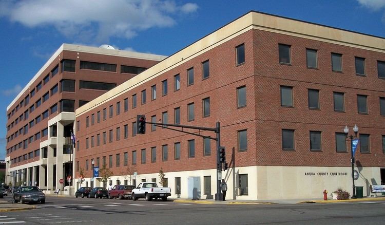
Anoka County (/əˈnoʊkə/ ə-NOH-kə) is the fourth-most-populous county in the U.S. state of Minnesota. As of the 2010 census, the population was 330,844. The county seat and namesake of the county is the City of Anoka, which is derived from the Dakota word anokatanhan meaning "on (or from) both sides," referring to its location on the banks of the Rum River. The largest city in the county is City of Coon Rapids, the twelfth-largest city in Minnesota and the seventh-largest Twin Cities suburb.
Contents
- Map of Anoka County MN USA
- History
- Geography
- Adjacent counties
- National protected area
- Climate and weather
- Demographics
- County Commissioners
- Township
- Census designated place
- Unincorporated community
- References
Map of Anoka County, MN, USA
Anoka County comprises the north portion of the Minneapolis-St. Paul-Bloomington, MN-WI Metropolitan Statistical Area, the largest metropolitan area in the state and the sixteenth-largest in the United States with about 3.3 million residents.
The county is bordered by the counties of Isanti on the north, Chisago and Washington on the east, Hennepin and Ramsey on the south, Sherburne on the west, and the Mississippi River on the southwest. The Rum River cuts through the county and was the site of many early European settlements. It was a common route to the Mille Lacs Lake, the spiritual homeland of the Mdewakanton Dakota (Sioux). The river was traveled under captivity by Father Louis Hennepin in his first exploration of the region. The area became a center of fur trade and logging as French and French Canadian communities grew in the cities of Anoka and Centerville. Organized in 1857, the county's southern border eventually met Minneapolis and has become a predominantly suburban area following the construction of Interstate 35W. The county is home to local Twin Cities destinations such as the Heights Theater in Columbia Heights and Northtown Mall and the National Sports Center in Blaine.
History
Anoka County was organized by an act of the territorial Legislature on May 23, 1857, the year prior to Minnesota's admission to the Union. It was formed from parts of Ramsey County and Benton County; the Rum River previously divided the line between the two counties. The boundaries were mainly the same as they are now, except for a small part of the southeastern tip along the Mississippi River and at the south, formerly known as Manomin County. It was a small portion that connected to Ramsey and occupied one-third of the congressional township. It was then attached to Anoka County by constitutional amendment November 2, 1869. It later became known as Fridley in 1879.
The first white men to explore what is now Anoka County were the Franciscan friar Louis Hennepin and two others in his party. Not soon after, fur traders began to settle in the area which is now Ramsey County. They settled on the Rum River and more people were attracted to the area. A community was created which is now called Anoka.
Geography
According to the U.S. Census Bureau, the county has a total area of 446 square miles (1,160 km2), of which 423 square miles (1,100 km2) is land and 23 square miles (60 km2) (5.2%) is water.
Adjacent counties
National protected area
Climate and weather
In recent years, average temperatures in the county seat of Anoka have ranged from a low of 5 °F (−15 °C) in January to a high of 81 °F (27 °C) in July, although a record low of −40 °F (−40 °C) was recorded in January 1977 and a record high of 103 °F (39 °C) was recorded in July 1988. Average monthly precipitation ranged from 0.87 inches (22 mm) in February to 4.45 inches (113 mm) in July.
Demographics
The 2000 United States Census found were 298,084 people, 106,428 households, and 79,395 families residing in the county. The population density was 704 people per square mile (272/km²). There were 108,091 housing units at an average density of 255 per square mile (99/km²). The 2010 United States Census found that 330,844 people are residing in the county.
At the time of the 2000 Census, the racial makeup of the county was 93.64 percent white, 1.60 percent black or African American, 0.70 percent Native American, 1.69 percent Asian, 0.02 percent Pacific Islander, 0.65 percent from other races, and 1.71 percent from two or more races, and 1.66 percent of the population were Hispanic or Latino of any race. The 2000 Census found 30.2 percent were of German, 14.3 percent Norwegian, 9.0 percent Swedish, 7.3 percent Irish and 5.9 percent Polish ancestry.
There were 106,428 households out of which 39.90% had children under the age of 18 living with them, 60.70% were married couples living together, 9.80% had a female householder with no husband present, and 25.40% were non-families. Of all households, 19.30% were made up of individuals and 5.30% had someone living alone who was 65 years of age or older. The average household size was 2.77 and the average family size was 3.19.
In the county, the population was spread out with 28.90% under the age of 18, 8.30% from 18 to 24, 34.10% from 25 to 44, 21.60% from 45 to 64, and 7.10% who were 65 years of age or older. The median age was 34 years. For every 100 females there were 101.10 males. For every 100 females age 18 and over, there were 99.30 males.
The median income for a household in the county was $57,754, and the median income for a family was $64,261. Males had a median income of $41,527 versus $30,534 for females. The per capita income for the county was $23,297. About 2.90% of families and 4.20% of the population were below the poverty line, including 4.90% of those under age 18 and 4.50% of those age 65 or over.
County Commissioners
As of January 2013