
Population 263,560 (2011 census) | ||
 | ||
LGA(s) BurwoodCanada BayInner West CouncilStrathfieldSydney | ||
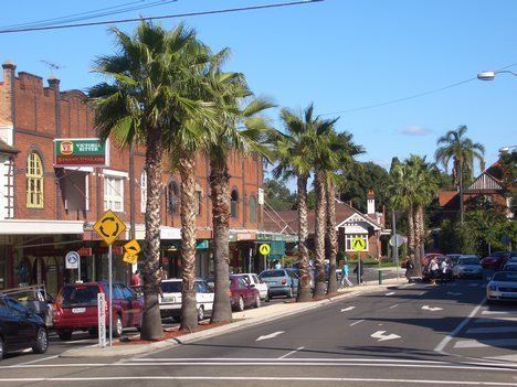
The Inner West is the metropolitan area directly to the west of the Sydney central business district, New South Wales, Australia. The suburbs of the Inner West are predominantly located along the southern shore of Port Jackson (Parramatta River), stretching south to the shores of the Cooks River.
Contents
- Streets of sydney episode 8 inner west
- Municipalities
- Suburbs
- Indigenous land
- Geography
- Housing
- Schools
- Transport
- Government
- Sport
- Social media
- References
Streets of sydney episode 8 inner west
Municipalities
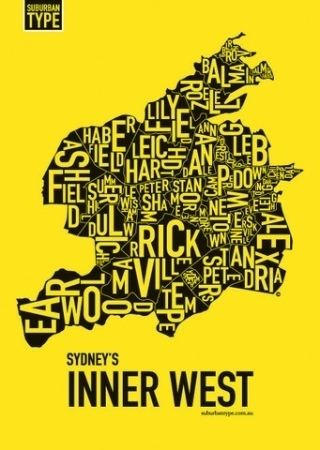
The Inner West is an imprecise geographical region. The Australian Government Bureau of Statistics, the New South Wales Government Department of Planning and Infrastructure, and local media variously describe the Inner West region to include the local government areas of:
Suburbs
Based on the distribution area of the Inner West Courier local newspaper and various Inner West Courier and media articles, the Inner West generally includes the suburbs:
Indigenous land
Prior to the arrival of the First Fleet, the Sydney region was home to the Darug people. This nation was broken up into a number of Aboriginal clans who tended to live in a certain geographic area. Each clan contained about 50 to 100 people and, to avoid genetic problems, the men would marry women from other clans. So the clans were interrelated and members from one clan would frequently travel in the territory of others, including to hunt, trade and perform ceremonies. They didn't consider themselves owners of the land, rather custodians.
What is now the Inner West was formerly home to two clans, the Cadigal, whose land stretched along Port Jackson from South Head to Lewisham, and the Wangal, whose land was immediately to the west of the Cadigals and stretched to about Homebush Bay. Other clans that would have been regular visitors to the area would have included the Birrabirragal and Muru-ora-dial in what is now the Eastern Suburbs, the Bediagal and Kameygal from the Cooks River area to the south, the Burramattagal from the Parramatta area to the west, and the Wallumattagal, Cammeraigal and Gorualgal from the northern shores of the Parramatta River.
Geography
The topography of the Inner West reflects rolling hills intersected by shallow valleys through which waterways including Iron Cove Creek, Hawthorne Canal (formerly Long Cove Creek), Whites Creek and Johnstons Creek flow. These waterways have been drastically altered since the late 19th century by the means of concrete lining. For example, in the 1860s Iron Cove Creek was a freely flowing waterway which in places broadened into ponds that made excellent and picturesque swimming holes. It is now barely a trickle lined by residential areas, parkland and fast-food restaurants.
Housing
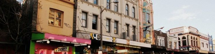
The suburbs within the region are characterised by medium to high-density housing and include some of the older constructions in Sydney such as the terraced houses of Glebe, Newtown and Annandale. Parts of the inner west have been subject to gentrification, particularly in Marrickville, Newtown and its surrounding areas.
Schools
It is also the location of several tertiary institutions such as Australian Catholic University, Catholic Institute of Sydney, the University of Sydney and the University of Technology, Sydney, which is reflected in the high student populations amongst the more downtown areas.
The Inner West also features schools such as Sydney Secondary College, Fort Street High School, Burwood Girls High School, Homebush Boys High School, Strathfield Girls High School, Ashfield Boys High School, Presbyterian Ladies' College, Sydney, MLC School, St. Patrick's College, Strathfield, Trinity Grammar School, Newington College and its preparatory school Wyvern House, Meriden School, Santa Sabina College and Rosebank College. The Inner West's two oldest schools are Newington College (established in 1863) and Rosebank College (established in 1867).
Transport
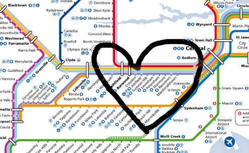
Public transport in the region includes trains, buses, ferries and light rail. Sydney Trains Airport, Inner West & South Line runs from Central station, largely running south of Parramatta Road to Strathfield and then to Macarthur via Granville. The North Shore, Northern & Western Line follows the same route to Strathfield and then branches off to the north to Epping, with stops at North Strathfield, Concord West and Rhodes. The Bankstown Line provides train services to suburbs such as Erskineville, St Peters, Sydenham, Marrickville and Dulwich Hill. There are various bus routes provided largely by Sydney Buses. Sydney Ferries operates services in the inner harbour and Parramatta river. The Dulwich Hill Line of Sydney's light rail network connects Pyrmont, Glebe, Lilyfield, Leichhardt and Lewisham to Central railway station.
Parramatta Road runs through the middle of this area. Although still playing only a small part in the overall transport task, use of bicycles for transport has increased significantly in the Inner West since the 1990s. Denser populations and shorter distances mean cycling is often quicker and more convenient than driving or taking public transport. A network of bicycle paths, signed bicycle routes on local streets and other aids to safe and convenient cycling is developing. Main bicycle routes include an East-West route from Five Dock to the Anzac Bridge cycleway, a Northwest route from Gladesville Bridge to Anzac Bridge, a Southwest Route from Marrickville to the City via Newtown. Groups of local bicycle user groups (BUGs) provide help for new cyclists, under the parent banner of Bicycle New South Wales.
Government
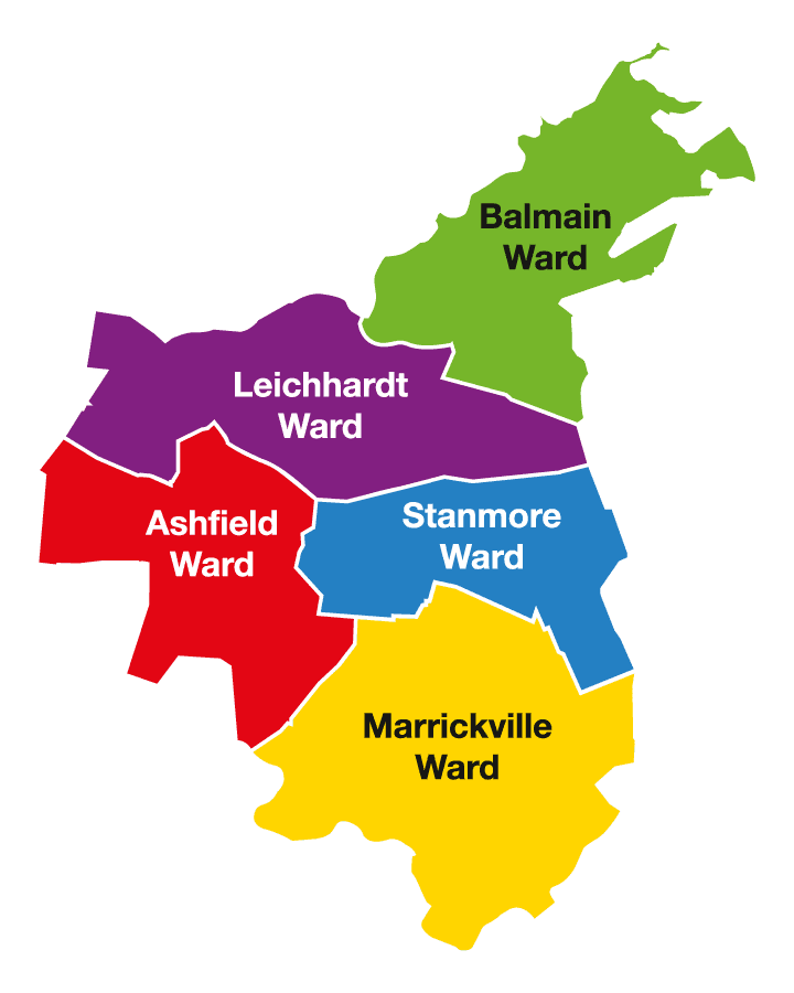
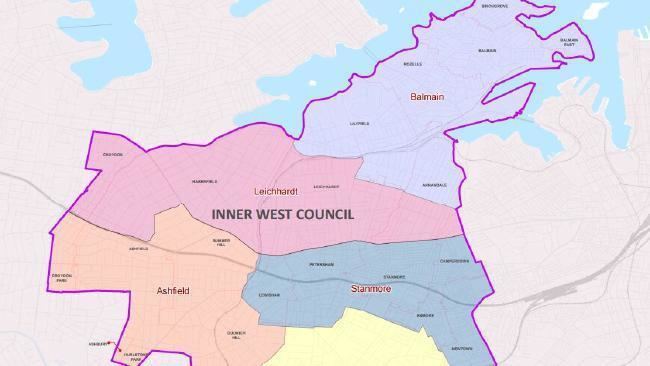
The local government areas with responsibility for the Inner West are Burwood, Inner West Council, and Strathfield. Parts of Canterbury-Bankstown and the City of Sydney are sometimes considered to be part of the Inner West region.
In the state parliament, the region is represented by the electoral districts of Balmain, Canterbury, Drummoyne, Newtown, Strathfield and Summer Hill. Following the 2015 state election, these seats were divided amongst the three main parties with Drummoyne represented by the Liberal Party, Canterbury, Strathfield and Summer Hill represented by the Australian Labor Party, and Balmain and Newtown represented by The Greens.
In the federal parliament, the area is represented by the electorate of Grayndler and part of the electorates of Reid, Sydney and Watson (which also encompases a substantial section of the Canterbury-Bankstown area). Three of these four seats are currently held by the Labor Party, with the seat of Reid represented by the Liberal Party at the 2013 federal election, which won the seat for the first time in 91 years.
Sport
The Inner West is represented in the National Rugby League by the Wests Tigers, a merger of the Balmain and Western Suburbs clubs. In rugby union the area is represented by Sydney Uni (the University of Sydney) and West Harbour in the Sydney grade competition. Non-competitive activities like walking, cycling and swimming are well catered for. The Inner West also has many semi-professional soccer teams playing in the various divisions of the NSW State Leagues. The most high profile club is NSW Premier League side APIA Leichhardt Tigers.
Commonly played organised sports include netball, soccer, little athletics, rugby league, rugby union, softball, baseball, sailing, rowing, tennis and lawn bowl. There are also ten pin bowling, table tennis, ice skating, gymnastics and rock climbing facilities in the region.
Soccer, swimming, and netball are the children's sports with the highest participation rates in NSW.
Social media
The uptake of social media in the young and technically minded demographic has been high. 2010 saw the start of the Inner West Live social media site. With a high follower base on Twitter, the group runs several Tweetups during the year and was quoted as affecting the outcome for Inner West seats of the recent NSW Election.