
Population 6,159 (2011 census) Postal code 2193 | Postcode(s) 2193 Canterbury Hurlstone Park | |
 | ||
Federal divisions | ||
Canterbury is a suburb in south-western Sydney, in the state of New South Wales, Australia. Canterbury is located 10.5 kilometres south-west of the Sydney central business district in the Canterbury-Bankstown Council.
Contents
- Map of Canterbury NSW 2193 Australia
- History
- Trams
- Demographics
- Climate
- Commercial area
- Transport
- Parks and gardens
- Schools
- Politics
- Notable residents
- References
Map of Canterbury NSW 2193, Australia
The former City of Canterbury takes its name from the suburb but its administrative centre is located in the adjacent suburb of Campsie, which is also a large commercial centre.
History
The original inhabitants of the area were the Bediagal clan of the Eora nation. In 1770, the land along the Cooks River was explored by British officers from the HMS Bark Endeavour.
In 1793, the area's first land grant was made to the Chaplain of the First Fleet, the Rev. Richard Johnson. He gave the 100 acre (40 hectare) grant, located one mile (1.6 km) north of the river, the name Canterbury Vale. The grant was passed onto William Cox, who sold the land for 525 pounds to Robert Campbell in May 1803, after going bankrupt. By 1834 the Campbell Estate grew to 1,242 acres (5 km²). In 1865, daughter Sarah Jeffrey subdivided the land into allotments, each containing several acres. The first major industry was established in 1841 with the building of the Australian Sugar Company's sugar mill by the Cooks River to produce molasses and spirits. Other industries and trades such as boiling down works and tanneries later developed along the river. The Methodists built the first church in the suburb, with services beginning in 1841. The railway line was completed in 1895, encouraging suburban development and leading to the area becoming heavily populated. This was too late for the Sugar Mill, which ceased production in September 1854, but was favourable for horse racing, which informally began in 1871.
After much petitioning of the State Government by local residents, the Municipality of Canterbury was proclaimed on 17 March 1879. A Town Hall was opened in 1889, but eventually Campsie became a more important centre and the city administration was moved from Canterbury in 1962.
Trams
In 1921, a tram line was extended from Hurlstone Park to Canterbury Station, in 1927, a through service from Canterbury to the city commenced. The Canterbury line commenced at the Canterbury terminus in Broughton Street where a tram turning loop was provided. Trams travelling towards the City or Balmain headed north-east along Canterbury Road. A service that was provided for by the Darling Street Wharf trams branched off from the main line at New Canterbury Road and connected with lines running along Parramatta Road for Balmain. Services heading towards Marrickville, Newtown, Sydenham and Tempe turned right into Marrickville Road.
The line from Dulwich Hill to Canterbury branched off from the Tempe line at Newtown, travelled along Enmore Road, then Victoria Road, before tuning right onto Marrickville Road and all the way through to Canterbury Road to the Canterbury terminus.
Another line also branched off from the route to Dulwich Hill at Addison Road on Enmore Road, then travelled along Addison Road to New Canterbury Road in Petersham. The line then travelled down New Canterbury Road through Dulwich Hill and Hurlstone Park to Canterbury railway station.
A short lived single track line operated from the Canterbury Line at Hurlstone Park along Old Canterbury Road and Prospect Road to Summer Hill railway station. Services operated between Canterbury and Summer Hill from 1915, however low patronage and competition from motor buses saw the line close in 1933. The disused track and overhead remained in place until the 1950s. Buses replaced the trams in 1954. The Canterbury terminus is currently used as a layover area for buses.
Demographics
According to the 2011 census of Population, there were 6,159 residents in Canterbury. Australian born residents are a minority with 45.6% of people being born in Australia. The most common countries of foreign birth were China 7.1%, Greece 4.4%, Vietnam 3.2%, Lebanon 2.8% and Portugal 2.6%. In Canterbury 35.0% of people only spoke English at home. Other languages spoken at home included Greek 10.8%, Arabic 6.3%, Mandarin 5.8%, Cantonese 4.9% and Portuguese 3.9%. The most common responses for religion in Canterbury were Catholic 29.0%, No Religion 16.2%, Eastern Orthodox 14.6%, Buddhism 7.1% and Anglican 5.9%.
13.3 percent of the population of Canterbury is of Chinese ancestry, 10.9 percent is of Lebanese ancestry and 10.8 is of Greek ancestry.
Climate
Canterbury has a humid subtropical climate (Cfa).
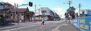
Commercial area
High density mixed use buildings are located along Charles Street, Broughton Street, Canterbury Road and Close Street. Commercial developments are mostly situated on Canterbury Road and surrounding streets. Commercial offices will be built along Canterbury Street, Broughton Street, Charles Street and Close Street as part of the Canterbury Centre Masterplan. The current shopping precinct, close to Canterbury railway station, includes an Aldi supermarket and the landmark Hotel Canterbury. A recently opened shopping plaza along Canterbury Road and Cooks Avenue includes dining shops, a supermarket and a fitness centre. On 16 November 2016 a Woolworths shopping centre opened on the corner of Canterbury Road and Charles Street.
Transport
Canterbury Road is a major arterial route, 11 kilometres long and the only vehicular crossing of the Cooks River within the suburb. The road connects the inner suburbs of Sydney with Bankstown and suburbs further to the south-west. Secondary routes, King and Holden Streets, connect the suburb to Ashfield in the north.
Canterbury railway station is located on the Bankstown line of the Sydney Trains network. The line, which crosses the Cooks River, was opened in 1895 and electrified in 1926. Two additional tracks were laid for goods traffic through to Port Botany. The station is the terminus for several Sydney bus routes.
Pedestrians and cyclists can cross the Cooks River at one of two dedicated footbridges making the riverside pleasant and accessible for recreational users. The popular Cooks River bicycle track follows the river along its northern bank connecting the suburb with Homebush to the north-west and Botany Bay to the east. The river itself is navigable only during high tide and used occasionally by canoeists.
Parks and gardens
Extensive parkland may be found on the banks of the Cooks River. Canterbury Park Racecourse, a 33 ha. racecourse on the northern bank, features a 1,578-metre track (racecourse) and attracts thousands to its horse racing carnivals.
Schools
Politics
Canterbury is part of Canterbury-Bankstown Council.
For New South Wales state elections, the suburb is in the Electoral district of Canterbury.
For federal elections, Canterbury is in the electoral division of Division of Watson . In state and federal elections, Canterbury residents predominantly vote for the Australian Labor Party.