
West end: IL 41 in Bardolph Length 27.55 km | Constructed 5 November 1918 | |
 | ||
Existed: November 5, 1918 – present | ||
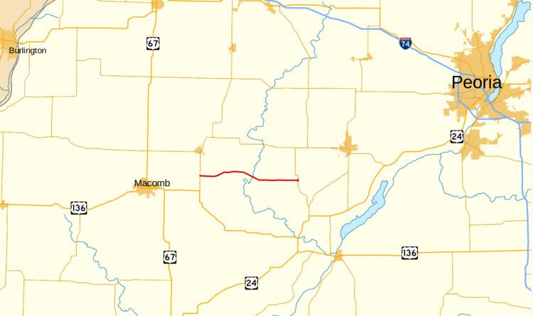
Illinois Route 95 is a minor east–west state road in west central Illinois. It runs from Illinois Route 41 just west of New Philadelphia east to Illinois Route 97 just south of Cuba. This is a distance of 17.12 miles (27.55 km).
Contents
Map of IL-95, Illinois, USA
Route description
Illinois 95 makes up part of direct highway between Macomb and Canton without touching either. It is an undivided, two-lane surface road for its entire length. At its eastern terminus, Illinois 95 and Illinois 97 form a unique Y-intersection.
History
SBI Route 95 ran from Niota (at the Mississippi River by Fort Madison, Iowa) to U.S. Route 24 at Illinois Route 78 via Illinois Route 9, Illinois 41, Illinois 95, Illinois 97, and U.S. 24. In 1937 this was changed to its modern alignment.
The future route for Illinois Route 336 between Macomb and Peoria will likely parallel or replace IL Route 95.