
Founded 1823 Area 2,287 km² | Website www.fultonco.org Population 36,346 (2013) Unemployment rate 6.3% (Apr 2015) | |
 | ||
Colleges and Universities Spoon River College, Graham Hospital School of Nursing Destinations | ||
Fulton County is a county in the U.S. state of Illinois. According to the 2010 census, it had a population of 37,069. Its county seat is Lewistown, and the largest city is Canton.
Contents
- Map of Fulton County IL USA
- History
- Geography
- Climate and weather
- Adjacent counties
- National protected area
- Airport
- Demographics
- Cities
- Townships
- References
Map of Fulton County, IL, USA
Fulton County comprises the Canton, IL Micropolitan Statistical Area, which is part of the Peoria-Canton, IL Combined Statistical Area. Fulton County is part of Forgottonia.
Bob Bucher is the Chairman of the Fulton County Board. Mike Hays was the County Administrator until the position was eliminated.
History
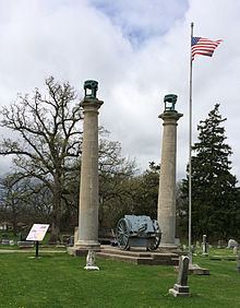
Fulton County was organized in 1823 from Pike County. It is named for Robert Fulton, inventor of the steamboat. It was the home of famous poet/writer Edgar Lee Masters in his early days; he wrote the famous Spoon River Anthology (1915). Fulton County was home to Camp Ellis during World War II.
The county is known for the annual Spoon River Scenic Drive which occurs the first 2 weekends in October. This has been a tradition since 1968 and attracts thousands of participants from all over the country.
Geography
According to the U.S. Census Bureau, the county has a total area of 883 square miles (2,290 km2), of which 866 square miles (2,240 km2) is land and 17 square miles (44 km2) (1.9%) is water.
Fulton County is the site of Dickson Mounds Museum, a state museum of Native American daily life in the Illinois River valley.
Climate and weather
In recent years, average temperatures in the county seat of Lewistown have ranged from a low of 14 °F (−10 °C) in January to a high of 88 °F (31 °C) in July, although a record low of −30 °F (−34 °C) was recorded in January 1999 and a record high of 106 °F (41 °C) was recorded in July 1983. Average monthly precipitation ranged from 1.85 inches (47 mm) in January to 4.43 inches (113 mm) in May.
Adjacent counties
National protected area
Airport
The county contains one public-use airport: Ingersoll Airport (CTK), located in Canton.
Demographics
As of the 2010 United States Census, there were 37,069 people, 14,536 households, and 9,744 families residing in the county. The population density was 42.8 inhabitants per square mile (16.5/km2). There were 16,195 housing units at an average density of 18.7 per square mile (7.2/km2). The racial makeup of the county was 93.4% white, 3.4% black or African American, 0.4% American Indian, 0.3% Asian, 1.6% from other races, and 0.9% from two or more races. Those of Hispanic or Latino origin made up 2.4% of the population. In terms of ancestry, 23.7% were German, 19.1% were American, 14.0% were English, and 13.2% were Irish.
Of the 14,536 households, 29.3% had children under the age of 18 living with them, 52.0% were married couples living together, 10.2% had a female householder with no husband present, 33.0% were non-families, and 28.1% of all households were made up of individuals. The average household size was 2.37 and the average family size was 2.86. The median age was 41.9 years.
The median income for a household in the county was $41,268 and the median income for a family was $50,596. Males had a median income of $41,376 versus $28,596 for females. The per capita income for the county was $20,309. About 9.9% of families and 13.8% of the population were below the poverty line, including 22.2% of those under age 18 and 8.0% of those age 65 or over.
Cities
Townships
Fulton County is divided into twenty-six townships: