
Population 8,300 (2015 est) Area 3,843 km² Mayor Cr Ray Robinson Gazetted 17 October 2002 | Established 2002 Founded 2002 | |
 | ||
Points of interest Alpine National Park, Mount Stirling, Mount Buller, Mount Terrible, Mount Samaria State Park Destinations Mansfield, Mount Buller, Eildon Dam, Alpine National Park, Eildon | ||
The Shire of Mansfield is a local government area in the Hume region of Victoria, Australia, located in the north-east part of the state. It covers an area of 3,843 square kilometres (1,484 sq mi) and, at the 2011 Census, had a population of 7,893. It includes the towns of Mansfield, Mount Buller, Bonnie Doon, Jamieson, Kevington, Merrijig, Tolmie and Woods Point. It was formed in 2002 from the de-amalgamation of the Shire of Delatite into the current shire and the Rural City of Benalla.
Contents
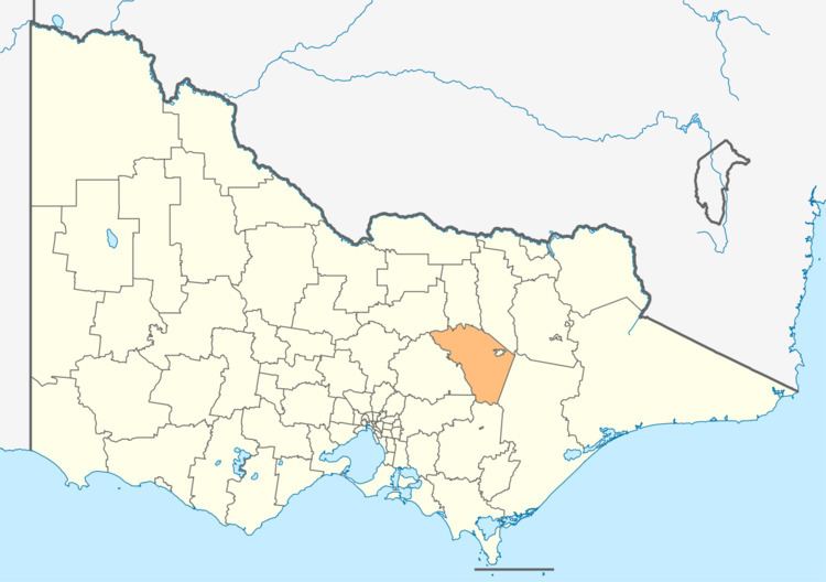
Map of Mansfield, VIC, Australia
The Shire is governed and administered by the Mansfield Shire Council; its seat of local government and administrative centre is located at the council headquarters in Mansfield. The Shire is named after the main urban settlement located in the north of the LGA, that is Mansfield, which is also the LGA's most populous urban centre with a population of 4,360.
The Shire is bordered by the Rural City of Benalla, the Shire of Baw Baw, the Shire of Murrindindi, the Shire of Yarra Ranges, the Shire of Strathbogie and the Shire of Wellington. There are two unincorporated areas within the shire; the areas around Mount Buller and Mount Stirling.
Current composition
The council is composed of four wards and five councillors, with two councillors elected to represent the Mansfield Ward and one councillor per remaining ward elected to represent each of the other wards.
Administration and governance
The council meets in the council chambers at the council headquarters in the Mansfield Municipal Offices, which is also the location of the council's administrative activities. It also provides customer services at its administrative centre in Mansfield.