
Type Highway | Length 212 km | |
 | ||
Route number(s) A39 (2014 to present) NSW/Vic Border - Arcadia M39 (2014-present) Arcadia–Seymour B340 (1998-present)Seymour - Yea B300/B340 (duplex) (1998-present)Yea - Cathkin B340 (1998-present)Cathkin- Eildon Formerroute number National Highway A39 (1998-2014) National Highway M39 (part, 2001-2014) National Highway 39 (?-1998)NSW/Vic Border - Seymour State Route 168 (1986-1998)Seymour - Yea State Route 153 & 168 (1986-1998) (duplex)Yea - Cathkin State Route 168 (1986-1998)Cathkin- Eildon SE end Eildon RoadEildon, Victoria Major settlements Strathmerton, Shepparton, Nagambie, Seymour, Yea, Alexandra | ||
The Goulburn Valley Highway is a highway located in Victoria, Australia. The section north of the Hume Freeway is part of the Melbourne to Brisbane National Highway (together with Hume Freeway) and is the main link between these two cities as well as a major link between Victoria and inland New South Wales. It is also the most direct route between Melbourne and the major regional centre of Shepparton in Victoria (via the Hume Freeway).
Contents
- Map of Goulburn Valley Hwy Victoria Australia
- Route description
- Freeway upgrade
- Timeline of upgrade
- Arcadia duplication
- Nagambie bypass
- Shepparton bypass
- Strathmerton deviation
- References
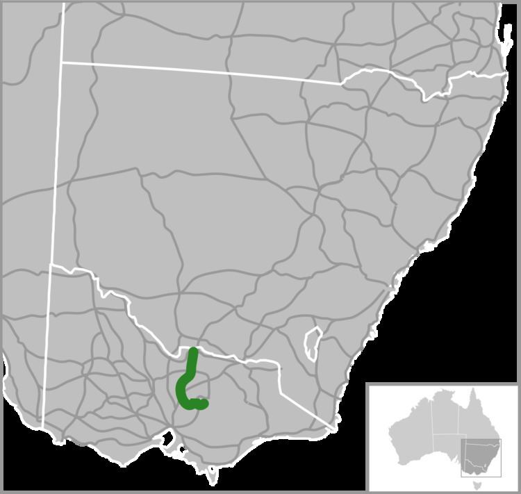
Map of Goulburn Valley Hwy, Victoria, Australia
Route description
The highway roughly follows the course of the Goulburn River, a tributary of the Murray River. The Highway serves the fruit and vegetable growing areas of the Goulburn Valley in Victoria, one of Australia's most productive agricultural regions.
The highway runs from Eildon to Seymour as a two lane single carriageway sealed road with shoulders. The section from the Hume Freeway to Arcadia via Nagambie has been fully converted into a dual carriageway and has been renamed as the Goulburn Valley Freeway. The freeway upgrade has made sections of the original Goulburn Valley Highway redundant, either incorporated into the new freeway or acting as local access roads. The freeway section is covered with a speed limit of 110 km/h, the standard speed limit for rural freeways in Australia. Between Arcadia and Tocumwal the highway is a two lane single carriageway but with tactile road lines, wide shoulders and small sections of 3 or 4 lane single carriageway road for overtaking. The Goulburn Valley Highway crosses the Murray River at Tocumwal to join the Newell Highway in New South Wales.
Freeway upgrade
The Goulburn Valley Highway is defined as a National Highway which means the Australian Government fully funds improvements to it. It is progressively being upgraded to freeway standard with the goal to ultimately bypass all towns between the Hume Freeway and the Murray River at the New South Wales border.
Timeline of upgrade
Arcadia duplication
The duplication was a $40.55 million project funded by the Australian Government as part of its Auslink Program. The works involved duplication of 10 km of the existing Goulburn Valley Highway between the Murchison East deviation and the proposed Shepparton Bypass, just north of Ross Road. It incorporates four at-grade intersections, frontage access roads, a rest area with full facilities, and wire rope safety barriers.
The Arcadia section runs adjacent to the Calder Woodburn Memorial Avenue of Honour. A Conservation Management Plan was developed in consultation with Heritage Victoria to ensure that impact on the Avenue of Honour was minimised. The plans included measures to enhance and highlight the avenue of trees. The project was started in June 2006, open to traffic in February 2008, with final completion of all works in April 2008.
The highway carries an estimated 6,500 vehicles per day, including more than 2,000 commercial vehicles.
Nagambie bypass
The Nagambie Bypass, funded as part of the Auslink 2 (2009–2014) Federal Government infrastructure program, bypasses the town of Nagambie to the east. Funding was announced in May 2009, and construction commenced in December 2009. The bypass opened to traffic in April 2013.
Costed at $222 million, $177.6 million was contributed by the Australian Government, with the remaining $44.4 million from the State Government. The project was made up of two sections: duplicating the existing highway north of Nagambie for 3.5 km between Kirwans Bridge-Longwood Road and Moss Road (completed in November 2011), and the 13.5 km bypass road from Mitchellstown Road to Kirwans Bridge-Longwood Road.
Shepparton bypass
An alignment for the Shepparton bypass has been decided. The bypass will cross the Goulburn River at Toolamba and travel west of Mooroopna rejoining the existing highway north of Congupna.
It was proposed that the Shepparton Bypass would be funded by Auslink 2 (2009–2014) however as of the beginning of 2017 it had not been built yet.
Strathmerton deviation
A realignment will bypass the small townships of Strathmerton and Yarroweyah and avoid dangerous bends south of the Murray River crossing at Tocumwal. The proposed new route will cross the Murray Valley Highway instead of follow it through those towns, and rejoin the current route just south of the Murray River.
The proposed Strathmerton Deviation was also to be funded by Auslink 2 (2009–2014) but had also not been constructed by the beginning of 2017.