
- left North Branch Length 63 km Basin area 1,637 km² | - right South Branch - elevation 260 ft (79 m) - elevation 0 ft (0 m) Area 17,602 km² Cities Balti | |
 | ||
Bridges Francis Scott Key Bridge, Thomas Viaduct, Patterson Viaduct, Hanover Street Bridge, Elysville Lower Bridge | ||
The Patapsco River is a 39-mile-long (63 km) river in central Maryland which flows into the Chesapeake Bay. The river's tidal portion forms the harbor for the city of Baltimore. With its South Branch, the Patapsco forms the northern border of Howard County, Maryland. The name "Patapsco" is derived from the Algonquian pota-psk-ut, which translates to "backwater" or "tide covered with froth."
Contents
- Map of Patapsco River Maryland USA
- Her first trout ever trout fishing the patapsco river
- Geography
- History
- Tributaries
- Water quality
- Recreation
- References
Map of Patapsco River, Maryland, USA
Her first trout ever trout fishing the patapsco river
Geography
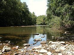
The Patapsco proper begins at the confluence of the North and South Branches, near Marriottsville, approximately 15 miles (24 km) west of downtown Baltimore. The 19.4-mile-long (31.2 km) South Branch rises further west at Parrs Spring, where Howard County, Carroll, Frederick, and Montgomery counties meet. The North Branch flows 20.9 miles (33.6 km) southward from its origins in Carroll County. Through most of its length, the Patapsco is a minor river, flowing for the most part through a narrow valley. The last 10 miles (16 km), however, form a large tidal estuary inlet of Chesapeake Bay. The inner part of this estuary provides the harbor of Baltimore, composed of the Northwest Harbor and the Middle Branch including Thoms Cove. (See Baltimore Inner Harbor.) The Patapsco estuary is south of the Back River and north of the Magothy River.
The Patapsco has a watershed area (including the water surface) of 680 square miles (1,760 km2), or 632 square miles (1,637 km2) of land. Thus, its total watershed area is 7% water.
Patapsco Valley State Park is adjacent to 32 miles (51 km) of the Patapsco and its branches, encompassing a total of 14,000 acres (5,700 ha) in five different areas. The river cuts a gorge 100–200 feet (35–70 m) deep within the park, which features rocky cliffs and tributary waterfalls.
Liberty Dam and its reservoir, located on the North Branch, is a major component of the Baltimore city water system. Besides Baltimore, the river also flows through Ellicott City (the county seat of Howard County) and Elkridge.
History
John Smith was the first European to explore the river noting it on his 1612 map as the Bolus River. The "Red river", was named after the clay color, and is considered the "old Bolus", as other branches were also labelled Bolus on maps. As the river was not navigable beyond Elkridge, it was not a major path of commerce with only one ship listed as serving the northern branch, and four others operating around the mouth in 1723. The Patapsco valley was used as the route of the Baltimore and Ohio Railroad's original main line west constructed from 1829 onwards, and this route remains, though much altered. Many old railroad bridges were constructed in the valley, most notably the Thomas Viaduct and the Patterson Viaduct, of which ruins remain. Flour mills and a hydropower dam were formerly powered by the river.
The valley is prone to flooding, though at long intervals. Modern floods include the 1868 a flood washed away 14 houses killing 39 around Ellicott City, A 1923 flood topped bridges, in 1952 an eight-foot wall of water swept the shops of Ellicott City and a 1956 flood inflicted heavy damage at the Bartigis Brothers plant. In 1972 as a result of rainfall from the remnants of Hurricane Agnes, in which Ellicott City and the Old Main Line sustained serious damage. In July 2016 a historic flood ravaged Main Street - leaving two dead.
The mouth of the Patapsco River forms Baltimore harbor, the site of the Battle of Baltimore during the War of 1812. This is where Francis Scott Key, while aboard a British ship, wrote "The Star-Spangled Banner," a poem later set to music as the national anthem of the United States. Today, a red, white, and blue buoy marks the spot where the HMS Tonnant was anchored.
Tributaries
Water quality
The eastern portion of the Patapsco River is in a highly urbanized area and is subject to extensive stormwater runoff and other forms of water pollution. The Maryland Department of the Environment has identified the Lower North Branch as containing high levels of heavy metals (chromium, arsenic, cadmium, copper, mercury, nickel, lead, selenium, and zinc), as well as phosphorus, fecal coliform bacteria, and PCBs.
Clean-up efforts by the residents of surrounding communities have been led by environmental nonprofit organizations, such as The Friends of Patapsco Valley & Heritage Greenway, Inc. (PHG). From 2006 to 2012, PHG volunteers participated in 183 stream clean ups, removing 264 tons of trash from the streams of the Patapsco Valley watershed.
Recreation
Teenagers enjoy swimming in areas of the Patapsco River, typically including rope swings, inner tubing, and wading. The river also serves as a venue for rafting.