
Founded July 4, 1851 Time zone Eastern (EST) (UTC-5) Founder William Clark | Founded by William Clark Local time Monday 11:13 AM Number of airports 1 | |
 | ||
Weather 7°C, Wind S at 10 km/h, 45% Humidity Area code Area codes 410, 443, and 667 | ||
Clarksville is an unincorporated community in Howard County; the second wealthiest county in the United States according to the U.S. Census Bureau. The community is named for William Clark, a farmer who owned much of the land on which the community now lies and served as a postal stop that opened on the 4th of July 1851.
Contents
Map of Clarksville, MD 21029, USA
Some of the most expensive homes on the East Coast are located in or around the town, whose property values are among the highest in the country. According to the U.S. Census Bureau, Clarksville District 5 has a population of 56,239, with an estimated average income of $195,124, with median income of $160,606.
The village of River Hill (which include Pheasant Ridge and Pointers Run), the newest addition to the Rouse Company development of Columbia, is adjacent to Clarksville.
Clarksville's public schools, part of the Howard County public school system, are among the highest-ranked in the nation and often have significantly higher funding than competing private and charter schools.
The area is located southwest of Baltimore and north of Washington, D.C., and many residents of Clarksville commute to work in one of these two cities or their close-in suburbs.
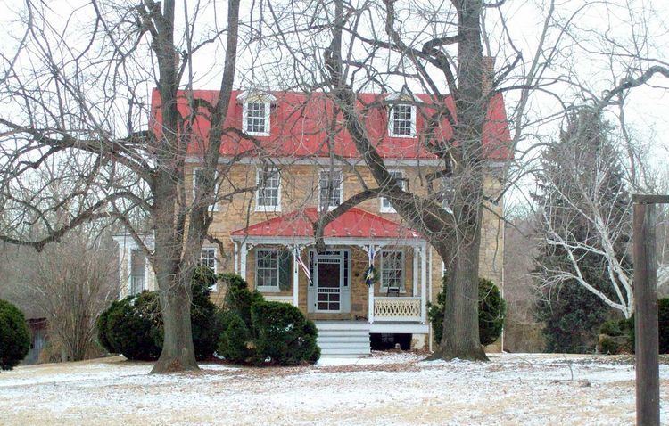
Montrose and Richland Farm are listed on the National Register of Historic Places in 1973.
History
In 1699, Thomas Browne, a Patuxent Ranger, ranged the river from the Snowden plantation to where Clarksville is sited. The area was settled with tobacco plantations such as Folly Quarter and Hobbs Regulation with slave labor. In 1838, Dr. William Watkins of Richland Manor proposed the "Howard District" of Anne Arundel County, which became Howard County in 1851. Clarksville's name originates from John R. Clark's family who immigrated from Ireland to the Howard District of Anne Arundel County in 1790. The land he purchased included Jack Howard's blacksmith shop, one of the few African American operated blacksmith's in the county. Clarksville postal office listed the population as just 65 in the 1930s with the key industry of agriculture and limestone mining. Numerous apple orchards were situated between Clarksville and Ashton. In 1869 the town became the terminus of the ten mile Ellicott City and Clarksville turnpike built over the old Sandy Spring road, a ten-mile private toll road created in a time before county maintained roads which later became route 108.
Schooling
River Hill High School is located in Clarksville.
Climate
The climate in this area is characterized by hot, humid summers and generally mild to cool winters. According to the Köppen Climate Classification system, Clarksville has a humid subtropical climate, abbreviated "Cfa" on climate maps.