
Type Highway Opened 1955 | Length 2,964 km (1,842 mi) | |
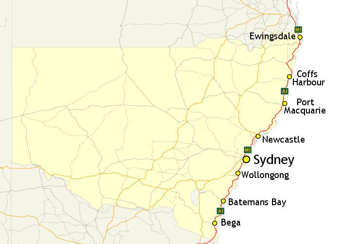 | ||
In New South Wales, Highway 1 is a 1,351-kilometre (839 mi) long route that crosses the state, from the Queensland/New South Wales border near Tweed Heads to the Victorian border near Timbillica. It provides the main coastal route between Brisbane and Melbourne via Sydney. Highway 1 continues around the rest of Australia, joining all mainland state capitals, and connecting major centres in Tasmania.
Contents
With the entire route passing close to the coast, for many New South Wales residents Highway 1 is synonymous with summer holiday road trips. Parts of the route are also busy intercity or commuter routes.
While the route is defined by its designation of "1", with today's alphanumeric route numbering system the route consists of eight sections, alternating between the M1 designation (for motorway grade sections) and the A1 designation (for other sections).
History
Highway 1 was created as part of the National Route Numbering system, adopted in 1955. The route was compiled from an existing network of state and local roads and tracks.
Route Numbering
When Highway 1 was declared in 1955, the entire route carried the National Route 1 shield. In 1974, the Sydney-Newcastle Freeway section was declared part of the National Highway, and the route marker was subsequently updated to National Highway 1 for this section
In 1993, the route numbering was further complicated with the introduction of the Metroad numbering system within the Sydney metro area. The section of highway 1 between Wahroonga and Waterfall was proclaimed Metroad 1.
In 2013, alphanumeric route numbering was introduced to New South Wales, and all sections of Highway 1 were changed to carry either the M1 or A1 designation, depending on the grade of the road. As of 2013, large sections of the Pacific Highway are actually of motorway standard, despite still carrying the A1 designation. The government has explained this is to avoid frequent changes in route designation, with plans to update the designation to M1 over time as large sections of road are brought to motorway standard.
Highway 1 travels multiple named roads on its journey from the Queensland to the Victorian border:
Major intersections
Highway 1 intersects the following major roads in New South Wales: