
Type Highway | Length 656 km | |
 | ||
Riding the best roads in australia the oxley highway
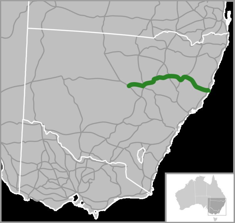
The Oxley Highway is a rural highway in New South Wales, Australia. It starts at Nevertire where it joins the Mitchell Highway. It links Nevertire, Warren, Gilgandra, Coonabarabran, Gunnedah, Carroll, Tamworth, Bendemeer, Walcha, Yarrowitch, Ellenborough, Long Flat, Wauchope and ends at Port Macquarie on the coast of the Tasman Sea.
Contents
- Riding the best roads in australia the oxley highway
- Map of Oxley Hwy New South Wales Australia
- Great motorcycling roads of australia the oxley highway
- History
- References
Map of Oxley Hwy, New South Wales, Australia
The Oxley Highway starts from the Mitchell Highway at Nevertire before journeying to the Castlereagh Highway at Gilgandra, from where it is duplexed with the Newell Highway to Coonabarabran, thence to the New England Highway at Tamworth, with which it is duplexed to Bendemeer, the Thunderbolts Way at Walcha, and the Pacific Highway near Port Macquarie.
The highway was formerly signed National Route 34 for its entire length, however during 2013 the route west of Coonabarabran was decommissioned and east to Port Macquarie signed as the B56 as part of the new system of alpha-numeric route marking in NSW.
Great motorcycling roads of australia the oxley highway
History
Work commenced in 1838 with the use of convicts working from Port Macquarie towards a spot known as "Prisoners’ Garden" about 20 km from Yarrowitch. Here it is said that the convicts were chained up each night. In 1842 the track from the Northern Tablelands to Port Macquarie was opened for the first time. Wool carried along this new route reduced the travelling time to 10 days, as opposed to 12–14 weeks for the trip to Maitland. The section from Walcha to Bendemeer existed as a mapped road in 1857, was surveyed in 1867, and proclaimed a Parish Road in c.1889. West of Walcha the road was only suitable for bullock teams and they too had difficulties, especially with the ranges.
The steep range section from Yarras to Yarrowitch was in serious need of repair in 1925 when the Main Roads Board was formed. Following a re-survey in 1927 the road was altered between Yarras and Tobins Camp. The Highway was named in 1928 to commemorate John Oxley who was the first European to explore much of inland New South Wales in 1818. On 30 September 1933 the Highway section between Walcha and Port Macquarie was officially opened. Walcha Shire maintained 106 km of the Highway until July 1966 when this part was taken over by the Department of Main Roads.
About 45 kilometres of the Yarrowitch to Wauchope section is unfenced and livestock (cattle) may be encountered there, along with other wild animals on most of the highway. Kangaroos are the most likely of those to be spotted, but wombats and other marsupials may be found.