
Type Motorway Route number(s) M1
Entire route | Opened 1975–1987 Length 47 km | |
 | ||
Former
route number National Route 1
(mid 1980s-2013)
F6
(1975-mid 1980s) North end Princes Highway (A1)
Waterfall, New South Wales South end Princes Highway (A1)
Illawarra Highway (A48)
Albion Park Rail, New South Wales Major cities Wollongong, Dapto, Helensburgh | ||
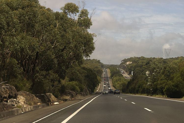
M1 princes motorway improvements picton road to bulli tops
The Princes Motorway, formerly known as the Southern Freeway is a 55-kilometre (34 mi) predominately dual carriage untolled motorway that links Sydney to Wollongong and further south through the Illawarra region to Albion Park Rail. Part of the Australian Highway 1 network, the motorway is designated with the route number M1, having previously been signposted as F6 (Freeway Route 6) and is sometimes commonly known by this latter name.
Contents
- M1 princes motorway improvements picton road to bulli tops
- Heavy fog princes motorway
- History
- Proposed extension
- References
As Wollongong and Port Kembla are important industrial centres, freight traffic is heavy. Despite the current decline of the local steel industry, emergence of Wollongong as a commuter city of Sydney has kept the freeway and the adjacent Mount Ousley Road busy.
Heavy fog princes motorway
History
In the north, the Princes Motorway route starts at Waterfall, taking more or less a parallel route with Princes Highway until the sprawling Bulli Tops interchange (with Appin Road (State Route 69) and Princes Highway). There it continues downhill, avoiding the steep Bulli Pass, and bypasses Wollongong CBD, through Gwynneville and continues for 20 kilometres (12 mi), bypassing the suburb of Yallah, and rejoining the Princes Highway north of Albion Park Rail near the Princes Highway junction with the Illawarra Highway.
From its opening on 24 July 1975, the Waterfall to Bulli Tops section of the then Southern Freeway incurred a toll. This part of the freeway did not feature the Helensburgh Interchange (which subsequently opened in February 2000). The toll operated for 20 years, which was 10 years short of its intended operating length. The main reason for this was local residents complaining that the F3 Freeway (now Pacific Motorway) had their toll dropped in 1988, which was at the time intended to be dropped as its loans had been fully paid off unlike those of the F6.
After much pressure the toll for the F6 freeway was removed on 30 July 1995 as the loans had been repaid. Remnants of the tollbooths are still able to be seen at the old toll plaza at Waterfall. One of the lanes and very faint markings are still intact. Heading southbound one set of warning lights to slow down for the toll plaza are also still intact minus signage.
In early 2013, as part of the New South Wales alphanumeric route conversion process, the road name changed from the Southern Freeway to the Princes Motorway. The new name was also applied to what was formerly known as Mount Ousley Road.
In November 2015, it was announced that the section between Bulli Tops and Picton Road would have a third lane added in each direction.
Proposed extension
The County of Cumberland Scheme of 1948 outlined an F6 extension from the current-day end-point at Waterfall. As such, an F6 corridor was set aside that passes through the Royal National Park from Waterfall to Campbell Road in St Peters. The land reservation tract currently passes through the suburbs of Loftus, Kirrawee, Gymea, Miranda, Taren Point, Sandringham, Sans Souci, Ramsgate, Monterey, Kogarah, Brighton-Le-Sands, Rockdale, Banksia, Kyeemagh and Tempe.
Of the proposed extension, only the six-lane Captain Cook Bridge and a short connecting section of Taren Point Road to the south have been built. Establishment of the bridge section of the F6 extension began in 1962, expedited to replace the ferry service that had operated from Taren Point to Sans Souci since 1916. Captain Cook Bridge was opened for general use in May 1965.
In the original plan, the F6 would connect to the Western Distributor. Then, in August 1977, premier Neville Wran cancelled the inner section of the F6 link, which at the time had an estimated construction cost of $96 million. At the same time, Wran announced that the inner section reservation would be sold off and the proposed extension would instead terminate at St Peters, a medium density industrial suburb.
Prior to the 2007 federal election, the Liberal-Nationals (Coalition) promised to allocate A$20 million towards planning for the F6 extension. Although the Coalition did not win the 2007 election, the funding was once again promised at the subsequent 2010 federal election. This funding would ensure the project is "shovel ready" when funding becomes available.
As part of modifications made during the planning stage of the WestConnex project, stub tunnels will be added to the "New M5" tunnel to allow for an extension connection to it by the F6 extension. In June 2016 the Roads & Maritime Services commenced geotechnical analysis to determine underground rock and soil conditions on the former F6 corridor from Waterfall to the Sydney Orbital Network at Rockdale with a view into developing a possible link between the Princes Motorway and the Orbital Network. It was further reported in October 2016 that any extension would be known as SouthConnex.