
Length 116 km | ||
 | ||
East end: I‑85 west of Atlanta Airport Counties Polk County, Georgia, Paulding County, Georgia, Cobb County, Douglas County, Georgia, Fulton County, Georgia | ||
State Route 6 (SR 6) is a 72.1-mile-long (116.0 km) state highway that travels northwest-to-southeast in the U.S. state of Georgia. It is known as Jimmy Lee Smith Parkway, Jimmy Campbell Parkway, Nathan Dean Parkway, and Wendy Bagwell Parkway in Paulding County; C.H. James Parkway in Cobb County; Thornton Road in Douglas County; and Camp Creek Parkway and honorarily as Tuskegee Airmen Parkway in Fulton County. It begins at the Alabama state line, where it is concurrent with US 278. Here, US 278 enters Alabama, concurrent with the unsigned state highway SR 74. Its eastern terminus is at an interchange with Interstate 85 (I-85) west of the Hartsfield–Jackson Atlanta International Airport.
Contents
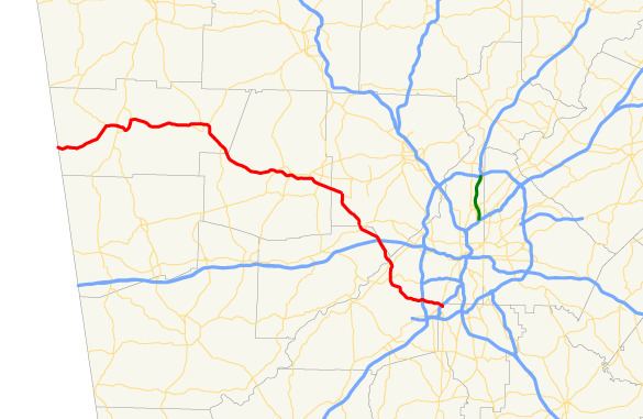
- Map of GA 6 Georgia USA
- Route description
- History
- Rockmart business loop
- Dallas Hiram business loop
- Former Dallas Spur
- Austell Spur
- References
Map of GA-6, Georgia, USA
Route description
SR 6 starts at the Alabama state line, southwest of Cedartown, and northwest of Esom Hill in Polk County, and initially heads east to Cedartown, concurrent with US 278 from its western terminus. Skirting Cedartown around the south, the highway continues east to Rockmart, where it turns sharply to the south and then southeast into Paulding County and Dallas. Bypassing Dallas to the south, SR 6 continues traveling to the southeast and travels through the southwestern corner of Cobb County, through Powder Springs, to Austell in Douglas County.
In Lithia Springs, the highway approaches the intersection with US 78/SR 5/SR 8, where US 278 turns left and joins a concurrency with US 78 as far east as Druid Hills, while SR 6 continues southeast where it has an intersection with Maxham Drive, a local boulevard spanning from the Westfork Shopping Center through SR 5, and later crosses over I-20, where it has a partial cloverleaf and half-diamond interchange. Forming the county line between Cobb and Douglas counties, the highway continues traveling to the southeast, and crosses the Chattahoochee River into Fulton County. Curving to the east, the highway crosses I-285 and reaches its eastern terminus at the western edge of Hartsfield–Jackson Atlanta International Airport in College Park.
History
On March 14, 1984, US 278 and SR 6, between Powder Springs and Austell, was designated as the 'C. H. (Fat) James, Sr., Memorial Highway'.
Recently, at the intersection of SR 6 and I-285 in East Point, there has been a renaissance for southern Fulton County: the opening of the Camp Creek MarketPlace. It was opened in late 2003, and the second portion opened in spring or summer of 2006.
On August 1, 2008, Camp Creek Parkway, the 12-mile (19 km) stretch of SR 6, between SR 70 and I-85, was honorarily designated Tuskegee Airmen Parkway.
As of March 2009, the portion of the highway in Fulton County is no longer signed as SR 6. The only signage on this route are the Tuskegee Airmen Parkway signs. The portion near I-285 and the Atlanta Airport, which is in Clayton County, is still signed as SR 6.
Rockmart business loop
State Route 6 Business (SR 6 Bus.) is a 3.2-mile-long (5.1 km) business route of SR 6. Nearly the entire road is within the city limits of Rockmart. Its entire length is concurrent with U.S. Route 278 Business (US 278 Bus.).
Dallas-Hiram business loop
State Route 6 Business (SR 6 Bus.) from Dallas to Hiram, Georgia consists of Buchanan Street, West Memorial Drive, East Memorial Drive, Merchants Drive, and Atlanta Highway. Unlike the Business Loop in Rockmart, it is not overlapped by a business route of U.S. Route 278 (US 278).
SR 6 Bus. begins along Buchanan Street as SR 120 turns right onto the intersection with US 278/SR 6 (Jimmy Campbell Parkway). Buchanan Street ends at West Memorial Drive, and SR 6 Bus. turns right. From that point on, it follows the former path of SR 6. Curving toward the northeast SR 6 Bus. encounters a paved trail that turns along the south side of the road, then both run along bridges over Weaver Creek and then run under a railroad bridge, before making a curve back towards the east-northeast as it gets closer to Downtown Dallas. At the intersection of North Confederate Avenue and Main Street, SR 61 leaves North Confederate Avenue and joins SR 6 Bus. in a concurrency, and the name changes from West Memorial Drive to East Memorial Drive.
SR 6 Bus. and SR 61 leave East Memorial Drive (former SR 381) and make a right curve onto Merchants Drive. The highways travel south-southeast down a hill along the eastern edge of Downtown Dallas, but then begins to elevate in the vicinity of the local post office. SR 61 leaves SR 6 Bus. at Nathan Dean Boulevard, and later the road curves from south-southeast to southeast at Hardee Street, formerly SR 6 Spur. It turns straight east just before the intersection with Heritage Club Boulevard, but then curves east-northeast before the intersection of Old Harris Road, only to turn straight east again after a fork in the road with Macland Road, across from an intersection with Butler Industrial Drive. The last intersection in Dallas is an intersection with WI Parkway, a road into an industrial park. East of there, it travels along the south side of Carter Lake.
Before the intersection with Paris Road, the highway enters the Hiram city limits, where Merchants Drive becomes Atlanta Highway, and climbs a slight hill. At New Canaan Baptist Church and Cemetery, the road descends along another hill, but climbs back up before the intersection with Cobbler Cove Drive. At Summerhill Road, SR 6 Bus. starts to curve to the southeast and approaches an intersection with SR 120/SR 360 (Charles Hardy Parkway). Shortly after this, the business route replaces the trajectory of Ratcliff Road, and curves to the right from a former fork in the road with Pace Road. SR 6 Bus. curves away from a former alignment of Atlanta Highway and ends at US 278/SR 6 at the intersection of a local street named Highland Falls Boulevard.
The entire route is in Paulding County.
Former Dallas Spur
State Route 6 Spur (SR 6 Spur) in Dallas, Georgia was a connecting spur route to SR 61 along Hardee Street. At some point, the highway was decommissioned, and SR 61 was realigned to Nathan Dean Boulevard, a connecting road over the former spur, leading to the former SR 6, which is now SR 6 Bus.
Austell Spur
State Route 6 Spur (SR 6 Spur) in Austell is a 0.8-mile-long (1.3 km) spur route that is known as Dr. Luke Glenn Garrett Jr. Memorial Highway. It travels from US 278/SR 6 to Powder Springs Road across from the Garrett Middle School, and serves a Norfolk Southern Railway yard.
The entire route is in Austell, Cobb County.