
Country United States County Paulding Area code(s) 770/678/470 Elevation 294 m Zip code 30141 Local time Saturday 9:42 PM | Time zone Eastern (EST) (UTC-5) FIPS code 13-39076 Area 7.8 km² Population 3,659 (2013) University Vogue Beauty School | |
 | ||
Weather 4°C, Wind NW at 11 km/h, 79% Humidity | ||
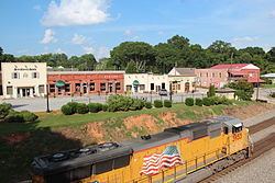
Hiram is a city in Paulding County, Georgia, United States. As of 2011, the population is 2,332. The city was named after Hiram Baggett, the town's first postmaster.
Contents
Map of Hiram, GA, USA
Geography
Hiram is located at 33°51′56″N 84°46′29″W (33.865575, -84.774593).
According to the United States Census Bureau, the city has a total area of 3.0 square miles (7.8 km2), of which, 3.0 square miles (7.8 km2) of it is land and 0.04 square miles (0.10 km2) of it (0.66%) is water.
At the intersection of US Highway 278 and Georgia State Route 92, Atlanta's tallest buildings can be seen, specifically the Bank of America Tower.
Demographics
The past decade saw a tremendous increase in the populations of Dallas and Hiram, as well as Paulding County.
Dallas and Hiram more than doubled in population from 2000 to 2010, according to figures from the U.S. Census. Dallas, Paulding's county seat, went from an overall population of 5,056 in the year 2000 to 11,544 in the 2010 census—just over a 128 percent increase.
But Hiram's growth was even more explosive over the last decade, jumping to 3,546 from 1,361-- an increase of more than 160 percent.
The county's numbers also swelled, but not at the rate experienced by Dallas and Hiram. From 2000's population of 81,678, the county saw nearly three-quarters of that total adding to its resident count, bringing it to 142,324.
As of the census of 2010, there were 3543 people and 1,538 households residing in the city. The population density in 2000 was 452.5 people per square mile (174.67/km²). There were 506 housing units at an average density of 168.2 per square mile (64.9/km²). The racial makeup of the city in 2010 was 60.88% White, 32% African American, 0.22% Native American, 1.04% Asian, 2.74% from other races, and 3.02% from two or more races. Hispanic or Latino of any race were 7.54% of the population.
There were 481 households out of which 38.7% had children under the age of 18 living with them, 55.9% were married couples living together, 14.8% had a female householder with no husband present, and 23.7% were non-families. 19.1% of all households were made up of individuals and 4.4% had someone living alone who was 65 years of age or older. The average household size was 2.83 and the average family size was 3.20.
In the city, the population was spread out with 28.4% under the age of 18, 11.4% from 18 to 24, 33.7% from 25 to 44, 19.3% from 45 to 64, and 7.3% who were 65 years of age or older. The median age was 32 years. For every 100 females there were 99.9 males. For every 100 females age 18 and over, there were 96.2 males.
The median income for a household in the city was $50,069, and the median income for a family was $51,705. Males had a median income of $36,048 versus $24,483 for females. The per capita income for the city was $19,254. About 4.1% of families and 5.2% of the population were below the poverty line, including 6.4% of those under age 18 and none of those age 65 or over.
Education
The city of Hiram has two public schools named after it, Hiram High School and Hiram Elementary School. The nearest middle schools are Dobbins Middle School, P.B. Ritch Middle School and East Paulding Middle School.