
Length 37.2 km | ||
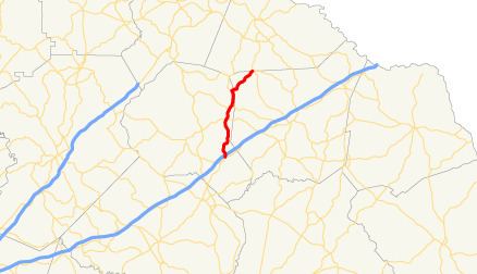 | ||
State Route 63 (SR 63) is a 23.1-mile-long (37.2 km) state highway in the northeastern part of the U.S. state of Georgia. It and SR 59 serve to connect Commerce and Toccoa.
Contents
Map of GA-63, Georgia, USA
Route description
SR 63 begins at an intersection with SR 59, northeast of Commerce. The route travels north-northeastward toward Toccoa. About 1,000 feet (300 m) after its southern terminus, SR 63 has an interchange with Interstate 85 (I-85) in rural Banks County. SR 63 continues to the north-northeast. It has intersections with SR 51, SR 198, and SR 184. The highway crosses the northwestern corner of Franklin County and enters Stephens County. SR 63 intersects SR 106 just north of the Franklin–Stephens county line. The two highways form a concurrency to the north-northeast. On the way to Toccoa, the route has an intersection with SR 17. Just before entering Toccoa, SR 63 has an intersection with SR 145 before traveling northwest and curve to the north until it meets its northern terminus, an intersection with US 123/SR 184/SR 365 in downtown Toccoa. This intersection also marks the northern terminus of SR 106.
SR 63 is not part of the National Highway System, a system of roadways important to the nation's economy, defense, and mobility.