
Length 135.2 km | ||
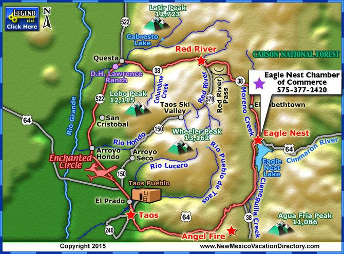 | ||
Enchanted circle scenic byway
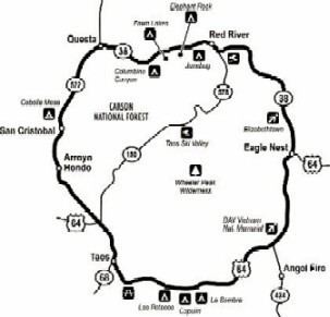
The Enchanted Circle Scenic Byway is a New Mexico Scenic Byway and National Forest Scenic Byway located in Northern New Mexico. It begins and ends in Taos, New Mexico.
Contents
- Enchanted circle scenic byway
- Route description
- Taos
- North of Taos
- Eastern end
- Early trails
- Trails of the 19th century
- Highways from the 20th century
- Scenic byway designation
- Gallery
- Popular culture
- References
Enchanted circle scenic byway
Route description
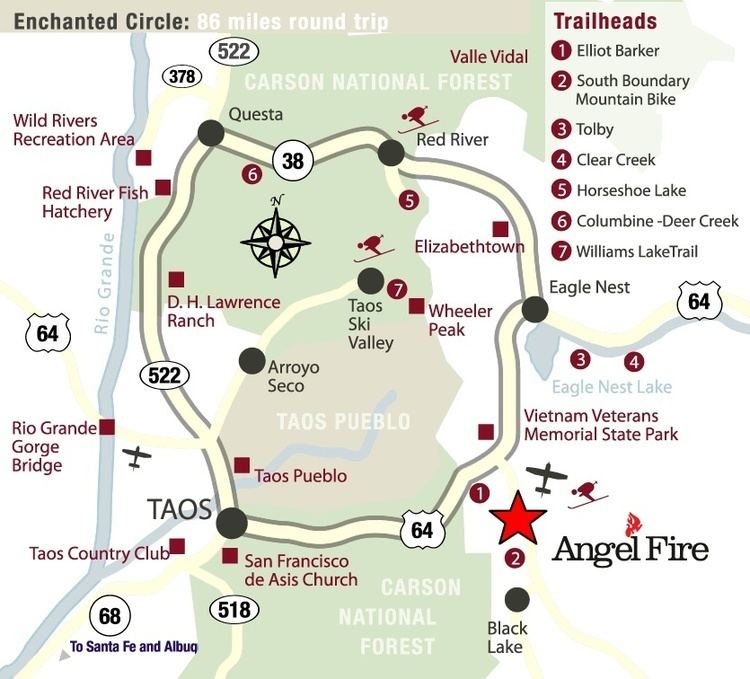
The 84-mile (135 km) Enchanted Circle Scenic Byway makes a loop through Taos following four main highways:
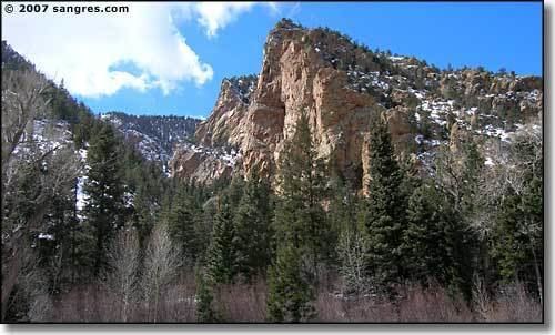
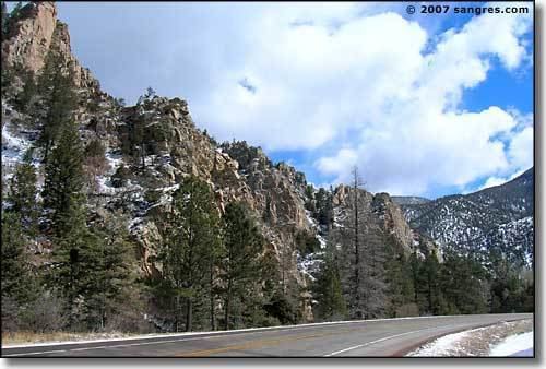
The byway encircles Wheeler Peak (13,161 feet (4,011 m)) of the Sangre de Cristo Mountains. It is the tallest mountain in New Mexico. The scenic byway passes through historic towns, alongside lakes and streams, and near ski resorts and recreational parks.
Taos
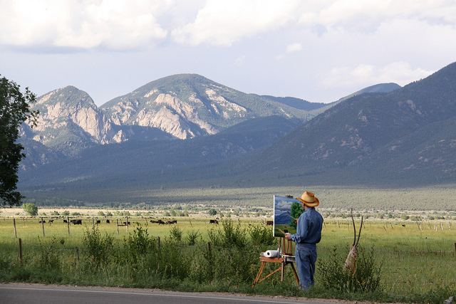
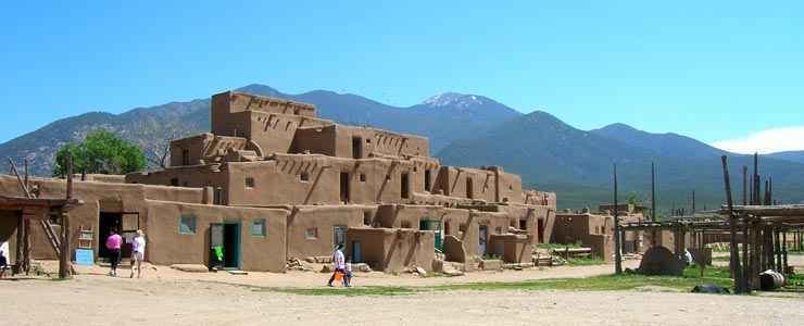
In Taos is its historic district of old adobe buildings. Within the town are the Taos Plaza, homes of historic figures, galleries, shops and the ancient Taos Pueblo. Recreational opportunities include rafting on the Rio Grande.
North of Taos
North of Taos NM 522 meets NM 38 at Questa, where Red River recreational opportunities include picnic facilities, fishing, and self-guided tours. The town of Questa is known for its artisans whose works are found at the Artesanos de Questa and historic santos and retablos are at the St. Anthony's Church.
Northeast of Questa, the Rio Grande and Red Rivers intersect in the Wild Rivers Recreation Area. East of Qesta is the Red River Valley—where there had been cooper, lead, silver and gold mining. The town of Red River offers staged gunfights, shopping, a ski resort, and a mining museum. Traveling east on New Mexico State Road 38 (NM 38) is Bobcat Pass (9,820 feet (2,990 m)) which leads into the Moreno Valley and a view of the north side of Mount Wheeler.
Eastern end
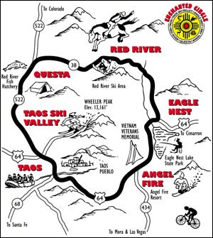
At the eastern edge of the scenic byway is Moreno Valley, which lies between Eagle Nest and Angel Fire. At the southernmost point of the valley is the Vietnam Veterans Memorial State Park. A ski resort and golf course are located south of the park on NM 434 in the village of Angel Fire. The ski resort's chairlift is used during the summer by hikers, sightseers and mountain bikers. From Angel Fire, west on US 64 is the Palo Flechado Pass (9,101 feet (2,774 m)) with a distant view of San Juan. Campsites, canyon trails, picnic areas, and artist's studios are located in the Canyon of the Rio Fernando de Taos.
Early trails
The earliest trails used by Plains Indians and Puebloan peoples were those created by buffalo and were followed for hunting. The buffalo were considered "the best civil engineers in the world" for their ability to find the easiest, lowest paths through the mountains. The Old Kiowa Trail, still used today by Native Americans on horseback, is at the base of the Rocky Mountains. An old Navajo Trail criss-crossed the Rio Grande before heading west at Warmsley Crossing (John Dunn Bridge at Arroyo Hondo) There were additional trails that radiated out of Taos from Taos Plaza.
Trails of the 19th century
A key trail into Taos was "The Old Taos Trail", which began at the Bent's Fort on the Arkansas River in Colorado, west of the Spanish Peaks, through Sangre de Cristo Pass (west of Walsenburg, Colorado), Old La Veta Pass and into Questa area (NM 522/NM38 area).
It came into Taos at either Taos Pueblo road or half a mile west on Couse Hill. Another route into Taos was along the Cimarron Route. It was this route that most wagon trains entered into the Rio de Fernando canyon valley. The two routes are the "mountain route" and the "Cimarron Route" of the Santa Fe Trail. One of the Cimarron Mountain Routes paralleled the present U.S. Route 64 from I-25 to Cimarron. Trails branched off of the Cimarron Route into several communities. A branch of the route from Bent's Fort went into Taos in or after the founding of the Santa Fe.Trail in 1821. The first wagon train was led by Charles Bent in 1831. Bent, the brother of William Bent of Bent's Fort, became the most successful merchant in Taos before being made governor of New Mexico.
Highways from the 20th century
History of individual highways:
Scenic byway designation
The Enchanted Circle Scenic Byway was made one of the New Mexico Scenic Byways on July 31, 1998.
It was designated a National Forest Scenic Byway by the U.S. Forest Service on December 14, 1989.
Gallery
Popular culture
The movies Easy Rider and Butch Cassidy and the Sundance Kid were filmed in the area.