
 | ||
Similar Wheeler Peak, Rocky Mountains, Vietnam Veterans Memorial, Eagle Nest Lake State Park, South Boundary Trail | ||
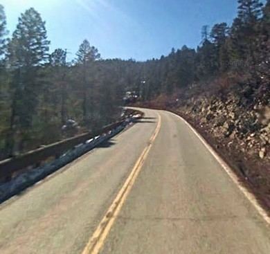
Palo flechado pass angel fire to taos
Palo Flechado Pass (Spanish: tree pierced with arrows), also called Taos Pass, is a mountain pass located in Taos County, New Mexico on the Enchanted Circle Scenic Byway.
Contents
- Palo flechado pass angel fire to taos
- Map of Palo Flechado Pass New Mexico 87571 USA
- Geography
- History
- Recreation
- References
Map of Palo Flechado Pass, New Mexico 87571, USA
Geography
Palo Flechado Pass is 9,109 feet (2,776 m) in altitude. It is located 3.5 miles west of Aqua Fria Creek on U.S. Route 64 in the Carson National Forest. A tributary of Agua Fria Creek, Palo Flechado Creek, is near the pass.
History
Comanche, Kiowa, and Apache used the mountain pass on a trail from the plains to and then alongside the Cimarron River before the arrival of the Spanish. It continued to be used by Native Americans, Spaniards and Europeans on journeys to Taos.
According to the historic marker placed at the pass, a band of Apaches, the Flecha de Palo, lived in the plains east of the mountains in 1706. A common theory for the name of the pass is based upon a Taos Pueblo tradition for shooting arrows into a tree at a mountain pass following a successful buffalo hunt.
Recreation
There are two hiking trails within a mile of the pass that go into the Palo Flechado Meadow and alongside a stream. The Elliot Barker Trail leads to a pond and then a dense spruce-fir forest. The La Jara Trail at Forest Road 5 parallels a stream in the Rio Grande valley.