
Incorporated 1637 Area 97.4 km² Local time Wednesday 6:05 AM | Settled 1624 Elevation 36 ft (11 m) Zip code 02332 Population 15,059 (2010) | |
 | ||
Weather 11°C, Wind S at 19 km/h, 95% Humidity | ||
Video of 32 long point lane duxbury massachusetts waterfront real estate homes
Duxbury (older spelling, "Duxborough") is a coastal town in Plymouth County, Massachusetts, United States. A suburb located on the South Shore approximately 35 miles (56 km) to the southeast of Boston, the population was 15,059 at the 2010 census.
Contents
- Video of 32 long point lane duxbury massachusetts waterfront real estate homes
- Map of Duxbury MA USA
- Waterview colonial in duxbury massachusetts
- History
- Revolutionary War Era
- Shipbuilding Era
- Geography
- Demographics
- Government
- Public schools
- Private schools
- Bus
- Road
- Other
- Duxbury Yacht Club
- Notable people
- Points of interest
- Newspapers
- Television
- Radio
- References
Map of Duxbury, MA, USA
Geographic and demographic information on the specific parts of the town of Duxbury is available in articles Cedar Crest, Duxbury (CDP), Duxbury Beach, and South Duxbury, respectively.
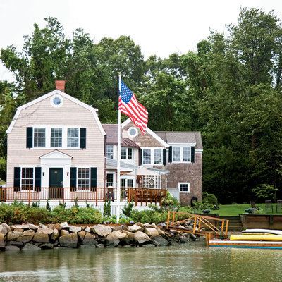
Waterview colonial in duxbury massachusetts
History
The area now known as Duxbury was inhabited by people as early as 12,000 to 9,000 B.C. By the time European settlers arrived here, the region was inhabited by the Wampanoags, who called this place Mattakeesett, meaning “place of many fish.”
In 1620, English settlers known as the Pilgrims established their colony in nearby Plymouth. Per the terms of their contract with financial backers in London, they were required to live together in a tight community for seven years. At the end of that term in 1627, land along the coast was allotted to settlers for farming. Thus, the coastline from Plymouth to Marshfield, including Duxbury, was parceled out, and many settlers began moving away from Plymouth.
At first, those who settled in Duxbury came to work their new farms just in the warmer months and returned to Plymouth during the winter. It was not long, however, before they began to build homes on their land, and soon requested permission from the colony to be set off as a separate community with their own church. Duxbury, which originally included land that is now Pembroke, was incorporated in 1637.
Some of the most influential men in the colony received grants in Duxbury and became its first leaders. Captain Myles Standish, the military leader of the colony, lived in “the Nook,” an area now known as Standish Shore. Elder William Brewster was for many years the religious leader of the colony, in which he led services to the colony until it received its own minister in 1637. John Alden was another important settler. His house, now a museum on Alden Street, was the site of many important meetings of the colony’s leaders. The graves of some of Duxbury’s first settlers can be found in the Old Burying Ground on Chestnut Street, next to the site of original meetinghouse. Theory has it that the town was named by Myles Standish after the family estate of his childhood in Lancashire. The ancient Standish family in northern England owned much land and large estates, including the two main family headquarters of Standish Hall and Duxbury Manor, in Lancashire, since before the Middle Ages. Myles Standish's will delineates his inheritance rights to very particular lands near and around Standish and mostly Duxbury Manor, stating his descent from both lines of the Standish family; and so it has been suggested that he named the new town in Massachusetts after the estate where he grew up.
Duxbury was primarily a farming community throughout the 17th and 18th centuries. Its quiet history in the 18th century was interrupted only by the Revolutionary War.
Revolutionary War Era
In the years leading the American Revolutionary War, opposition to the British was quite fierce in Duxbury, with crowds meeting regularly at Captain's Hill to burn effigies of British officials in protest of the Stamp Act. In 1775 General Thomas Gage had to dispatch a company of regulars to the town in response to pleas from the loyalists at Marshfield, Massachusetts.
When the Minuteman alarm sounded on April 19, 1775, with news of the battles at Concord and Lexington. Many volunteers mustered to the regiment of Colonel Theophilus Cotton from Plymouth, Kingston and Duxbury, headed for Marshfield to engage the British. The colonial officers held a council of war at the home of Lt. Col. Briggs Alden in Duxbury.
Shipbuilding Era
The most remarkable period in Duxbury’s history, the shipbuilding era, began immediately after the American Revolution. Following the Treaty of Paris, the newborn nation was granted fishing rights on the Grand Banks. Several families took advantage of the new opportunity and began to build large fishing schooners. Soon, the schooners built in the 1790s gave way to larger brigs and eventually three-masted ships. As several merchant families began to amass large fleets, shipyards and other ancillary industries flourished and Duxbury prospered. By the 1840s, Duxbury boasted about 20 shipyards and produced an average of ten large sailing vessels per year.
The largest industry in Duxbury was owned by Ezra Weston, who came to be known as "King Caesar" due to his success and influence. Weston began building small vessels in 1764 and soon became famous for his successful merchant fleet. His son, Ezra Weston II, who inherited his father’s kingly sobriquet, would bring the industry to its height. By 1841, the younger King Caesar had constructed the largest vessel built in New England up to that time. The ship Hope was an astounding 880 tons. Lloyd's of London recognized Weston as the owner of the largest fleet in America, and this judgment was confirmed by Daniel Webster in a speech in 1841. His empire, a fore-runner of vertical integration, dominated the town. The King Caesar House is now a museum owned by the Duxbury Rural and Historical Society.
The shipbuilding era in Duxbury ended as quickly as it began. By the 1850s, sailing vessels were made obsolete by other modes of transportation such as steamships and railroads. While other Massachusetts towns grew, Duxbury went into a long economic decline.
There was, however, a silver lining. By the 1870s, Duxbury’s rural character and unspoiled bay began to attract summer visitors. Duxbury soon gained a reputation as an idyllic summer resort. With the 1871 completion of the Duxbury & Cohasset Railroad, large numbers of city-folk from Boston could pay $1.50 for a round-trip ticket and enjoy Duxbury’s refreshing environment. Boarding houses sprang up everywhere. The Miles Standish Hotel on the Nook soon became enormously popular. The Myles Standish monument, completed in 1898, was a result of this tourist influx.
This pattern continued in Duxbury well into the 20th century. It was not until the construction of Route 3 that transportation to Boston became expedient and the town’s population exploded with the arrival of thousands of year-round residents.
Geography
According to the United States Census Bureau, the town has a total area of 37.6 square miles (97.4 km²), of which, 23.8 square miles (61.5 km²) is land and 13.9 square miles (35.9 km²) (36.87%) is water. Duxbury is bordered by Cape Cod Bay to the east, Duxbury Bay, Kingston Bay and Plymouth to the southeast, Kingston to the southwest, Pembroke to the west and northwest, and Marshfield to the north. The town's border with Plymouth is due to the town's having the only land access to Saquish Neck, a thin, hook-shaped strip of land along Duxbury Bay whose tip is in Plymouth.
Duxbury is the sixth largest cranberry producer in Massachusetts. It has come to be known in recent years also for its oyster beds, as well as other shellfish. The town has many ponds and bogs throughout. The Back River lies along the western edge of Saquish Neck, and has many tributaries from the local rivers, brooks and marshes. There are several sanctuaries, a conservation area and other forests within the town, especially in the western half.
It also has many recreational parks available for hiking, dog walking, horseback trail riding and bike riding.
Demographics
As of the census of 2010, there were 15,059 people, 5,344 households, and 4,162 families residing in the town. The population density was 632.7 people per square mile (244.9/km²). There were 5,875 housing units at an average density of 246.7 per square mile (86.9/km²). The racial makeup of the town was 98.0% White, 0.60% Black or African American, 0.30% Native American, 1.40% Asian, 0.10% Pacific Islander, 0.50% from other races, and 0.80% from two or more races. Hispanic or Latino of any race were 1.20% of the population.
There were 5,344 households, of which 38.7% had children under the age of 18 living with them, 68.1% were married couples living together, 7.4% had a female householder with no husband present, and 22.1% were non-families. 19.5% of all households were made up of individuals and 11.8% had someone living alone who was 65 years of age or older. The average household size was 2.79 and the average family size was 3.23.
In the town, the population was spread out with 22.6% under the age of 15; 7.6% from 15 to 19; 5.3% from 20 to 29; 7.0% from 30 to 39; 17.5% from 40 to 49; 23.7% from 50 to 64 and 16.3% who were 65 years of age or older. The median age was 44.8 years. For every 100 females, there were 92.6 males. For every 100 females age 18 and over, there were 88.5 males.
The median income for a household in the town was $117,124; and the median income for a family was $136,245. Males had a median income of $77,228 versus $41,730 for females. The per capita income for the town was $50,242. About 1.2% of families and 2.3% of the population were below the poverty line, including 3.1% of those under age 18 and 3.1% of those age 65 or over.
Government
On the national level, Duxbury is a part of Massachusetts's 9th congressional district, and is currently represented by Bill Keating. The state's senior (Class II) member of the United States Senate, elected in 2012, is Elizabeth Warren. The junior (Class I) senator is Ed Markey.
On the state level, Duxbury is represented in the Massachusetts House of Representatives as a part of the Sixth and the Twelfth Plymouth districts; the Sixth includes the towns of Hanson, Pembroke, and precincts 2-6 of Duxbury. The Twelfth includes all or parts of the towns of Halifax, Kingston, Middleborough, Plymouth, Plympton, and precinct 1 of Duxbury. The town is represented in the Massachusetts Senate as a part of the Plymouth and Norfolk district, which includes the towns of Cohasset, Duxbury, Hingham, Hull, Marshfield, Norwell, Scituate and Weymouth. The town is patrolled by the First (Norwell) Barracks of Troop D of the Massachusetts State Police.
Duxbury is governed by the open town meeting form of government, and is led by a town manager and a board of selectmen. The town operates its own police and fire departments, with the police station and central fire station located in the southeast and additional fire station in the northwest parts of town. There are two post offices in town; one is at Hall's Corner (near Goose Point) and the other is at Snug Harbor, along Duxbury Bay just south of Powder Point. The Duxbury Free Library is located in the heart of town, next to the John Alden House, and is a member of the Old Colony Library Network. The town also has a highway department, located behind the Town Hall, and a harbormaster, whose office is located next to the Duxbury Yacht Club near Snug Harbor. Duxbury is located within ten miles (16 km) of the Pilgrim Nuclear Power Station, and as such has a well-organized emergency management agency. The nearest hospitals are Jordan Hospital in Plymouth, South Shore Hospital in Weymouth, and Brockton Hospital.
Public schools
Over $26 million of Duxbury's annual budget is devoted to the town's nationally recognized public school system. According to Newsweek magazine's 2005, 2006 and 2007 rankings of the Nation's Top 1200 Public High Schools (the top 5% of public school systems), Duxbury was ranked at 246, 185 and 142 respectively. By 2013 though, it had fallen off of the Newsweek national rankings and locally, Boston Magazine's yearly town/school rankings, dropped it out of a top 40 spot.
Duxbury operates its own school system for the town's approximately 3,400 students, serving preschool through 12th grade. Chandler School is located near Tree of Knowledge Corner in the west of town and serves students from pre-kindergarten through second grade. The Alden Elementary School, near the John Alden House, serves grades 3-5.
Duxbury High School is on Saint George Street and serves grades 9-12. Duxbury High School was just recently rebuilt into a new building along with Duxbury Middle School called the 21st Learning experience. Duxbury's athletic teams are known as the Dragons, and their colors are green and white. Their chief rival is Marshfield High School, team mascot the Rams, and they play against them in the Thanksgiving Day Tournament. It is an important local event whose rivalry goes back 30 years.
Private schools
There are two private schools located in Duxbury. Bay Farm Montessori Academy is a private, independent school located in the southern corner of town and serves Toddlers through grade 8. Good Shepherd Christian Academy is a private, Christian school which serves students from kindergarten through eighth grade. The nearest private high school is Sacred Heart in Kingston. The town does not have any agreements with vocational schools.
Bus
For buses in Duxbury, the local Greater Attleboro Taunton Regional Transit Authority (GATRA) bus passes through the town on the SAIL line (Seaside Area Inter-town Link) and it stops at Halls Corner shopping district (South Duxbury), Island Creek, Millbrook Motors (Cox Corner), and the Duxbury Free Library (Millbrook). Another Bus Line that goes through Duxbury is the P&B Line (Plymouth & Brockton) which stops at Millbrook Motors (Cox Corner). The last bus line that goes through Duxbury is the Greyhound Bus Line which runs national service and into Canada, which stops at Millbrook Motors (Cox Corner).
Road
Route 3, a two-lane freeway also known as the Pilgrims Highway, passes through the town, with two exits granting access to the town from it. Routes 3A, 14, 53 and 139 also pass through the town. Routes 14 and 139 both end in the town, and Route 53 ends less than 1/2 mile south of the town line, at Route 3A.
Other
There is no rail or air service in town. The Kingston-Plymouth Line of the MBTA's commuter rail passes through (and terminates in) neighboring Kingston and Plymouth, as the southern end of a route which starts at South Station in Boston. The nearest municipal airport is Marshfield Municipal Airport; the nearest national and international air service can be reached at Logan International Airport in Boston.
Duxbury Yacht Club
The Duxbury Yacht Club near Snug Harbor was founded in 1875 and incorporated in 1895. As part of the club's 120th anniversary celebrations, David A. Mittell wrote 'The Duxbury Yacht Club story'