
Area 1,650 km² Unemployment rate 6.9% (Apr 2015) | Congressional district At-large Founded 1862 Population 4,320 (2013) | |
 | ||
Rivers Caine Creek, Hidewood Creek | ||
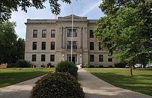
Deuel County (pronounced "DOOL") is a county located in the U.S. state of South Dakota. As of the 2010 census, the population was 4,364. Its county seat is Clear Lake. The county was created in 1862 and organized in 1878. It is named for Jacob Deuel, a legislator in 1862.
Contents
- Map of Deuel County SD USA
- Geography
- Major Highways
- Adjacent Counties
- 2000 census
- 2010 census
- Cities
- Towns
- Unincorporated communities
- Townships
- References
Map of Deuel County, SD, USA
Geography
According to the U.S. Census Bureau, the county has a total area of 637 square miles (1,650 km2), of which 623 square miles (1,610 km2) is land and 14 square miles (36 km2) (2.2%) is water.
Major Highways
Adjacent Counties
2000 census
As of the census of 2000, there were 4,498 people, 1,843 households, and 1,258 families residing in the county. The population density was 7 people per square mile (3/km²). There were 2,172 housing units at an average density of 4 per square mile (1/km²). The racial makeup of the county was 98.51% White, 0.09% Black or African American, 0.29% Native American, 0.18% Asian, 0.02% Pacific Islander, 0.24% from other races, and 0.67% from two or more races. 0.76% of the population were Hispanic or Latino of any race. 46.9% were of German and 29.1% Norwegian ancestry.
There were 1,843 households out of which 29.20% had children under the age of 18 living with them, 60.40% were married couples living together, 4.90% had a female householder with no husband present, and 31.70% were non-families. 28.60% of all households were made up of individuals and 14.40% had someone living alone who was 65 years of age or older. The average household size was 2.40 and the average family size was 2.97.
In the county, the population was spread out with 25.30% under the age of 18, 5.90% from 18 to 24, 25.40% from 25 to 44, 22.60% from 45 to 64, and 20.70% who were 65 years of age or older. The median age was 41 years. For every 100 females there were 99.60 males. For every 100 females age 18 and over, there were 99.60 males.
The median income for a household in the county was $31,788, and the median income for a family was $39,511. Males had a median income of $26,306 versus $19,282 for females. The per capita income for the county was $15,977. About 6.90% of families and 10.30% of the population were below the poverty line, including 9.80% of those under age 18 and 16.70% of those age 65 or over.
2010 census
As of the 2010 United States Census, there were 4,364 people, 1,819 households, and 1,228 families residing in the county. The population density was 7.0 inhabitants per square mile (2.7/km2). There were 2,204 housing units at an average density of 3.5 per square mile (1.4/km2). The racial makeup of the county was 97.5% white, 0.3% American Indian, 0.3% black or African American, 0.1% Asian, 1.0% from other races, and 0.9% from two or more races. Those of Hispanic or Latino origin made up 2.0% of the population. In terms of ancestry, 50.4% were German, 25.4% were Norwegian, 8.0% were Irish, 6.6% were Dutch, 5.5% were English, and 2.9% were American.
Of the 1,819 households, 28.2% had children under the age of 18 living with them, 58.6% were married couples living together, 5.0% had a female householder with no husband present, 32.5% were non-families, and 29.1% of all households were made up of individuals. The average household size was 2.37 and the average family size was 2.92. The median age was 43.9 years.
The median income for a household in the county was $47,000 and the median income for a family was $55,439. Males had a median income of $35,197 versus $26,020 for females. The per capita income for the county was $22,276. About 3.0% of families and 6.1% of the population were below the poverty line, including 5.6% of those under age 18 and 11.9% of those age 65 or over.
Cities
Towns
Unincorporated communities
Townships
The county is divided into sixteen townships: