
Congressional district At-large Website www.codington.org Founded 1877 Unemployment rate 3.8% (Apr 2015) | Area 1,857 km² Population 27,853 (2013) | |
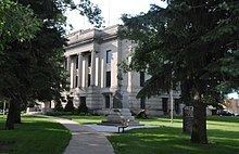 | ||
University Lake Area Technical Institute Points of interest Codington County Heritage, Redlin Art Center, Bramble Park Zoo, Lake Kampeska, Joy Ranch | ||
Codington County is a county located in the U.S. state of South Dakota. As of the 2010 census, the population was 27,227. Its county seat is Watertown. The county was created in 1877 and organized in 1878. It is named for Rev. George S. S. Codington, legislator.
Contents
- Map of Codington County SD USA
- Geography
- Major highways
- Adjacent counties
- 2000 census
- 2010 census
- City
- Towns
- Census designated place
- Unincorporated communities
- Townships
- References
Map of Codington County, SD, USA
Codington County comprises the Watertown, SD Micropolitan Statistical Area.
Geography
According to the U.S. Census Bureau, the county has a total area of 717 square miles (1,860 km2), of which 688 square miles (1,780 km2) is land and 29 square miles (75 km2) (4.0%) is water.
Major highways
Adjacent counties
2000 census
As of the census of 2000, there were 25,897 people, 10,357 households, and 6,877 families residing in the county. The population density was 38 people per square mile (15/km²). There were 11,324 housing units at an average density of 16 per square mile (6/km²). The racial makeup of the county was 96.74% White, 0.14% Black or African American, 1.41% Native American, 0.28% Asian, 0.02% Pacific Islander, 0.57% from other races, and 0.84% from two or more races. 1.06% of the population were Hispanic or Latino of any race. 48.2% were of German, 20.0% Norwegian and 5.5% Irish ancestry according to the 2000 census. 96.7% spoke English, 1.5% Spanish and 1.2% German as their first language.
There were 10,357 households out of which 33.60% had children under the age of 18 living with them, 54.50% were married couples living together, 8.10% had a female householder with no husband present, and 33.60% were non-families. 27.90% of all households were made up of individuals and 10.80% had someone living alone who was 65 years of age or older. The average household size was 2.46 and the average family size was 3.04.
In the county, the population was spread out with 26.80% under the age of 18, 10.40% from 18 to 24, 28.00% from 25 to 44, 20.70% from 45 to 64, and 14.10% who were 65 years of age or older. The median age was 35 years. For every 100 females there were 98.50 males. For every 100 females age 18 and over, there were 96.50 males.
The median income for a household in the county was $36,257, and the median income for a family was $45,153. Males had a median income of $30,279 versus $19,826 for females. The per capita income for the county was $18,761. About 5.60% of families and 9.00% of the population were below the poverty line, including 8.60% of those under age 18 and 10.80% of those age 65 or over.
2010 census
As of the 2010 United States Census, there were 27,227 people, 11,432 households, and 7,216 families residing in the county. The population density was 39.5 inhabitants per square mile (15.3/km2). There were 12,397 housing units at an average density of 18.0 per square mile (6.9/km2). The racial makeup of the county was 95.3% white, 2.0% American Indian, 0.4% Asian, 0.3% black or African American, 0.6% from other races, and 1.3% from two or more races. Those of Hispanic or Latino origin made up 1.6% of the population. In terms of ancestry, 54.3% were German, 22.6% were Norwegian, 9.6% were Irish, 6.7% were English, and 3.3% were American.
Of the 11,432 households, 30.7% had children under the age of 18 living with them, 49.9% were married couples living together, 9.0% had a female householder with no husband present, 36.9% were non-families, and 30.6% of all households were made up of individuals. The average household size was 2.35 and the average family size was 2.93. The median age was 37.7 years.
The median income for a household in the county was $43,275 and the median income for a family was $60,202. Males had a median income of $39,076 versus $26,945 for females. The per capita income for the county was $24,781. About 8.9% of families and 12.7% of the population were below the poverty line, including 13.7% of those under age 18 and 16.8% of those age 65 or over.
City
Towns
Census-designated place
Unincorporated communities
Townships
The county is divided into seventeen townships: