
Congressional district At-large Website grantcounty.sd.gov Founded 1873 Unemployment rate 3.6% (Apr 2015) | Area 1,782 km² Population 7,281 (2013) | |
 | ||
Rivers Caine Creek, Soo Creek, North Fork Yellow Bank River | ||
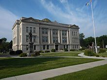
Grant County is a county located in the U.S. state of South Dakota. As of the 2010 census, the population was 7,356. The county seat is Milbank. The county was founded in 1873 and organized in 1878. It is named for Ulysses S. Grant, 18th President of the United States.
Contents
- Map of Grant County SD USA
- Geography
- Major highways
- Adjacent counties
- 2000 census
- 2010 census
- Cities
- Unincorporated communities
- Townships
- References
Map of Grant County, SD, USA
Geography
According to the U.S. Census Bureau, the county has a total area of 688 square miles (1,780 km2), of which 681 square miles (1,760 km2) is land and 6.1 square miles (16 km2) (0.9%) is water.
The lowest point in the state of South Dakota is located on Big Stone Lake at Big Stone City in Grant County, adjacent to Ortonville, Minnesota, where the lake flows into the Minnesota River.
Major highways
Adjacent counties
2000 census
As of the census of 2000, there were 7,847 people, 3,116 households, and 2,156 families residing in the county. The population density was 12 people per square mile (4/km²). There were 3,456 housing units at an average density of 5 per square mile (2/km²). The racial makeup of the county was 98.61% White, 0.01% Black or African American, 0.43% Native American, 0.23% Asian, 0.40% from other races, and 0.32% from two or more races. 0.55% of the population were Hispanic or Latino of any race. 52.0% were of German, 16.3% Norwegian and 5.4% American ancestry according to the 2000 census.
There were 3,116 households out of which 33.40% had children under the age of 18 living with them, 60.60% were married couples living together, 5.20% had a female householder with no husband present, and 30.80% were non-families. 28.60% of all households were made up of individuals and 15.00% had someone living alone who was 65 years of age or older. The average household size was 2.44 and the average family size was 3.02.
In the county, the population was spread out with 26.60% under the age of 18, 5.70% from 18 to 24, 25.10% from 25 to 44, 23.50% from 45 to 64, and 19.10% who were 65 years of age or older. The median age was 40 years. For every 100 females there were 97.70 males. For every 100 females age 18 and over, there were 96.10 males.
The median income for a household in the county was $33,088, and the median income for a family was $40,407. Males had a median income of $27,941 versus $20,192 for females. The per capita income for the county was $16,543. About 7.50% of families and 9.90% of the population were below the poverty line, including 9.80% of those under age 18 and 10.30% of those age 65 or over.
2010 census
As of the 2010 United States Census, there were 7,356 people, 3,089 households, and 2,076 families residing in the county. The population density was 10.8 inhabitants per square mile (4.2/km2). There were 3,526 housing units at an average density of 5.2 per square mile (2.0/km2). The racial makeup of the county was 97.1% white, 0.5% American Indian, 0.3% Asian, 0.1% black or African American, 1.1% from other races, and 0.8% from two or more races. Those of Hispanic or Latino origin made up 2.3% of the population. In terms of ancestry, 49.9% were German, 16.8% were Norwegian, 8.9% were Irish, 6.7% were Swedish, 5.6% were English, and 5.2% were American.
Of the 3,089 households, 28.1% had children under the age of 18 living with them, 57.2% were married couples living together, 6.1% had a female householder with no husband present, 32.8% were non-families, and 29.6% of all households were made up of individuals. The average household size was 2.35 and the average family size was 2.89. The median age was 45.1 years.
The median income for a household in the county was $42,625 and the median income for a family was $56,250. Males had a median income of $36,204 versus $25,567 for females. The per capita income for the county was $22,887. About 7.0% of families and 11.6% of the population were below the poverty line, including 13.8% of those under age 18 and 17.8% of those age 65 or over.
Cities
Unincorporated communities
Townships
The county is divided into seventeen townships: