
Country United States County Deuel Time zone Central (CST) (UTC-6) Elevation 564 m Population 106 (2013) | Incorporated 1880 Area code(s) 605 Zip code 57218 Local time Thursday 11:01 AM | |
 | ||
Weather -6°C, Wind N at 16 km/h, 65% Humidity | ||
Brandt is a town in Deuel County, South Dakota, United States. The population was 107 at the 2010 census.
Contents
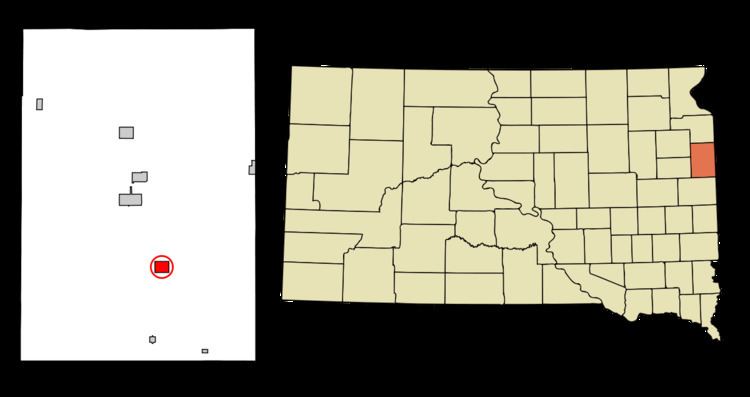
Map of Brandt, SD 57218, USA
History
Brandt was laid out in 1884. The town was named for the Rev. P.O. Brandt.
Geography
Brandt is located at 44°39′51″N 96°37′25″W (44.664256, -96.623601).
According to the United States Census Bureau, the town has a total area of 1.26 square miles (3.26 km2), all of it land.
Brandt has been assigned the ZIP code 57218, and the FIPS place code 06940. Brandt sits in the middle east of the county, and is 9 miles off I-29 which goes through the east side of South Dakota. Brandt is 76 miles N of Sioux Falls.
2010 census
As of the census of 2010, there were 107 people, 43 households, and 24 families residing in the town. The population density was 84.9 inhabitants per square mile (32.8/km2). There were 50 housing units at an average density of 39.7 per square mile (15.3/km2). The racial makeup of the town was 96.3% White, 0.9% from other races, and 2.8% from two or more races. Hispanic or Latino of any race were 3.7% of the population.
There were 43 households of which 20.9% had children under the age of 18 living with them, 48.8% were married couples living together, 4.7% had a female householder with no husband present, 2.3% had a male householder with no wife present, and 44.2% were non-families. 37.2% of all households were made up of individuals and 11.6% had someone living alone who was 65 years of age or older. The average household size was 2.49 and the average family size was 3.46.
The median age in the town was 35.8 years. 25.2% of residents were under the age of 18; 10.2% were between the ages of 18 and 24; 24.3% were from 25 to 44; 29% were from 45 to 64; and 11.2% were 65 years of age or older. The gender makeup of the town was 51.4% male and 48.6% female.
2000 census
As of the census of 2000, there were 113 people, 51 households, and 29 families residing in the town. The population density was 90.1 people per square mile (34.9/km²). There were 61 housing units at an average density of 48.6 per square mile (18.8/km²). The racial makeup of the town was 98.23% White, 0.88% African American, and 0.88% from two or more races.
There were 51 households out of which 33.3% had children under the age of 18 living with them, 47.1% were married couples living together, 3.9% had a female householder with no husband present, and 43.1% were non-families. 39.2% of all households were made up of individuals and 23.5% had someone living alone who was 65 years of age or older. The average household size was 2.22 and the average family size was 3.00.
In the town, the population was spread out with 27.4% under the age of 18, 7.1% from 18 to 24, 38.1% from 25 to 44, 13.3% from 45 to 64, and 14.2% who were 65 years of age or older. The median age was 36 years. For every 100 females there were 98.2 males. For every 100 females age 18 and over, there were 95.2 males.
The median income for a household in the town was $30,417, and the median income for a family was $31,250. Males had a median income of $23,750 versus $13,750 for females. The per capita income for the town was $15,358. There were 21.1% of families and 21.2% of the population living below the poverty line, including 47.4% of under eighteens and 13.6% of those over 64.