
Length 223.6 km | ||
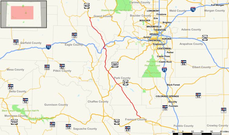 | ||
State Highway 9 (SH 9) in the U.S. state of Colorado is a 138-mile-long (222 km) state highway through central Colorado.
Contents
Map of CO-9, Colorado, USA
Route description
State Highway 9 starts at a junction with US 50 west of Cañon City. It heads northwest, following Currant Creek most of the way to Currant Creek Pass where it enters an open area known as South Park. The south fork of the South Platte is crossed as the highway enters Hartsel and a junction with US 24. SH 9 follows US 24 west for 0.5 mi (0.80 km), then splits off to head northwest again. Just south of Fairplay, it joins northbound US 285. At Fairplay SH 9 leaves US 285 to head northwest, following the middle fork of the South Platte most of the way to Hoosier Pass where it crosses the Continental Divide 11,532 ft (3,515 m) above sea level. Switchbacks drop the highway to the Blue River which it follows north through Breckenridge to Dillon Reservoir. The highway goes around the west side of the reservoir, through Frisco and joins I 70 as it heads northeast. At Silverthorne, SH 9 leaves I 70 to continue northwest alongside the Blue River. SH 9 crosses the Colorado River just before its termination at a junction with US 40 in Kremmling.