
Length 117.8 km | ||
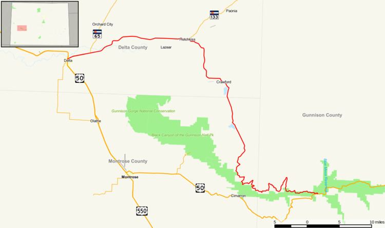 | ||
State Highway 92 is a stretch of highway that runs between the small Colorado communities of Hotchkiss and Sapinero. SH 92 is 73.22 miles (117.84 km) long.
Contents
Map of CO-92, Colorado, USA
Route description
From its southern terminus at U.S. Highway 50 at the town of Sapinero, the highway crosses the Gunnison River at Blue Mesa Reservoir. Proceeding westward, SH 92 quickly climbs a ridge high above the Gunnison River. This stretch of road lasts for 25 to 30 miles (48 km) before it veers northward toward Hotchkiss.
History
The route was established in the 1920s and was paved by 1975.
References
Colorado State Highway 92 Wikipedia(Text) CC BY-SA