
Length 30.33 km | ||
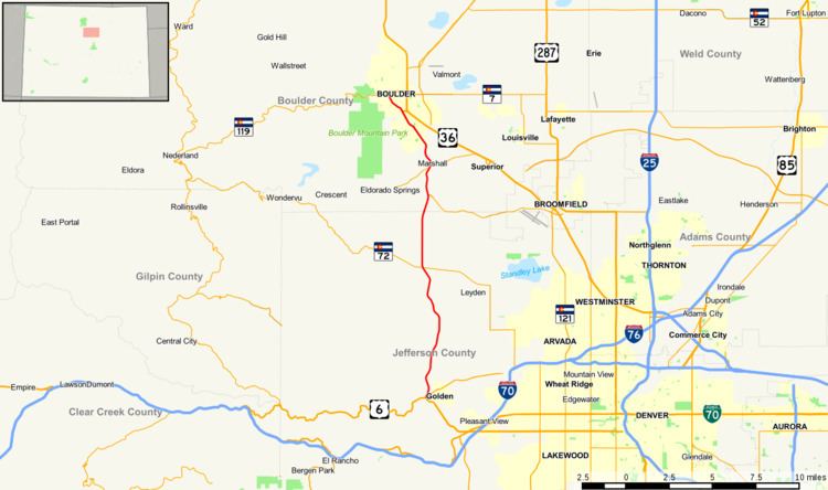 | ||
State Highway 93 is a highway in Colorado that connects Golden and Boulder.
Contents
Map of CO-93, Colorado, USA
Route description
SH 93 runs 18.8 miles (30.3 km), starting at its southern junction with U.S. Highway 6 at the entrance to Clear Creek Canyon in Golden. It runs north, just east of the mountains, ending at a junction with SH 119 in central Boulder.
References
Colorado State Highway 93 Wikipedia(Text) CC BY-SA