
Population 128,962 (2015 est) Area 257.1 km (99.3 sq mi) | Established 1897 Mayor Barry Sammels Local time Monday 1:26 PM | |
 | ||
Weather 29°C, Wind SW at 21 km/h, 54% Humidity Points of interest Penguin Island, Rockingham Wild Encounters, Cape Peron, Shoalwater Islands Marine P, Rockingham Lakes Regional | ||
The City of Rockingham is a local government area in the far southern suburbs of the Western Australian capital city of Perth.
Contents
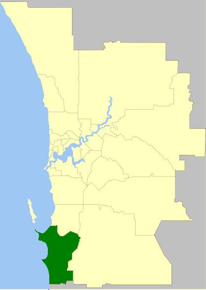
- Map of Rockingham WA Australia
- History
- Wards
- Suburbs
- Population
- Media
- Sport Recreation
- Sister cities
- References
Map of Rockingham, WA, Australia
History
In 1896, residents of Rockingham petitioned to establish a road board, which they proposed be called "Clarence" which was the name of the failed settlement of Thomas Peel at Woodman Point. The area at the time fell within the responsibility of the Fremantle District Road Board. The name "Clarence" was declined by the Department of Lands and Surveys, and the Rockingham Roads District was gazetted on 4 February 1897.
The agricultural hall on the corner of Flinders Lane and Kent Street in Rockingham was used for the Roads Board's administration until an office was constructed for the Roads Board on the corner of Office Road and Mandurah Road in East Rockingham in 1905. In 1929 the Board resolved to relocate the administration to Rockingham Beach and the various buildings, including the Agricultural Hall and the vacated Rockingham Beach Primary School building on Kent Street, were used as the Board's offices.
A new office was constructed for the Roads Board in 1946 on the corner of Flinders Lane and Kent Street.
In February 1954 the Kwinana Road District was formed from the northern portion of the Rockingham Road District.
On 1 July 1961, the Road District became the Shire of Rockingham following enactment of the Local Government Act 1960. In 1971, the Shire relocated to new offices on Council Avenue on land donated by developers Rockingham Park Pty Ltd 2 km southeast of the traditional centre of Rockingham Beach, which was to become the new major centre of Rockingham and Kwinana. The Rockingham City Shopping Centre opened in the new centre in 1971. Despite the move to the new "city centre," the community apparently considered Rockingham Beach to be the rightful civic heart of Rockingham, as evidenced by the Shire's decision to construct Flinders Hall on Flinders Lane, despite the new Council offices being constructed in the same year.
On 12 November 1988 the Council attained City status. In 1994, the City relocated to new Council chambers and civic centre on Civic Boulevard.
In 2008, the Council adopted a plan for the Rockingham Strategic Regional (or Primary) Centre which incorporated both the traditional centre at Rockingham Beach and the "City Centre" of the 1970s into a larger, encompassing centre. The plan seeks to increase the residential population within this new city centre envelope from 12,000 to 36,000 through the provision of transit-oriented development, which would in turn support the operation of light rail between the Rockingham Train Station and Rockingham Beach.
Wards
The city has been divided into 4 wards. The mayor is elected from among the councillors.
Suburbs
Population
In 1954, Kwinana was excised from Rockingham.
Media
Rockingham is serviced by two local newspapers: The Sound Telegraph is delivered every Wednesday, and the Weekend Courier on Fridays.
Rockingham's local radio station is 104.1 Rock FM. The internet radio station broadcasts 24 hours a day on its website, and on the Stickam social networking service.
Sport & Recreation
Rockingham is home to the Rockingham Rams in the Peel Football League, Rockingham City FC in the Football West State League, the Rockingham Rugby Union club in the RugbyWA competition. Rockingham Flames in the State Basketball League and the Rockingham Coastal Sharks in the Western Australia Rugby League.
Sister cities
The City of Rockingham has two active affiliations to which it is a signatory, being: