
Population 110,500 (1992) Founded 1863 | Established 1863 Area 99.7 km² | |
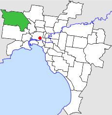 | ||
The City of Keilor was a local government area about 13 kilometres (8 mi) northwest of Melbourne, the state capital of Victoria, Australia. The city covered an area of 99.70 square kilometres (38.49 sq mi), and existed from 1863 until 1994.
Contents
History
Keilor was first incorporated as a road district on 3 March 1863. It became a shire on 22 December 1871, and was proclaimed a city on 29 April 1961. Its boundaries were relatively stable throughout its existence.
On 15 December 1994, the City of Keilor was abolished, and its area divided by the Maribyrnong River and the Albion-Jacana freight railway line; its eastern section was merged with the City of Essendon, to form the newly created City of Moonee Valley, while its western section was merged with parts of the City of Sunshine, including St Albans, to form the newly created City of Brimbank. Melbourne Airport and a small section of Tullamarine, north of Sharps Road, were transferred to the City of Hume.
Wards
The City of Keilor was divided into three wards, each electing three councillors:
Suburbs
* Suburb gazetted since the amalgamation.
Population
* Estimate in the 1958 Victorian Year Book.