
Population 42,500 (1992) Founded 1862 | Established 1862 Area 422.2 km² | |
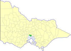 | ||
The Shire of Bulla was a local government area located about 40 kilometres (25 mi) northwest of Melbourne, the state capital of Victoria, Australia. The shire covered an area of 422.17 square kilometres (163.0 sq mi), and existed from 1862 until 1994.
Contents
History
The Bulla Road District was created on 16 September 1862. It became a shire on 9 March 1866. It gained some territory from the Shire of Broadmeadows in 1955, including then-rural areas such as Craigieburn. The Shire Offices were transferred from Bulla to Sunbury in 1956.
On 15 December 1994, the Shire of Bulla was abolished, and, along with sections of the City of Broadmeadows north of the Western Ring Road and parts of the Cities of Keilor and Whittlesea, was merged into the newly created City of Hume.
Council formerly met at the Shire Offices, in Sunbury. The facility is used today by the City of Hume, Western Water and VicRoads.
Wards
The Shire of Bulla was divided into four ridings on 1 April 1985, each of which elected three councillors:
Suburbs and localities
Population
* Estimate in the 1958 Victorian Year Book.
+ Includes population gained from City of Broadmeadows in 1955.