
Founded September 1, 1851 Area 1,145 km² | Website www.co.chisago.mn.us Population 53,761 (2013) | |
 | ||
University Hazelden Betty Ford Graduate School of Addiction Studies Points of interest Franconia Sculpture Park, Interstate State Park, Ojiketa Regional Park, Folsom House, Ki Chi Saga Park Destinations | ||
Chisago County (/ʃᵻˈsɑːɡoʊ/ shə-SAH-go) is a county located in the U.S. state of Minnesota. As of the 2010 census, the population was 53,887. Its county seat is Center City. The county's name comes from Chisago Lake.
Contents
- Map of Chisago County MN USA
- History
- Geography
- Major highways
- Adjacent counties
- National protected area
- Climate and weather
- 2010 census
- 2000 census
- Education
- Unincorporated communities
- Arts and culture
- References
Map of Chisago County, MN, USA
Chisago County is included in the Minneapolis-St. Paul-Bloomington, MN-WI Metropolitan Statistical Area.
History
Chisago County was organized in 1851. It took its name from Chisago Lake.
Geography
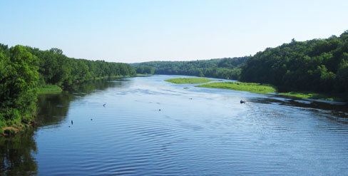
According to the U.S. Census Bureau, the county has a total area of 442 square miles (1,140 km2), of which 415 square miles (1,070 km2) is land and 28 square miles (73 km2) (6.2%) is water. Examples of native vegetation in the county: https://commons.wikimedia.org/wiki/File:Wild_River_State_Park_New_Wiki_Version.jpg
Major highways
Adjacent counties
National protected area
Climate and weather
In recent years, average temperatures in the county seat of Center City have ranged from a low of 2 °F (−17 °C) in January to a high of 84 °F (29 °C) in July, although a record low of −38 °F (−39 °C) was recorded in January 1977 and a record high of 104 °F (40 °C) was recorded in July 1988. Average monthly precipitation ranged from 0.89 inches (23 mm) in January to 4.48 inches (114 mm) in June.
2010 census
As of the 2010 census, there were 53,887 people, 19,470 households, and 14,389 families residing in the county. The population density was 122 people per square mile (47/km²). There were 21,172 housing units at an average density of 48 per square mile (18/km²). The racial makeup of the county was 95.80% White, 1.20% Black or African American, 0.60% Native American, 0.90% Asian, 0.01% Pacific Islander, 0.30% from other races, and 1.20% from two or more races. 1.50% of the population were Hispanic or Latino of any race.
There were 19,470 households out of which 37.20% had children under the age of 18 living with them, 61.00% were married couples living together, 7.90% had a female householder with no husband present, and 26.10% were non-families. 20.30% of all households were made up of individuals and 8.60% had someone living alone who was 65 years of age or older. The average household size was 2.68 and the average family size was 3.09.
In the county, the population was spread out with 25.70% under the age of 18, 7.30% from 18 to 24, 26.80% from 25 to 44, 28.60% from 45 to 64, and 11.60% who were 65 years of age or older. The median age was 39 years. For every 100 females there were 101.60 males. For every 100 females age 18 and over, there were 101.50 males. The per capita income for the county was $29,293. About 6.20% of the population was below the poverty line.
2000 census
As of the 2000 census, there were 41,101 people, 14,454 households, and 11,086 families residing in the county. The population density was 98 people per square mile (38/km²). There were 15,533 housing units at an average density of 37 per square mile (14/km²). The racial makeup of the county was 97.21% White, 0.51% Black or African American, 0.45% Native American, 0.70% Asian, 0.03% Pacific Islander, 0.31% from other races, and 0.80% from two or more races. 1.15% of the population were Hispanic or Latino of any race. 31.3% were of German, 18.1% Swedish, 11.3% Norwegian and 6.9% Irish ancestry.
There were 14,454 households out of which 41.00% had children under the age of 18 living with them, 64.50% were married couples living together, 8.00% had a female householder with no husband present, and 23.30% were non-families. 18.40% of all households were made up of individuals and 7.40% had someone living alone who was 65 years of age or older. The average household size was 2.79 and the average family size was 3.18.
In the county, the population was spread out with 30.20% under the age of 18, 7.10% from 18 to 24, 32.20% from 25 to 44, 20.70% from 45 to 64, and 9.80% who were 65 years of age or older. The median age was 34 years. For every 100 females there were 103.90 males. For every 100 females age 18 and over, there were 101.70 males.
The median income for a household in the county was $52,012, and the median income for a family was $57,335. Males had a median income of $40,743 versus $27,653 for females. The per capita income for the county was $21,013. About 3.20% of families and 5.10% of the population were below the poverty line, including 5.40% of those under age 18 and 8.00% of those age 65 or over.
Education
Unincorporated communities
Arts and culture
Chisago County is, like many other counties in Minnesota, strongly influenced by the German, Swedish and Norwegian immigrants that settled there in the middle of the 19th century. It provided the setting for much of Swedish author Vilhelm Moberg's The Emigrants suite of novels in the 1950s, and Moberg engaged in both archival and oral history research in preparation for his books to recreate the early Swedish immigration in the area. Sculptor Ian Dudley's bronze statue of the author, holding his bicycle as if ready to ride away, stands on a stepped platform in Chisago City’s town park. His fictional characters Karl-Oskar and Kristina Nilsson from Ljuder parish in Småland settled around the Lake Ki-Chi-Saga (from the Ojibwe language Ki-chi-saga-igun (Gichi-zaaga'igan in the contemporary spelling) meaning "Big Lake-with-an-outlet," which was later shortened to Lake Chisago). The heritage of the early settlers is still honored by the annual Karl Oskar Days in Lindström.