
Website www.kanabeccounty.org Population 15,996 (2013) | Area 1,383 km² Unemployment rate 7.5% (Apr 2015) | |
 | ||
Founded March 13, 1858 (created)1882 (organized) Named for The Ojibwe word for "snake," after the Snake River Rivers Snake River, Groundhouse River, Little Ann River | ||
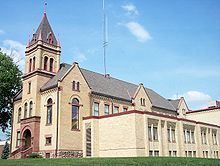
Kanabec County (/kəˈneɪbᵻk/ kə-NAY-bək) is a county located in the U.S. state of Minnesota. As of the 2010 census, the population was 16,239. Its county seat is Mora, although the original county seat was Brunswick. The county was founded on March 13, 1858 from Pine County and organized in 1882. It is named after the Ojibwe Ginebig, meaning "Snake," after the Snake River — Kanabecosippi (Ginebigo-ziibi in the modern spelling) — which flows through this county.
Contents
- Map of Kanabec County MN USA
- Geography
- Major highways
- Adjacent counties
- Demographics
- Cities
- Unincorporated communities
- References
Map of Kanabec County, MN, USA
Geography
According to the U.S. Census Bureau, the county has a total area of 534 square miles (1,380 km2), of which 522 square miles (1,350 km2) is land and 12 square miles (31 km2) (2.3%) is water.
Major highways
Adjacent counties
Demographics
As of the census of 2010, there were 16,239 people and 6,277 households in the county. The population density was 31.1 people per square mile (11/km²). There were 7,808 housing units (2014 estimate). The racial makeup of the county was 96.6% White, 0.6% Black or African American, 0.8% Native American or Alaska Native, 0.4% Asian, <0.1% Pacific Islander or Native Hawaiian, and 1.6% from other races or two or more races. 1.7% of the population were Hispanic or Latino of any race. As of the 2000 census, 30.2% were of German, 18.1% Swedish, 13.1% Norwegian, 5.5% American and 5.4% Irish ancestry.
In the census of 2000, there were 5,759 households out of which 34.10% had children under the age of 18 living with them, 58.80% were married couples living together, 8.40% had a female householder with no husband present, and 28.00% were non-families. 23.80% of all households were made up of individuals and 10.30% had someone living alone who was 65 years of age or older. The average household size was 2.58 and the average family size was 3.03.
In the county, the population was spread out with 24.0% under the age of 18 and 16.4% who were 65 years of age or older. For every 100 females there were 101.2 males.
The median income for a household in the county was $47,068. The per capita income for the county was $22,291. About 14.2% of the population were below the poverty line.