
Country United States Elevation 751 ft (229 m) Area code(s) 651 Zip code 55084 | County Chisago Time zone Central (CST) (UTC-6) FIPS code 27-64318 Population 973 (2013) | |
 | ||
Weather 10°C, Wind N at 6 km/h, 62% Humidity Points of interest Interstate State Park, Folsom House, Visitors Center - MN Interstate | ||
Taylors Falls is a city in Chisago County, Minnesota, United States, located at the junction of U.S. Highway 8 and Minnesota State Highway 95. The population was 976 at the 2010 census.
Contents
- Map of Taylors Falls MN 55084 USA
- History
- Geography
- 2010 census
- 2000 census
- Notable structures
- Points of interest
- In popular culture
- References
Map of Taylors Falls, MN 55084, USA
History
Taylors Falls was platted in 1850 or 1851, and incorporated in 1858. The city was named for Jesse Taylor, a territorial politician. A post office has been in operation in Taylors Falls since 1851.
Geography
According to the United States Census Bureau, the city has a total area of 4.39 square miles (11.37 km2), of which, 4.10 square miles (10.62 km2) is land and 0.29 square miles (0.75 km2) is water.
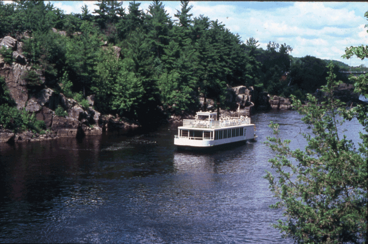
Taylors Falls is located adjacent to St. Croix Falls, Wisconsin, at the Dalles of the St. Croix River, an area of forested bluffs and high cliffs. The first interstate state park in the United States, aptly named Interstate Park, was jointly founded by the states of Minnesota and Wisconsin in 1895, and straddles the border of the two states immediately south of the city.
2010 census
As of the census of 2010, there were 976 people, 413 households, and 261 families residing in the city. The population density was 238.0 inhabitants per square mile (91.9/km2). There were 457 housing units at an average density of 111.5 per square mile (43.1/km2). The racial makeup of the city was 94.4% White, 0.6% African American, 0.7% Native American, 2.5% Asian, 0.4% from other races, and 1.4% from two or more races. Hispanic or Latino of any race were 0.5% of the population.
There were 413 households of which 30.0% had children under the age of 18 living with them, 47.7% were married couples living together, 9.7% had a female householder with no husband present, 5.8% had a male householder with no wife present, and 36.8% were non-families. 29.8% of all households were made up of individuals and 8.9% had someone living alone who was 65 years of age or older. The average household size was 2.35 and the average family size was 2.89.
The median age in the city was 41.7 years. 23.7% of residents were under the age of 18; 6.7% were between the ages of 18 and 24; 23.5% were from 25 to 44; 30% were from 45 to 64; and 16.1% were 65 years of age or older. The gender makeup of the city was 48.6% male and 51.4% female.
2000 census
As of the census of 2000, there were 951 people, 369 households, and 247 families residing in the city. The population density was 255.6 people per square mile (98.7/km²). There were 386 housing units at an average density of 103.7 per square mile (40.1/km²). The racial makeup of the city was 91.48% White, 0.32% Native American, 7.05% Asian, 0.21% Pacific Islander, 0.21% from other races, and 0.74% from two or more races. Hispanic or Latino of any race were 0.74% of the population.
There were 369 households out of which 34.7% had children under the age of 18 living with them, 51.2% were married couples living together, 12.2% had a female householder with no husband present, and 32.8% were non-families. 26.0% of all households were made up of individuals and 11.7% had someone living alone who was 65 years of age or older. The average household size was 2.57 and the average family size was 3.11.
In the city, the population was spread out with 29.8% under the age of 18, 7.5% from 18 to 24, 29.5% from 25 to 44, 19.3% from 45 to 64, and 13.9% who were 65 years of age or older. The median age was 35 years. For every 100 females there were 96.5 males. For every 100 females age 18 and over, there were 87.6 males.
The median income for a household in the city was $35,250, and the median income for a family was $39,886. Males had a median income of $40,357 versus $24,250 for females. The per capita income for the city was $17,615. About 11.5% of families and 20.0% of the population were below the poverty line, including 35.4% of those under age 18 and 9.5% of those age 65 or over.
Notable structures
Taylors Falls has the oldest public school in Minnesota, built in 1852. Other notable structures include the Folsom House, located in the historic Angel Hill District, and the Taylors Falls Public Library.
Points of interest
The town also includes a ski and snowboard resort, Wild Mountain. The Resort, which is also a water park in the summer months, is located 7.4 miles north of downtown Taylors Falls and 61 miles from Downtown Minneapolis. The site has 26 ski hills spread over 100 acres of land. It also boasts as being the first ski resort to open in Minnesota every year.
In popular culture
Taylors Falls was the location where the main characters of the Swedish novel The Emigrants settled.