
Car plates GBY | Area 2,193 km² | |
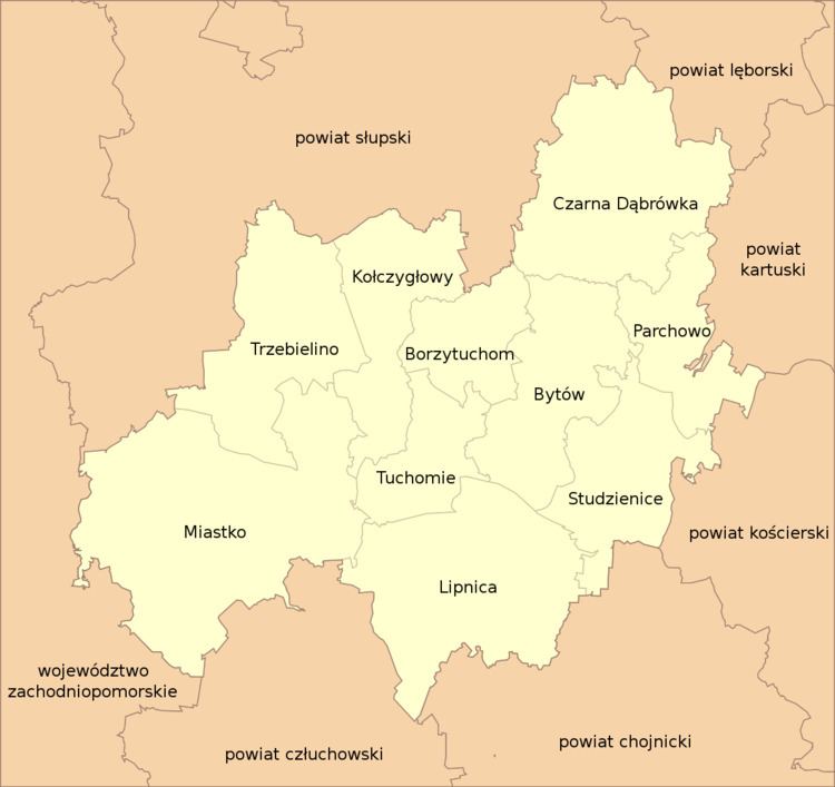 | ||
Gminas Total 10Gmina BorzytuchomGmina BytówGmina Czarna DąbrówkaGmina KołczygłowyGmina LipnicaGmina MiastkoGmina ParchowoGmina StudzieniceGmina TrzebielinoGmina Tuchomie Points of interest Burg Bütow, Bytów Castle, Brda, Elektrownia Wodna Struga, Rezerwat przyrody Jeziorka | ||
Bytów County (Kashubian: bëtowsczi pòwiat, Polish: powiat bytowski) is a unit of territorial administration and local government (powiat) in Pomeranian Voivodeship, northern Poland. It came into being on January 1, 1999, as a result of the Polish local government reforms passed in 1998. Its administrative seat and largest town is Bytów, which lies 79 kilometres (49 mi) west of the regional capital Gdańsk. The only other town in the county is Miastko, lying 37 km (23 mi) west of Bytów.
Contents
Map of Byt%C3%B3w County, Poland
The county covers an area of 2,192.81 square kilometres (846.6 sq mi). As of 2006 its total population is 75,313, out of which the population of Bytów is 16,715, that of Miastko is 10,987, and the rural population is 47,611.
Bytów County on a map of the counties of Pomeranian Voivodeship
Bytów County is bordered by Słupsk County to the north, Lębork County to the north-east, Kartuzy County and Kościerzyna County to the east, Chojnice County and Człuchów County to the south, and Szczecinek County and Koszalin County to the west.
Administrative division
The county is subdivided into 10 gminas (two urban-rural and eight rural). These are listed in the following table, in descending order of population.