
Car plates GKS | Area 1,166 km² | |
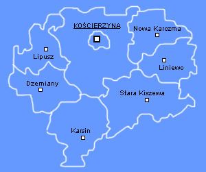 | ||
Gminas Total 8 (incl. 1 urban)KościerzynaGmina DziemianyGmina KarsinGmina KościerzynaGmina LiniewoGmina LipuszGmina Nowa KarczmaGmina Stara Kiszewa Points of interest Musée‑parc ethnographique des Cach, Skansen Parowozownia Kościerzyna, Rezerwat przyrody Kręgi Ka, Muzeum Ziemi Kościersk, Kamienne Kręgi Destinations | ||
Kościerzyna County (Polish: powiat kościerski) is a unit of territorial administration and local government (powiat) in Pomeranian Voivodeship, northern Poland. It came into being on January 1, 1999, as a result of the Polish local government reforms passed in 1998. Its administrative seat and only town is Kościerzyna, which lies 51 kilometres (32 mi) south-west of the regional capital Gdańsk. Its borders equal approximately the borders of the old Marquessate of Berent in the German Empire.
Contents
Map of Ko%C5%9Bcierzyna County, Poland
The county covers an area of 1,165.85 square kilometres (450.1 sq mi). As of 2006 its total population is 66,778, out of which the population of Kościerzyna is 23,016 and the rural population is 43,762.
Kościerzyna County on a map of the counties of Pomeranian Voivodeship
Kościerzyna County is bordered by Kartuzy County to the north, Gdańsk County and Starogard County to the east, Chojnice County to the south, and Bytów County to the west.
Administrative division
The county is subdivided into eight gminas (one urban and seven rural). These are listed in the following table, in descending order of population.