
Car plates ZSZ | Area 1,765 km² | |
 | ||
Gminas Total 6 (incl. 1 urban)SzczecinekGmina BarwiceGmina Biały BórGmina Borne SulinowoGmina GrzmiącaGmina Szczecinek Points of interest Muzeum Regionalne w Szczeci, Dom Oficera, Prywatna Izba Muzealna, Ratusz, Wieża św Mikołaja | ||
Szczecinek County (Polish: powiat szczecinecki) is a unit of territorial administration and local government (powiat) in West Pomeranian Voivodeship, north-western Poland. It came into being on January 1, 1999, as a result of the Polish local government reforms passed in 1998. Its administrative seat and largest town is Szczecinek, which lies 143 kilometres (89 mi) east of the regional capital Szczecin. The county contains three other towns: Borne Sulinowo, 19 km (12 mi) south-west of Szczecinek, Barwice, 23 km (14 mi) west of Szczecinek, and Biały Bór, 23 km (14 mi) north-east of Szczecinek.
Contents
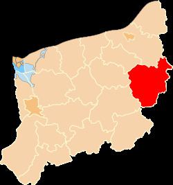
Map of Szczecinek County, Poland
The county covers an area of 1,765.22 square kilometres (681.6 sq mi). As of 2006 its total population is 77,232, out of which the population of Szczecinek is 38,756, that of Borne Sulinowo is 4,224, that of Barwice is 3,838, that of Biały Bór is 2,127, and the rural population is 28,287.
Neighbouring counties
Szczecinek County is bordered by Koszalin County to the north, Bytów County to the north-east, Człuchów County to the east, Złotów County to the south, Drawsko County and Świdwin County to the west, and Białogard County to the north-west.
Administrative division
The county is subdivided into six gminas (one urban, three urban-rural and two rural). These are listed in the following table, in descending order of population.