
Gmina Brzeg (urban gmina) Elevation 150 m (490 ft) Area 16 km² | County Brzeg County Town rights 1248 Demonym(s) Brzeżanin Population 36,381 (2015) Local time Sunday 4:28 AM | |
 | ||
Weather 12°C, Wind S at 14 km/h, 59% Humidity University Wyższa Szkoła Humanistyczno-Ekonomiczna w Brzegu | ||
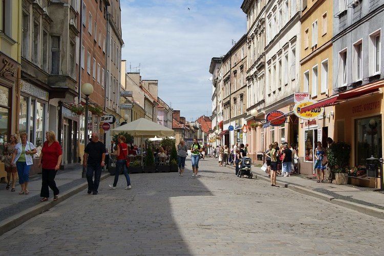
Brzeg ([bʐɛk]; former German name: Brieg) is a town in southwestern Poland with 36,381 inhabitants (2015) and the capital of Brzeg County. It is situated in Silesia in the Opole Voivodeship on the left bank of the Oder.
Contents
- Map of Brzeg Poland
- Etymology
- Prehistory
- Silesian period and foundation
- Middle Ages and Early Modern period
- Late modern and contemporary
- Traditional Garrison Town
- History of the Jewish population
- Status
- Topography
- Settlement and trade
- Environment
- History
- Main sights
- Industry
- Tourism
- Education
- Transport
- Sports
- Notable people
- Twin towns and sister cities
- References
Map of Brzeg, Poland
The town of Brzeg was first mentioned as a trading and fishing settlement in the year 1234. In 1248, Duke Henry III the White granted the settlement town rights and by the late 13th century the city became fortified. During the interwar period, Brzeg, often referred to as “the garden town”, was considered one of the most beautiful locations on the Oder River. Its size greatly expanded after the construction of dwelling houses which were located on the city outskirts.
Towards the end of World War II, in February 1945, the Soviet army captured Brzeg, which resulted in moderate destruction of the town's buildings and infrastructure. In accordance with the Yalta and Potsdam agreements, the area was annexed by Poland. Subsequently the town’s German population was deported and replaced with Polish settlers from the Eastern Borderlands. Since 1950 the reconstructed town has been a part of the Opole Voivodeship.
Etymology
Brzeg was in earlier documents referred to as Civitas Altae Ripae, meaning "city at high banks" of the Oder (Odra) river; its name is derived from the Polish Brzeg (shore). The historian Konstanty Darmot (1841-1895), in his book of the etymology of Silesian localities, states that in a Latin document from 1234, the settlement's name was Visoke breg (Polish: Wysokibrzeg; German: Wissokembreghe) (High Bank).
Prehistory
The locality in and around present-day Brzeg has been settled by people since the Mesolithic era, with the earliest signs of settlement between 8000–4200 BC, as concluded from archaeological findings in Myślibórz, Kościerzyce, Lubsza and Lipki. The early human populous left behind traces of lithic flakes, flint flakes and other flint related tools. The earliest signs of agriculture come around during the Neolithic Era (4200–1700 BC). The Neolithic culture developed agriculture and domesticated farm animals; this lifestyle led Nomadic cultures to settle in the locality. The era saw the development of weaving, pottery and mining in the Brzeg Plain, with archaelogical finds in Brzeg, Buszyce, Prędocin, Lewin Brzeski, Małujowice, Lipki, Myśliborze, Mąkoszyce and Obórki.
The time period of 1300–700 BC bears the existence of the Lusatian culture of the late Bronze Age and the early Iron Age. Tribes of the Lusatian culture were Orthodox, being the ancestors of the early Slavic peoples. The culture settled in the region and in large continued to develop agriculture and the domestication of farm animals. The natural economy of the culture was based on weaving, pottery and metal works. The Lusatian culture's populous that inhabited the Brzeg Lands was identified by archaeological excavations, revealing 17 individual localities, including 3 hamlets and 8 burial sites, namely a gord in Rybna and an open-pit crematory in Pisarzowice (with 30 discovered burial sites).
To follow the Lusatian culture, which witnessed its declension around 500 BC, were the Celts, around 400–300 BC in Silesia, as identified with archaeological findings in Lubsza and Pawłów (located in the eastern vicinity of Brzeg). Around 100 BC, the peoples of Silesia began trading with the Roman Empire, as evidenced through the findings of Roman currency in the locality. By 500 AD, the Slav peoples, settling in this region of Europe at the turn of the new millenium increased the locality's economic development, as evidenced through Iron tools and the blacksmith-based hamlets found in Kantorowice and Pępice.
Silesian period and foundation
The ages of 500–1000 AD saw the establishment of the early feudal system in Silesia. The era was characteristic of the establishment of gord settlements, towns and the continued development of trade and crafts. It is believed the permanent populous around modern-day Brzeg was set up by Silesian tribes. The first mention of the Silesian tribes is made in the mid-ninth-century document known as the Bavarian Geographer (Latin: Geographus Bavarus), which included the Silesian gord of Ryczyn, located 8.3 km north-west of Brzeg, in the eastern Oława County. The Ryczyn gords became the main line of defence for the Silesians, namely to protect the river trade routes along the River Oder and the land trade route between Ryczyn (the locality's administrative centre, home to a castellan) and Brzeg (being some 10 km in length). The importance of the Ryczyn gords is demonstrated by Henry V of the Holy Roman Empire's army halting their advancement before the gords in 1109.
Between the ninth and early-tenth century, the Brzeg Lands, together with that of Silesia, were part of the Kingdom of Great Moravia until its demise in 906 AD, after which, until 990 the region was under the rule of the Przemyslids. Around the year 990, Silesia was annexed into Mieszko I's Poland. During the Fragmentation of Poland (1138–c. 1314), the area of the Brzeg Lands, together with Silesia, came under the control of King of Poland, Bolesław III Wrymouth's oldest son, Władysław II the Exile.
The most favourable area for the settlement of Brzeg is located between the Castle Square (Plac Zamkowy), with elevated ground extending south-east towards the Square of the American Polonia (Plac Polonii Amerykańskiej). Before the town's foundation, three separate settlements existed in its modern-day territory, with "Wysoki Brzeg" (Alta ripa) bearing the main administration role in the region. Between the late-twelfth and early-thirteen century, the Dukes of Wrocław set up a curia, led by a claviger. In 1235, Henry the Bearded occupied the area around Oława, by which Walloons had to turn over a tribute of 1 scale of grain and of oat to the settlement of Brzeg, suggesting the existence of a granary and other outbuildings in the curia's established headquarters.
Some two-hundred metres south-west from the curia was the former location, on what was later to be called Mary's Hill (Góra Marii), the Romanesque St. Mary's Church (Kościół Najświętszej Marii Panny). During the Reformation, the church was deconstructed, and its brickwork used for the construction of the town's fortifications. A chronicle from the sixteenth-century states it was "the first church", however, no more is known about the holy site. Historians believe the founder of the church may have been Bolesław I the Tall or Henry the Bearded. Around the peripheries of the settlement, was the location of several hospital buildings. Towards the route to Wrocław in the town's west, was the location of the Hospital of the Holy Ghost (Świętego Ducha), used for both to cure the town's dwellers and as an inn for travellers along the Wrocław-Opole route the town of Brzeg was located in the middle of, with an average walking distance between each town taking one day. The area around the Holy Ghost Hospital, present-day Moniuszko Square (Plac Moniuszki), was the location of a major market, positioned by the cross roads of the Wrocław–Nysa route, east of the Wrocławska Gate. By the end of the thirteenth-century, the Duke of Brzeg possessed 10 shambles. The market is believed to be characteristic of other Silesian towns, commonly selling agricultural produce, namely bread, meat and shoes. Prior to the locality receiving its town charter in 1248 or 1250, the settlement had characteristics of a town and not of an ordinary fishing village, being referred to as "civitas" in an early Latin document, as exemplified by the existence of the curia, church and a major market, allowing the settlement to develop through the exchange of produce and barter.
Prior to Brzeg receiving its town charter, the Duke of Wrocław, Henry III the White, received the settlement of Małkowice, (present-day Kępa Młyńska), in exchange of his feudal rights over Zębice (south-west from Oława). The fishermen living in Małkowice (present-day ul. Rybacka), in accordance to ancient Polish law were charged with the task of protecting the Ducal Castle along the riverside. By the turn of the thirteenth century, the defenceless populous living in the pastures of the Brzeg Plain began to relocate into the fortified Visoke breg, building up a new osiedle around the present-day streets of: ul. Łokietka, Piastowska and Trzech Kotwic (extending in the south-east direction). The osiedle was documented as Stary Brzeg (Antiqua Brega; Alt Brieg), to be renamed Wieś Brzeska: Brygischedorf (c. 1329) and villa Bregensis in c. 1339. To the west of the fortified centre of Brzeg, the settlement of Rataje (a separate village until 1975) as the former village's etymology suggests, centered around the upkeep of the ducal pastures.
Middle Ages and Early Modern period
The town received municipal rights in 1250 from the Wrocław Duke Henry III the White, and was fortified in 1297. While in power, Henry III, granted the town (by a singular payment) the forest around the locality of Lubsza. His successor, Henryk IV the Righteous regulated the town's church affairs, as well as renouncing his patronage over St. Mary's Church (Kościół Św. Marii Panny), located west of the town's western boundary. The church was granted to the Order of Saint John, subsequently founding the Church of St. Nicholas in 1292.
From 1311-1675 Brzeg was the capital of a Lower Silesian duchy (Duchy of Brzeg) ruled by the Piast dynasty, a branch of the dukes of Lower Silesia, one of whom built a castle in 1341. Much of Silesia was part of the Kingdom of Bohemia during the Middle Ages. The town was burned by the Hussites in 1428 and soon afterwards rebuilt.
In 1595 Brieg was again fortified by Joachim Frederick of Brieg and Liegnitz. In the Thirty Years' War it suffered greatly; in the War of the Austrian Succession it was heavily bombarded by the Prussian forces; and in 1807 it was captured by Napoleon's army. When Bohemia fell to the Habsburg Monarchy of Austria in 1526, the town fell under the overlordship of the Habsburgs in their roles of Kings of Bohemia, although it was still ruled locally by the Silesian Piasts. Upon the extinction of the last duke George William of Legnica in 1675, Brieg came under the direct rule of the Habsburgs.
Late modern and contemporary
In 1537 the duke Frederick II of Legnica concluded a treaty with Elector Joachim II of Brandenburg, whereby the Hohenzollerns of Brandenburg would inherit the duchy upon the extinction of the Silesian Piasts. On the death of George William the last duke in 1675, however, Austria refused to acknowledge the validity of the treaty and annexed the duchies and Frederick the Great of the Kingdom of Prussia used this treaty to justify his claim at the invasion of Silesia during the War of the Austrian Succession in 1740. Brieg and most of Silesia were annexed by Prussia in 1741 during the First Silesian War. In 1807 the town's fortifications were pulled down by Napoleon's army. The Prussian Province of Silesia, and thus Brieg, consequently became part of the German Empire when it was proclaimed in 1871 on the unification of Germany.
During World War II, 60% of Brieg was destroyed and many of the town's inhabitants died during the severe winter of 1944-5 as they fled from the advancing Red Army, in its entire history the war had brought the most severe destruction to the town. Some of the town's population was evacuated by the German Army who moved its population further west into Germany for safety and declared Brieg "Festung Brieg" (Fortification Brieg). After the fall of the town to the Soviets the remaining German population were later subject to harassment and expulsion (see Expulsion of Germans after World War II). After the war, the Potsdam Conference placed Silesia, and thus the town, under Polish administration. Subsequently, Brzeg and Lower Silesia were repopulated by Polish whom Soviets expelled from the eastern part of prewar Poland.
Traditional Garrison Town
From the late 19th century the then German town of Brieg had expanded into a traditional military garrison town, from 1897 until 1919 it was the home town base to Infantry Regiment No. 157 designated from 1902 the 4th Silesian Infantry Regiment No. 157 (4. Schlesisches Infanterie-Regiment Nr. 157) of the Royal Prussian Army and respectively the Imperial German Army. In 1914 under the regiment's last peacetime commander Lieutenant General Paul Tiede the regiment began mobilizing for the Western Front at the outbreak of World War I as part of VI Army Corps (VI. Armee-Korps), 12th Division (12. Division), 78th Infantry Brigade (78. Infanterie-Brigade).
At the end of World War I the garrison barracks at Brieg remained for some years after without a stationed military regiment. The Imperial German Army Air Arm (Luftstreitkräfte) military aerodrome (Fliegerhorst) found in nearby Grüningen was furthermore dismantled and destroyed as part of the Treaty of Versailles. It was not until 4 August 1930 that the 5th Squadron of Cavalry Regiment No. 8 (5. Schwadron Reiterregiments Nr. 8) of the German Reichswehr arrived in Brieg from Breslau-Carlowitz, other cavalry squadrons from Militsch and Oels followed shortly after. This resulted in the garrison's Tiede-Barracks (named after Generalleutnant Paul Tiede) located in Moltke-, Sedan-, Roon- und Bismarckstraße requiring some alterations to accommodate the new arrival of horse-cavalry residents. It was from Brieg garrison, the German Cavalry Captain (Rittmeister) Konrad Freiherr von Wangenheim became famous for securing a Gold medal win at the 1936 Summer Olympics in Berlin for the German equestrian team whilst suffering with a broken collarbone. In 1933 an airfield located in nearby Hermsdorf was also new built and thereby a much larger military aerodrome established. The new aerodrome was occupied by Flight Reconnaissance Group 113 (Fliegeraufklärungsgruppe 113).
Soldiers and officers of all ranks from Brieg garrison have fought in all theaters of war on land, at sea and in the air during World War I and World War II. A return home to their garrison town was bestowed to very few men for short periods, most never saw their old home garrison town again. Countless soldiers from Brieg garrison were killed in action or wounded and thousands shared the same fate as others as displaced persons.
History of the Jewish population
As the town was situated on the commercial route to Wrotizla, in which a colony of Jews had long resided, Jews settled there about 1324. The Jewish community of Brieg had its separate place of worship from early times. In 1358 Jews lent money to local noblemen and the duke of Brieg, Ludwig I, who granted the Jews freedom of movement in the duchy in that year. In the 14th century the Jews of Brieg were persecuted on account of their usurious practices; one outbreak of such violence occurred in 1362. In 1392 it was claimed that all debts of the duke had been discharged by the payments to a Jew of Brieg (Jacob, the son of Moses), of a certificate of indebtedness. In 1398 the Brieg Jews bought a letter of protection from the duke, whereby they were guaranteed the peaceful possession of their privileges. But in 1401 they were driven from the city, except Jacob and Seman von Reichenbach, who had received a patent of protection from the duke's council for six years from May 1, 1399. In 1423, duke Ludwig II granted the Jews rights of residence on payment of an annual tax of 20 gulden, but they were expelled from the duchies of Brieg and Liegnitz in 1453 as a result of the inflammatory preachings of the Franciscan John Capistrano. Solomo, a capitalist, lent large sums of money to royal houses in the 15th century. In the 16th century, one of the local Jews served as a physician to the duke of Brieg.
With the decline of Breslau as a trade center, the Jews of Brieg became little more than an isolated community; and in modern times they shared the lot of the other Silesian Jews. They carried on insignificant trade operations as a rule. The conquest of Silesia by Frederick the Great brought but slight change in their condition.
A synagogue was built in Brieg in 1799, and a rabbi was first appointed in 1816. The Jewish population numbered 156 in 1785; 376 in 1843; 282 in 1913; 255 in 1933; and 123 in 1939. In the Kristallnacht pogroms of 1938 the interior of the synagogue was completely demolished and the Torah scrolls publicly burned; numerous shops were ransacked. The community was not reestablished after the Holocaust.
Status
The shape of the town, including its neighbouring osiedla, is comparable to that of a deformed rectangle, elongated 3.54 km north-south and 4.10 km west-east. The area of the town, including the village of Rataje, which was incorporated into Brzeg on January 1, 1973, is some 16 km2 (6.2 sq mi). In comparison to Opole, with a total area of 48 km2 (19 sq mi); Nysa's 29 km2 (11 sq mi) and Kędzierzyn-Koźle's 23 km2 (8.9 sq mi); Brzeg is ranked fourth in the Opole Voivodeship by both population and area.
Topography
Brzeg, as the regional capital of Brzeg County (Powiat Brzeski), is located in the west of the Opole Voivodeship, in the south-east of Poland. The settlement is located in the valley of the River Odra, located between Opole 38.5 km to its east and Wrocław, 40.7 km to its north-west. The town has a predominantly flat relief (in comparison to the river scarp on the eastern bank of the River Odra. The River Odra, at low water levels (predominantly between June and early September) forms eyots north of Jerzynowa, Kępa and Srebrna Islands. The locality is located in the Brzeg Plain (Rownina Brzeska), part of the Silesian Lowlands. The Brzeg Plain's boundaries are outlined by the River Odra to its north, the Nysa Kłodzka Valley to its south-east, the hillocks of Grodków Hills and the Wawrzyszów Hills to its south. The western boundary of the Brzeg Plain is marked by the Oława Valley, along the River Odra's mid-course.
The Brzeg Plain was formed by the Riss glaciation period (347,000 to 128,000 years ago), leaving behind remnants of a ground moraine from the last glacial period. The ground moraines have left two equally small hills, bearing characteristics of kames. The kames form the Łosiów Range (Wał Łosiowski), between the confluence of the River Nysa Kłodzka and the Oława Valley. Small streams, having their sources around the range, are fed directly into the River Odra in the region of Nysa Kłodzka and Oława.
Settlement and trade
The settlement of Brzeg, historically located in the regional unit of Lower Silesia as opposed to Upper Silesia, is due to the formation of a "przesieka" ("clearing"). The "clearing" was a lateral formation, extending northernly from the former Sudetes Wildland to the southern foothills of the Sudetes Mountains. The clearing's characteristics set it as a point for defence in the Lower Silesia region, lined with barrages made out of cut down woodland. The Brzeg Plain was settled due to its fertile soil, allowing for the earliest forms of agriculture to develop in the locality. The locality was first settled by Silesian tribes and in later history, until 1675, by the Piast duchies of Duchy of Brzeg, Legnica and Wołów, united under the Duchy of Legnica-Wołów-Brzeg. Presently, the region is spotted with numerous towns, including Brzeg, Grodków and Strzelin, as well as villages, with agriculture providing the major source of income. The development of agriculture is met with a lack of forested areas, apart from the Stobrawa Landscape Park, located 7.2 km to the north of Brzeg and the River Odra. The Stobrawa woodland, agriculture and the River Odra (as a form of transport) provided Brzeg the necessary diversity to remain the regional trade capital in Silesia.
Brzeg's geographical position between two trade routes, running from west to east (Legnica–Opole) and north to south (Gniezno–Nysa) and further on into the Kingdom of Bohemia, additionally stimulated the town's demographic and economic expansion. Presently, Brzeg remains located between the European route E67 and E40.
Environment
Brzeg has five public parks, three of which encircle the Old Town (Stare Miasto), after the area was transformed into parkland with the deconstruction of the garrison town's fortifications during the Napoleonic Wars in 1807. The parkland, surrounding the Old Town to its south, became known as the Planty. The Planty constitute of the Central Park of J. Czajkowski (Park Centralny im. J. Czajkowskiego), with a total area of 6.1 ha. The Central Park contains an artificial lake and a stream, connecting its waters to the western portion of the Planty, the Park nad Fosą. The Park by the Moat (Park nad Fosą), with a total area of 3.7 ha, is located south of the Silesian Piasts' Castle. The third and largest by area parkland surrounding the Old Town is located by the River Odra, the Odranian Park (Park Nadodrzański), with a total area of 10.9 ha. The castle, together with the town's fortification remnants, the Odrzańska Gate is located in the park.
The largest parkland in Brzeg, located in the south-west of the town is the Park of Juliusz Peppel (Park im. Juliusza Peppela) and formerly Liberty Park (Park Wolności) having a total area of 68.8 ha. The parkland was established after donations from the owners of Skarbimierz and the landed-elite family von Lobbecke donated the area to the town's authorities, to make way for a landscape park in the area. The smallest of the five public parks in Brzeg is the Park Ptasi, located in the south of the town, west of the osiedle of Westerplatte. The park has a total area of 1 ha.
History
After 1945, the town of Brzeg was part of the population transfers of the Soviet and Polish People's Republic's campaign to resettle Poles from the Kresy (annexed by the USSR) to the newly annexed territories by Poland from the defeated Germany, as part of the Potsdam Agreement. During the Polish resettlement campaign, the German population of Brzeg was expelled to the remaining territories of Germany and Austria. The newly arrived population in Brzeg predominantly came from the countryside, being former peasants. The integration of the residents came in phases: education, communual work, marriages and the provision of material goods and items left behind by the former populous. By 1975, 37.9% of the population of Brzeg came after 1960.
Breakdown of population origin of Brzeg in 1950:
Breakdown of migrant population origin of Brzeg in 1950:
Main sights
Industry
Brzeg is the centre for industry and production in the Brzeg County. The town's industries include the production of agricultural machinery, electric engines, margarine and sugar production.
The largest concentration of industry in Brzeg is located in the town's eastern quarter, south of the River Odra, with numerous manufacturers, including: the German Bartling GmbH (plastic packaging company); "BESEL" (Polish electric engine company, founded in the town in 1950), and CIK car accessories plant. All three industries are located between Ciepłownicza Street (ul. Ciepłownicza) and Składowa Street (ul. Składowa).
Tourism
As of 2015, Brzeg had the lowest number of foreign tourists in the Opole Voivodeship, with some 95% being national tourists. Per 1000 of the population, there are 1.60–3.89 available accommodations, which is behind nine of the eleven regional capitals (being at level with Kędzierzyn-Koźle) in the Opole Voivodeship, including Opole, with 3.90–5.89 tourist accommodations per 1000 of the population.
Education
Brzeg has a total of 7,826 citizens in the potential education age group (3-24 year of age). The number of city dwellers in Brzeg that have completed higher education is at 14.4% of the population, which is similar to the statistical average of the amount of people obtaining higher education in the Opole Voivodeship, being at 15.1%. Data from 2015 indicates that 2.5% of the population of Brzeg have completed post-lyceum (policealne) education, with Brzeg having two post-lyceum schools (szkoły policealne): Medyczne Studium Zawodowe by Ofiar Katynia Street (medical practice institution); Policealne Studium Zawodowe – Zespół Szkół Ekonomicznych by Jan Paweł II Street (higher school of economics). The population of Brzeg that is in the age of potential further education (aged 19–24) is 26.8%, out of which 27.1% are women and 26.6% are men.
Some 22.4% of the population of the town of Brzeg (as of 2015) has some sort of work-related further education (i.e. scholarship or college course). In 2015, 5.3% of the town's population participated in secondary education, while some 19.6% have attended primary education in that same year. The city council of Brzeg spends 33.3% of its annual budget on education, amounting to 35.2 million złoty annually.
Post-secondary education institutions:
Public gymnasium (secondary school) institutions:
Transport
Brzeg is located at the crossroads of the National Road (northbound to Namysłów and Kępno; southbound to Wiązów and Strzelin) and the National Road (westbound to Oława, Wrocław, Bolesławiec and Zgorzelec; eastbound to Opole, Strzelce Opolskie, Bytom, Kraków, Tarnów, Jarosław and Korczowa. The interchange to the Motorway (Węzeł Przylesie) is located 14 km south of Brzeg.
Brzeg has well developed railway and bus transportation services. The PKP Brzeg railway station is operated by PKP Intercity and Przewozy Regionalne. The town has direct connections to Opole, Wrocław, Kraków, Warszawa, Katowice, Poznań, Szczecin, Zielona Góra, Lublin, Kielce, Przemyśl, Zamość, Nysa, and other cities. The Brzeg bus service is operated by PKS Brzeg, with ten bus lines around the town and Gmina Brzeg. The important routes are to Wrocław, Opole, Grodków, Namysłów, Nysa, Karpacz, Strzelin, Wiązów, and others. On Sunday, there is a special route to Szklarska Poręba.
In 2013, a hospital helipad was opened by Mossora Street (ul. Mossora).
Sports
Notable people
Twin towns and sister cities
Brzeg is twinned with: