
- elevation 2,890 ft (881 m) Length 241 km | - elevation 128 ft (39 m) | |
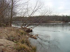 | ||
The Broad River is a principal tributary of the Congaree River, about 150 miles (240 km) long, in western North Carolina and northern South Carolina in the United States. Via the Congaree, it is part of the watershed of the Santee River, which flows to the Atlantic Ocean.
Contents
Map of Broad River, South Carolina, USA
CourseEdit
The Broad River originates in the Blue Ridge Mountains of eastern Buncombe County, North Carolina and flows generally south-southeastwardly, through or along the boundaries of Rutherford, Polk and Cleveland Counties in North Carolina; and Cherokee, York, Union, Chester, Fairfield, Newberry and Richland Counties in South Carolina. In North Carolina, the river is dammed to form Lake Lure; in South Carolina it passes through the Sumter National Forest and the communities of Cherokee Falls and Lockhart before joining the Saluda River to form the Congaree River in the city of Columbia.
Principal tributaries of the Broad River include the Green, Second Broad and First Broad Rivers in North Carolina ; and the Bowens, Pacolet, Sandy, Tyger, Enoree and Little Rivers in South Carolina.
DamsEdit
This is an incomplete list of dams starting at Lake Lure and moving downstream
North Carolina
South Carolina
CrossingsEdit
The Broad River is crossed several times by many highways (Note: this list at times may be incomplete)
North Carolina
US 64 / US 74 Alt.
US 221 Alt.
South Carolina
Variant namesEdit
According to the Geographic Names Information System, the Broad River has also been known as
It was also known in colonial times as the English Broad River to distinguish it from the French Broad River which also originates in western North Carolina, but flows northwest into what was then part of the claimed territory of New France.
The present name is descriptive of the river's width.