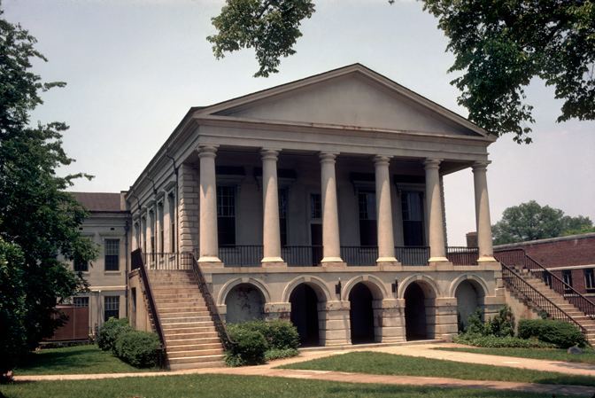
Area 1,518 km² Population 32,578 (2013) | Website www.chestercounty.org Founded 1785 Unemployment rate 8.5% (Apr 2015) | |
 | ||
Rivers Fishing Creek, Broad River, Catawba River, Turkey Creek | ||
Chester County is a county located in the U.S. state of South Carolina. As of the 2010 census, its population was 33,140. Its county seat is Chester.
Contents
- Map of Chester County SC USA
- Geography
- Adjacent counties
- National protected area
- 2000 census
- 2010 census
- Economy
- Media
- City
- Towns
- Census designated places
- Unincorporated communities
- Notable residents
- References
Map of Chester County, SC, USA
Chester County is included in the Charlotte-Concord-Gastonia, NC-SC Metropolitan Statistical Area.
Geography
According to the U.S. Census Bureau, the county has a total area of 581 square miles (1,500 km2), of which 581 square miles (1,500 km2) is land and 5.5 square miles (14 km2) (0.9%) is water.
Adjacent counties
National protected area
2000 census
As of the census of 2000, there were 34,068 people, 12,880 households, and 9,338 families residing in the county. The population density was 59 people per square mile (23/km²). There were 14,374 housing units at an average density of 25 per square mile (10/km²). The racial makeup of the county was 59.93% White, 38.65% Black or African American, 0.33% Native American, 0.28% Asian, 0.01% Pacific Islander, 0.25% from other races, and 0.55% from two or more races. 0.75% of the population were Hispanic or Latino of any race.
There were 12,880 households out of which 32.90% had children under the age of 18 living with them, 48.80% were married couples living together, 18.60% had a female householder with no husband present, and 27.50% were non-families. 24.20% of all households were made up of individuals and 9.90% had someone living alone who was 65 years of age or older. The average household size was 2.62 and the average family size was 3.11.
In the county, the population was spread out with 26.90% under the age of 18, 8.40% from 18 to 24, 28.20% from 25 to 44, 23.80% from 45 to 64, and 12.70% who were 65 years of age or older. The median age was 36 years. For every 100 females there were 92.50 males. For every 100 females age 18 and over, there were 87.60 males.
The median income for a household in the county was $32,425, and the median income for a family was $38,087. Males had a median income of $30,329 versus $21,570 for females. The per capita income for the county was $14,709. About 11.90% of families and 15.30% of the population were below the poverty line, including 21.20% of those under age 18 and 14.90% of those age 65 or over.
2010 census
As of the 2010 United States Census, there were 33,140 people, 12,876 households, and 9,073 families residing in the county. The population density was 57.1 inhabitants per square mile (22.0/km2). There were 14,701 housing units at an average density of 25.3 per square mile (9.8/km2). The racial makeup of the county was 59.8% white, 37.4% black or African American, 0.4% American Indian, 0.3% Asian, 0.6% from other races, and 1.5% from two or more races. Those of Hispanic or Latino origin made up 1.4% of the population. In terms of ancestry, 19.9% were American, 7.5% were Irish, 5.6% were English, and 5.1% were German.
Of the 12,876 households, 34.1% had children under the age of 18 living with them, 44.5% were married couples living together, 19.8% had a female householder with no husband present, 29.5% were non-families, and 25.9% of all households were made up of individuals. The average household size was 2.56 and the average family size was 3.04. The median age was 40.3 years.
The median income for a household in the county was $32,743 and the median income for a family was $42,074. Males had a median income of $39,008 versus $27,701 for females. The per capita income for the county was $17,687. About 18.6% of families and 21.4% of the population were below the poverty line, including 30.0% of those under age 18 and 18.0% of those age 65 or over.
Economy
Chester county operates on an industrial and agriculture community, with much land area in timber production. Forestry plays a major role in the county economy with several mills in the county and others near it. Forest land ownership is majority family landowners who manage their properties for a variety of uses. Agriculture is a big segment of the economy with crops consisting of cotton, wheat, oats, rye, beef and dairy cattle, hay, corn, peaches, other vegetables, peanuts, soybeans, and pecans.
